Category:First Military Mapping Survey of Austrian Empire (Moravia)
Jump to navigation
Jump to search
Subcategories
This category has only the following subcategory.
Media in category "First Military Mapping Survey of Austrian Empire (Moravia)"
The following 11 files are in this category, out of 11 total.
-
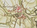 Jaroměřice-1764.jpg 692 × 532; 157 KB
-
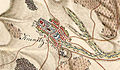
 Kojetice map old 1.jpg 799 × 314; 65 KB
-
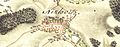
 Mapa Scharditzka.jpg 600 × 673; 221 KB
-
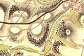
 Mikulovice map old 1.jpg 799 × 313; 65 KB
-
 Miroslavské Knínice - 1. vojenské mapování.jpg 1,740 × 1,008; 2.28 MB
-
 Přeskače-1.vojenské-mapování.jpg 779 × 584; 352 KB
-
 Příbor-první-vojenské-mapování.jpg 1,867 × 960; 943 KB
-
 Třebíč Borovina 2 map from year 1782.jpg 663 × 443; 69 KB
-
 Třebíč Borovina map from year 1782.jpg 665 × 443; 67 KB
-
 Třebíč Pocoucov map 1.jpg 669 × 444; 59 KB
-
 Říkovice 1VM.jpg 1,175 × 663; 642 KB


