Category:Fernmeldeturm Solling
Jump to navigation
Jump to search
| Object location | | View all coordinates using: OpenStreetMap |
|---|
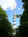
tower  | |||||
| Upload media | |||||
| Instance of | |||||
|---|---|---|---|---|---|
| Made from material | |||||
| Location | Lower Saxony, Germany | ||||
| Commissioned by | |||||
| Owned by | |||||
 | |||||
Media in category "Fernmeldeturm Solling"
The following 6 files are in this category, out of 6 total.
-
 Espol.jpg 4,236 × 2,172; 4.08 MB
-
 Fernmeldeturm Solling 2009 Weper.JPG 1,456 × 2,184; 1.84 MB
-
 Fernmeldeturm Solling 2009.JPG 1,456 × 2,184; 2.03 MB
-
 Fernmeldeturm Solling.jpg 2,264 × 2,980; 3.27 MB
-
 Landschaftsschutzgebiet Solling - Alte Hauung bei Espol - Fernmeldeturm Solling.jpg 3,864 × 5,812; 5.34 MB
-
 LandstraßeEspol1.jpg 2,184 × 1,456; 3.71 MB


