Category:Farm buildings in Denbighshire
Jump to navigation
Jump to search
Media in category "Farm buildings in Denbighshire"
The following 47 files are in this category, out of 47 total.
-
 Adeiladau fferm Ty Coch - geograph.org.uk - 385225.jpg 640 × 452; 138 KB
-
 Bachymbyd Bach - geograph.org.uk - 136213.jpg 640 × 417; 77 KB
-
 Cefn Maen Llwyd - geograph.org.uk - 1802395.jpg 640 × 480; 103 KB
-

-
 Farm buildings near Henllan - geograph.org.uk - 595404.jpg 640 × 480; 73 KB
-
 Farm steading at Bryn-newydd - geograph.org.uk - 649534.jpg 640 × 428; 72 KB
-
 Fron Deg, Eryrys. - geograph.org.uk - 113827.jpg 640 × 480; 125 KB
-
 Hengoed - geograph.org.uk - 245664.jpg 640 × 479; 72 KB
-
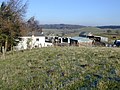
 March snow at the farm - geograph.org.uk - 131879.jpg 640 × 480; 56 KB
-
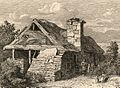 Near Valle Crucis Abbey, Denbighshire May 1 1815.jpeg 1,195 × 874; 1.07 MB
-
 Plas yr Esgob - geograph.org.uk - 135383.jpg 640 × 441; 81 KB
-
 Ysceifiog farm building - geograph.org.uk - 132309.jpg 640 × 480; 70 KB
-
 Bon yr On - geograph.org.uk - 559283.jpg 640 × 480; 125 KB
-
 Bron Haul - geograph.org.uk - 390128.jpg 640 × 480; 93 KB
-

-
 Calves, Plas Einion - geograph.org.uk - 676451.jpg 640 × 480; 101 KB
-
 Converted farm buildings - geograph.org.uk - 30656.jpg 512 × 384; 35 KB
-
 Cornel Rhedyn - geograph.org.uk - 317268.jpg 640 × 480; 72 KB
-
 Dinbren Isaf - geograph.org.uk - 165720.jpg 640 × 480; 111 KB
-
 Dinbren-uchaf - geograph.org.uk - 165732.jpg 640 × 480; 87 KB
-
 Dol Fawr - geograph.org.uk - 237338.jpg 640 × 480; 141 KB
-
 Drws - y - Buddel - geograph.org.uk - 387956.jpg 640 × 438; 166 KB
-
 Dyffryn Maelor - geograph.org.uk - 82706.jpg 640 × 480; 185 KB
-
 Farm Buildings at Cefn Meiriadog - geograph.org.uk - 28107.jpg 640 × 480; 86 KB
-
 Farm buildings at Garth-y-dwr - geograph.org.uk - 558310.jpg 640 × 480; 113 KB
-
 Farm buildings at Pengwern Hall - geograph.org.uk - 623269.jpg 640 × 480; 96 KB
-
 Farm buildings at Ty'n-y-celyn - geograph.org.uk - 257329.jpg 640 × 480; 137 KB
-
 Farm buildings at Wernpennant - geograph.org.uk - 471642.jpg 640 × 480; 81 KB
-
 Farm house and outbuildings - geograph.org.uk - 29541.jpg 448 × 336; 20 KB
-
 Farmbuildings near Tremeirchion - geograph.org.uk - 30509.jpg 474 × 355; 24 KB
-
 Ffynnon Tudur - geograph.org.uk - 180544.jpg 640 × 479; 87 KB
-
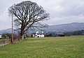
 Glan Alwen - geograph.org.uk - 559445.jpg 640 × 480; 102 KB
-
 Glanllyn - geograph.org.uk - 25341.jpg 448 × 336; 20 KB
-
 Graig Farm near Llandegla - geograph.org.uk - 205256.jpg 640 × 480; 84 KB
-
 Gwern-brain-uchaf - geograph.org.uk - 352458.jpg 640 × 480; 204 KB
-
 Gwern-brain-uchaf - geograph.org.uk - 354091.jpg 640 × 480; 235 KB
-
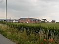
 Hay field at Abbey Farm - geograph.org.uk - 542846.jpg 480 × 640; 150 KB
-
 Highgate Farm - geograph.org.uk - 170347.jpg 640 × 480; 71 KB
-
 Hollows - geograph.org.uk - 257318.jpg 640 × 480; 106 KB
-
 Llwyn Uchaf - geograph.org.uk - 273692.jpg 640 × 480; 81 KB
-
 Maes Tyddyn Isaf - geograph.org.uk - 390136.jpg 640 × 480; 123 KB
-
 Outbuildings at Glyn - geograph.org.uk - 242934.jpg 640 × 480; 119 KB
-
 Pentre Isaf - geograph.org.uk - 208052.jpg 640 × 480; 68 KB
-
 Rhyllon - lane and farm building - geograph.org.uk - 26210.jpg 384 × 288; 37 KB
-
 Shearing shed at Cefn y Ffridd - geograph.org.uk - 469881.jpg 640 × 480; 114 KB
-
 The Ruined Pen-y-bryn Farmhouse - geograph.org.uk - 354477.jpg 640 × 480; 200 KB
-
 Tyn Twll, Rhewl. - geograph.org.uk - 206738.jpg 640 × 480; 129 KB


