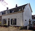
Category:De Brink 4, Cothen
Jump to navigation
Jump to search
| Object location | | View all coordinates using: OpenStreetMap |
|---|
building in Wijk bij Duurstede, Netherlands  | |||||
| Upload media | |||||
| Instance of | |||||
|---|---|---|---|---|---|
| Location | Cothen, Utrecht, Netherlands | ||||
| Street address |
| ||||
| Located on street |
| ||||
| Heritage designation |
| ||||
 | |||||
|
This is a category about rijksmonument number 11515
|
| Address |
|
Media in category "De Brink 4, Cothen"
The following 5 files are in this category, out of 5 total.
-
 3945 Cothen, Netherlands - panoramio (3).jpg 2,048 × 1,148; 784 KB
-
 Cothen EF De Brink 4 RM 11515.JPG 1,163 × 888; 347 KB
-
 Cothen RM De Brink 4.jpg 3,101 × 2,819; 3.24 MB
-
 EF Cothen.De Brink.JPG 2,288 × 1,397; 1.08 MB
-
 Voorgevels - Cothen - 20047296 - RCE.jpg 1,200 × 802; 194 KB
.jpg)


