Category:Dairsie
Jump to navigation
Jump to search
village in Fife, Scotland, UK  | |||||
| Upload media | |||||
| Instance of | |||||
|---|---|---|---|---|---|
| Location |
| ||||
 | |||||
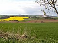
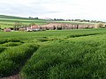
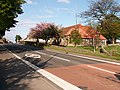
English: Dairsie, or Osnaburgh, is a village in north-east Fife, Scotland. It is east-northeast of Cupar on the A91 Stirling to St Andrews road. The village grew out of two smaller settlements (called Dairsiemuir and Osnaburgh), and developed principally around the industry of weaving. Since the late twentieth century it has become a dormitory settlement for nearby towns.
Gàidhlig: 'S e baile ann am Fìobha a th' ann an Darfhasaidh (Beurla: Dairsie neo Osnaburgh).
Subcategories
This category has the following 6 subcategories, out of 6 total.
C
- Craiglug (3 F)
D
- Dairsie Bridge (4 F)
- Dairsie Castle (3 F)
- Dairsie church (1 F)
- Dairsie House (3 F)
O
- Dairsie Old church (7 F)
Media in category "Dairsie"
The following 28 files are in this category, out of 28 total.
-
 Across the Eden - geograph.org.uk - 168641.jpg 640 × 480; 347 KB
-
 Beechwood and Middlefoodie - geograph.org.uk - 650646.jpg 640 × 480; 61 KB
-
 By Dairsie - geograph.org.uk - 168683.jpg 640 × 480; 310 KB
-
 By Dairsie Mains - geograph.org.uk - 229903.jpg 383 × 640; 84 KB
-
 Casual water - geograph.org.uk - 923210.jpg 640 × 480; 69 KB
-
 Dairsie - geograph.org.uk - 168661.jpg 640 × 480; 292 KB
-
 Dairsie from the south - geograph.org.uk - 650420.jpg 640 × 480; 48 KB
-
 Dairsie Mains - geograph.org.uk - 229892.jpg 640 × 424; 95 KB
-
 Dairsie Primary School - geograph.org.uk - 168667.jpg 640 × 479; 372 KB
-
 Dairsie village hall, detail - geograph.org.uk - 168679.jpg 627 × 640; 446 KB
-
 Dairsie, west end. - geograph.org.uk - 168674.jpg 640 × 480; 343 KB
-
 Easter Craigfoodie Farm - geograph.org.uk - 487569.jpg 640 × 414; 69 KB
-
 Field by Dairsie Mains - geograph.org.uk - 229880.jpg 640 × 424; 99 KB
-
 Manse Field - geograph.org.uk - 229910.jpg 640 × 424; 84 KB
-
 Middlefoodie - geograph.org.uk - 168646.jpg 640 × 480; 256 KB
-
 Near Todhall - geograph.org.uk - 577846.jpg 640 × 396; 76 KB
-
 Pigeon Cote - geograph.org.uk - 186442.jpg 480 × 640; 80 KB
-
 Pittormie - geograph.org.uk - 88024.jpg 640 × 442; 96 KB
-
 River Eden, Dairsie Bridge - geograph.org.uk - 1441514.jpg 640 × 480; 140 KB
-
 South Dron - geograph.org.uk - 88020.jpg 640 × 480; 235 KB
-
 Strath Eden - geograph.org.uk - 577874.jpg 640 × 468; 109 KB
-
 Todhall - geograph.org.uk - 577904.jpg 640 × 424; 82 KB
-
 Towards Dairse Mains - geograph.org.uk - 84620.jpg 640 × 480; 112 KB
-
 Towards Dairsie Mains - geograph.org.uk - 577857.jpg 640 × 387; 91 KB
-
 Towards Lydox Mill - geograph.org.uk - 229888.jpg 640 × 424; 91 KB
-
 Towards the Eden - geograph.org.uk - 83656.jpg 640 × 480; 245 KB
-
 Towards Todhall - geograph.org.uk - 577892.jpg 640 × 391; 74 KB
-


