Category:Cottages in Oxfordshire
Jump to navigation
Jump to search
Ceremonial counties of England: Bedfordshire · Berkshire · Buckinghamshire · Cambridgeshire · Cheshire · Cornwall · Cumbria · Derbyshire · Devon · Dorset · Durham · East Riding of Yorkshire · East Sussex · Essex · Gloucestershire · Greater London · Greater Manchester · Hampshire · Herefordshire · Hertfordshire · Kent · Lancashire · Leicestershire · Lincolnshire · Merseyside · Norfolk · North Yorkshire · Northamptonshire · Northumberland · Nottinghamshire · Oxfordshire · Rutland · Shropshire · Somerset · South Yorkshire · Staffordshire · Suffolk · Surrey · Tyne and Wear · Warwickshire · West Midlands · West Sussex · West Yorkshire · Wiltshire · Worcestershire
City-counties: Bristol ·
Former historic counties: Huntingdonshire ·
Other former counties:
City-counties: Bristol ·
Former historic counties: Huntingdonshire ·
Other former counties:
Subcategories
This category has the following 12 subcategories, out of 12 total.
1
- 1-7 Blenheim Road, Shirburn (3 F)
A
B
- 9 London Road, Bicester (2 F)
- Ayres Cottage, Blewbury (4 F)
E
- Rose Cottage, East Hendred (2 F)
O
- Cottages in Oxford (11 F)
S
Media in category "Cottages in Oxfordshire"
The following 200 files are in this category, out of 284 total.
(previous page) (next page)-
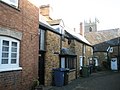
 A cottage in Whitchurch-on-Thames - geograph.org.uk - 642318.jpg 530 × 640; 137 KB
-
 Level crossing in Ambrosden - geograph.org.uk - 1767686.jpg 640 × 480; 74 KB
-
 Anchor Cottage - geograph.org.uk - 78644.jpg 640 × 481; 44 KB
-
 Arches by the river - geograph.org.uk - 1509816.jpg 640 × 427; 92 KB
-
 Ivy on the walls - geograph.org.uk - 1197172.jpg 400 × 600; 102 KB
-
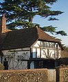
 Arncott JuniperCottage 2010.JPG 2,880 × 1,920; 1.74 MB
-
 Arncott JuniperCottage 2012.jpg 3,008 × 2,000; 1.91 MB
-
 Bus shelter in Aston - geograph.org.uk - 1567110.jpg 640 × 480; 117 KB
-
 Back or Front - geograph.org.uk - 708864.jpg 640 × 427; 78 KB
-
 Church View, Bampton - geograph.org.uk - 1542237.jpg 640 × 427; 119 KB
-
 Battlemoor Cottage.jpg 4,000 × 3,000; 5.31 MB
-
 Beansheaf Terrace - geograph.org.uk - 926498.jpg 640 × 426; 64 KB
-
 Bicester NorthSt 31–33.jpg 1,024 × 614; 359 KB
-
 Bicester SheepSt 73–75.jpg 1,024 × 512; 261 KB
-
 Bicester StJohnsSt 12–16 south.jpg 1,024 × 512; 270 KB
-
 Bicester StJohnsSt 12–16 southwest.jpg 1,024 × 512; 272 KB
-
 Bishops Cottage, South Hinksey - geograph.org.uk - 129460.jpg 640 × 480; 88 KB
-
 The Cottage, Bix - geograph.org.uk - 557647.jpg 640 × 477; 95 KB
-
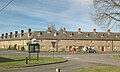
 Blenheim Estate cottages in Bladon - geograph.org.uk - 1481914.jpg 640 × 427; 68 KB
-
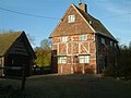
 Bletchingdon TerracedCottages.JPG 3,000 × 1,800; 2.37 MB
-
 Across the junction - geograph.org.uk - 1377626.jpg 640 × 480; 85 KB
-
 Blewbury Green - geograph.org.uk - 1155834.jpg 640 × 427; 206 KB
-
 Roses over the porch - geograph.org.uk - 1360682.jpg 640 × 426; 85 KB
-
 Blooms Cottage - geograph.org.uk - 706684.jpg 640 × 427; 110 KB
-
 Cottages in Bourton - geograph.org.uk - 814402.jpg 640 × 480; 82 KB
-
 Mill Road Cottages - geograph.org.uk - 305794.jpg 640 × 480; 76 KB
-
 Briar Cottage, Bletchingdon.jpg 4,000 × 3,000; 2.03 MB
-
 Brick cottage in Checkendon, Oxfordshire, England.jpg 440 × 640; 106 KB
-
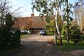
 Glebe Farm (geograph 3444823).jpg 640 × 427; 227 KB
-
 The village (geograph 3444835).jpg 640 × 427; 180 KB
-
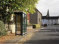
 Brightwell Baldwin Phone Box (geograph 2026561).jpg 3,648 × 2,736; 3.19 MB
-
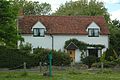
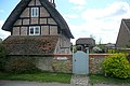
 Thatched cottage in Brightwell 2 - geograph.org.uk - 921115.jpg 640 × 480; 104 KB
-
 Crossing cottage - geograph.org.uk - 1232288.jpg 640 × 427; 70 KB
-
 Crossroads in Burford - geograph.org.uk - 1564623.jpg 640 × 480; 87 KB
-
 Bus img 6004 (16147756207).jpg 3,072 × 2,304; 2.64 MB
-
 Bushnell's Cottage.jpg 4,000 × 3,000; 5.01 MB
-
 Canal workers' cottages at Grove in Oxfordshire.jpg 640 × 426; 75 KB
-
 Carterton, Rock Farm Cottages - geograph.org.uk - 361104.jpg 640 × 471; 143 KB
-
 Castle Farmhouse, Benson - geograph.org.uk - 579247.jpg 428 × 640; 83 KB
-
 Old Cottage, Charlbury - geograph.org.uk - 1437389.jpg 640 × 438; 99 KB
-
 Optare Solo SR YJ14 BWH Charlbury ParkSt.jpg 1,280 × 721; 451 KB
-
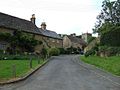
 Cottages in Chilson - geograph.org.uk - 989435.jpg 640 × 426; 84 KB
-
 Cottages in Chilson - geograph.org.uk - 989687.jpg 640 × 426; 83 KB
-
 Cottages on the street - geograph.org.uk - 1704202.jpg 1,024 × 683; 150 KB
-
 Choseley Cottage, Tiddington.jpg 3,456 × 2,304; 3.68 MB
-
 Church Cottage, Kelmscott, April 2022.jpg 4,032 × 3,024; 6.34 MB
-
 Church Enstone1.jpg 640 × 480; 82 KB
-
 Hand and Shears, Church Hanborough - geograph.org.uk - 147024.jpg 640 × 480; 64 KB
-
 ChurchHanborough ChurchView HartsCottage Hand&Shears.jpg 1,280 × 645; 387 KB
-
 ChurchHanborough ShepherdsWell WalnutCottage.jpg 1,280 × 705; 456 KB
-
 Clouds Hill cottages - geograph.org.uk - 294672.jpg 640 × 427; 62 KB
-
 Cornwell village - geograph.org.uk - 1713615.jpg 4,000 × 3,000; 3.24 MB
-
 Cotswold stone cottages in Burford - geograph.org.uk - 1417630.jpg 640 × 427; 102 KB
-
 Cottage and woodland, Wormsley Estate - geograph.org.uk - 743361.jpg 640 × 480; 129 KB
-
 Cottage and woodland, Wormsley Estate - geograph.org.uk - 745151.jpg 640 × 480; 105 KB
-
 Cottage at Knighton - geograph.org.uk - 3829824.jpg 1,200 × 804; 1.31 MB
-
 Cottage in Coleshill - geograph.org.uk - 274321.jpg 480 × 640; 135 KB
-
 Cottage in Whitchurch-on-Thames - geograph.org.uk - 21251.jpg 640 × 480; 192 KB
-
 Cottage on Hookend Lane - geograph.org.uk - 591774.jpg 640 × 477; 101 KB
-
 Cottage on the street - geograph.org.uk - 1324982.jpg 640 × 426; 70 KB
-
 Cottage on West Ginge Down - geograph.org.uk - 838221.jpg 640 × 480; 130 KB
-
 Cottage, Whitchurch-on-Thames - geograph.org.uk - 21248.jpg 640 × 480; 170 KB
-
 Cottages - Sheephouse Barn Farm - geograph.org.uk - 94419.jpg 640 × 480; 127 KB
-
 Cottages along the lane - geograph.org.uk - 781311.jpg 640 × 427; 67 KB
-
 Cottages and modern houses, Mixbury - geograph.org.uk - 143134.jpg 640 × 427; 110 KB
-
 Cottages and road, Nuneham Park - geograph.org.uk - 717288.jpg 640 × 480; 170 KB
-
 Cottages at Burford Bridge - geograph.org.uk - 300737.jpg 480 × 640; 150 KB
-
 Cottages at Cote crossroads - geograph.org.uk - 324637.jpg 640 × 480; 82 KB
-
 Cottages at Lechlade Road, Faringdon - geograph.org.uk - 629914.jpg 640 × 479; 67 KB
-
 Cottages at Poffley End - geograph.org.uk - 319387.jpg 640 × 480; 84 KB
-

-
 Cottages in Bletchingdon - geograph.org.uk - 357782.jpg 640 × 480; 108 KB
-
 Cottages in Burford - geograph.org.uk - 627627.jpg 640 × 480; 93 KB
-
 Cottages in Clifton Hampden - geograph.org.uk - 46086.jpg 640 × 481; 66 KB
-
 Cottages in East Lockinge - geograph.org.uk - 621022.jpg 640 × 431; 101 KB
-
 Cottages in Mill Road - geograph.org.uk - 54413.jpg 640 × 481; 62 KB
-
 Cottages in Nuneham Courtney - geograph.org.uk - 1334801.jpg 640 × 427; 96 KB
-
 Cottages in Nuneham Courtney - geograph.org.uk - 1334807.jpg 640 × 427; 73 KB
-
 Cottages in Over Kiddington - geograph.org.uk - 5608607.jpg 6,000 × 4,000; 6.12 MB
-
 Cottages in Postcombe village - geograph.org.uk - 39122.jpg 640 × 480; 118 KB
-
 Cottages in upper High Street, Burford - geograph.org.uk - 300530.jpg 640 × 480; 162 KB
-
 Cottages in Westwell - geograph.org.uk - 636715.jpg 640 × 480; 95 KB
-
 Cottages in Wigginton - geograph.org.uk - 765388.jpg 640 × 426; 90 KB
-
 Cottages of Queen Street, Eynsham - geograph.org.uk - 637541.jpg 640 × 480; 90 KB
-
 Cottages on Steventon Road - geograph.org.uk - 113746.jpg 640 × 481; 50 KB
-
 Cottages, Bladon - geograph.org.uk - 1407991.jpg 640 × 480; 78 KB
-
 Cottages, Mixbury - geograph.org.uk - 143128.jpg 640 × 427; 101 KB
-
 Juniper Hill - geograph.org.uk - 344107.jpg 640 × 480; 89 KB
-
 Juniper Hill - geograph.org.uk - 344135.jpg 480 × 640; 97 KB
-
 Kennel cottages, Cottisford - geograph.org.uk - 344203.jpg 640 × 480; 64 KB
-
 Row of cottages in Beauchamp Lane - geograph.org.uk - 1254930.jpg 640 × 427; 84 KB
-

-
 Crossing Cottage - geograph.org.uk - 304869.jpg 640 × 480; 121 KB
-
 CurbridgeFarmCottages.jpg 1,280 × 719; 569 KB
-
 A slightly smaller Centrepoint - geograph.org.uk - 973399.jpg 640 × 480; 100 KB
-
 Cottages in The Tchure - geograph.org.uk - 643066.jpg 640 × 480; 78 KB
-
 Paper Mill Cottages - geograph.org.uk - 447803.jpg 640 × 531; 100 KB
-
 Tax assist in Chapel Square - geograph.org.uk - 973397.jpg 640 × 480; 76 KB
-
 Deddington ChapelSq CentrePoint.jpg 1,280 × 606; 437 KB
-
 Deddington HighSt 7–10.jpg 1,280 × 595; 411 KB
-
 Deddington HighSt GroveCottages.jpg 1,280 × 636; 516 KB
-
 Deddington HighSt MaundsFarmhouse.jpg 1,280 × 597; 502 KB
-
 Deddington HighSt OsborneCottage OsborneHouse CornerHouse.jpg 1,280 × 604; 473 KB
-
 Deddington NewSt AfricHouse Treholford west.jpg 1,129 × 1,280; 717 KB
-
 Deddington NewSt AfricHouse Treholford.jpg 1,280 × 636; 515 KB
-
 Deddington SSPeter&Paul CWGC 5.jpg 1,280 × 913; 814 KB
-
 Deddington StThomasSt StableEnd OldButchery PearTreeCottage.jpg 1,280 × 595; 490 KB
-
 Denchworth ChurchCottage south.jpg 1,024 × 614; 381 KB
-
 Drayton BaptistChurch.jpg 1,024 × 683; 340 KB
-
 Drayton HighSt 25–33.jpg 1,024 × 614; 344 KB
-
 Duns Tew village1.jpg 640 × 480; 129 KB
-
 East Hagbourne - geograph.org.uk - 129930.jpg 640 × 480; 82 KB
-
 Converted Chapel in East Hendred - geograph.org.uk - 1308805.jpg 640 × 427; 84 KB
-
 High Street, East Hendred - geograph.org.uk - 1308808.jpg 640 × 427; 81 KB
-
 Typical Residential Street in East Hendred - geograph.org.uk - 10238.jpg 640 × 480; 278 KB
-
 East Hendred.jpg 640 × 480; 241 KB
-
 Enocks Colony Sibford Gower - geograph.org.uk - 1719107.jpg 2,592 × 1,944; 1.66 MB
-
 Corner of Epwell near the church - geograph.org.uk - 449073.jpg 477 × 640; 125 KB
-
 Evenlode-1.jpg 4,608 × 3,072; 3.57 MB
-
 Evenlode-2.jpg 4,608 × 3,072; 6.93 MB
-
 Faringdon golf course, south of Faringdon - geograph.org.uk - 893879.jpg 640 × 480; 166 KB
-
 Farm Cottages - geograph.org.uk - 307418.jpg 640 × 480; 64 KB
-
 Field Cottage, Whitehill.jpg 3,456 × 2,304; 2.51 MB
-
 Gagingwell - The lane to Radfordbridge - geograph.org.uk - 154236.jpg 640 × 480; 104 KB
-
 Gainfield Cottages - geograph.org.uk - 309740.jpg 640 × 480; 97 KB
-
 Cottages in Garford - geograph.org.uk - 113757.jpg 640 × 481; 53 KB
-
 Glympton cottages.jpg 3,000 × 2,000; 2.41 MB
-
 Cottages on the corner - geograph.org.uk - 1629144.jpg 640 × 427; 92 KB
-
 Gothic cottage - geograph.org.uk - 791916.jpg 640 × 427; 71 KB
-
 Great Bourton from the Church yard - geograph.org.uk - 1138884.jpg 640 × 480; 94 KB
-
 Box Tree Cottage, Great Coxwell - geograph.org.uk - 307446.jpg 640 × 480; 100 KB
-
 Grimsdyke Farm Cottages - geograph.org.uk - 358612.jpg 640 × 445; 120 KB
-
 Hamlet House, Clare - geograph.org.uk - 718491.jpg 640 × 480; 125 KB
-
 Cottages at Hampton Gay - geograph.org.uk - 357868.jpg 640 × 481; 111 KB
-
 Hanwell - Main Street - geograph.org.uk - 1138872.jpg 640 × 480; 85 KB
-
 Roadside cottages in Hatford - geograph.org.uk - 1004738.jpg 640 × 427; 98 KB
-
 Henley-on-Thames - 43 And 45, Gravel Hill - 20231021165435.jpg 4,000 × 3,000; 3.15 MB
-
 Henley-on-Thames ReadingRd 273–281.jpg 1,280 × 1,215; 565 KB
-
 Hethe - geograph.org.uk - 344242.jpg 640 × 480; 84 KB
-
 High Street Burford. - geograph.org.uk - 627621.jpg 640 × 480; 97 KB
-
 High Street, Uffington - geograph.org.uk - 645382.jpg 640 × 480; 144 KB
-
 Cottage near The Pear Tree pub - geograph.org.uk - 765393.jpg 640 × 426; 109 KB
-
 Roofing variations - geograph.org.uk - 318538.jpg 640 × 432; 92 KB
-
 Hope Cottage, Forest Hill.jpg 4,000 × 3,000; 5.66 MB
-
 House in Piddington - geograph.org.uk - 180103.jpg 640 × 480; 116 KB
-
 Houses and church in Sydenham - geograph.org.uk - 39201.jpg 640 × 480; 92 KB
-
 Houses by the green in Sydenham - geograph.org.uk - 39206.jpg 640 × 480; 186 KB
-
 Houses on the High Street - geograph.org.uk - 832480.jpg 640 × 480; 113 KB
-
 Level Crossing (Mill Street), Islip - geograph.org.uk - 1472126.jpg 640 × 480; 100 KB
-
 Level Crossing (Mill Street), Islip - geograph.org.uk - 1472132.jpg 640 × 480; 70 KB
-
 Ivy covered cottage, Hethe - geograph.org.uk - 1416399.jpg 640 × 480; 106 KB
-
 Keepers Cottage, Wytham Woods - geograph.org.uk - 307425.jpg 640 × 480; 129 KB
-
 Kencot, Church Green - geograph.org.uk - 381276.jpg 640 × 427; 109 KB
-
 Kencot, Ivy Nook - geograph.org.uk - 381258.jpg 640 × 479; 151 KB
-
 Cottage in Kingham - geograph.org.uk - 902339.jpg 640 × 426; 69 KB
-
 Cottages in Kingham - geograph.org.uk - 899660.jpg 426 × 640; 87 KB
-
 Cottages in Kingham - geograph.org.uk - 899665.jpg 640 × 426; 90 KB
-
 Stone cottage and phonebox in Kingham - geograph.org.uk - 290728.jpg 640 × 427; 79 KB
-
 Typical Cotswold cottages, Kingham - geograph.org.uk - 280076.jpg 640 × 427; 98 KB
-

-

-
 Cottages in Kirtlingtom - geograph.org.uk - 785694.jpg 640 × 512; 104 KB
-
 Main through road, Kirtlington - geograph.org.uk - 1416345.jpg 640 × 442; 64 KB
-
 Kirtlington OldBakehouse southwest.jpg 1,280 × 663; 522 KB
-
 Kirtlington.jpg 3,456 × 2,304; 506 KB
-
 Langford war memorial - geograph.org.uk - 622557.jpg 640 × 427; 99 KB
-
 Lidstone - geograph.org.uk - 62331.jpg 427 × 640; 103 KB
-
 Lidstone Village - geograph.org.uk - 1801803.jpg 4,000 × 3,000; 4.45 MB
-
 Little Coxwell by Andrew Smith.jpg 640 × 480; 130 KB
-
 Blenheim Cottages, Little Milton - geograph.org.uk - 844654.jpg 640 × 480; 122 KB
-
-
 Manor Cottage, Little Milton - geograph.org.uk - 844688.jpg 640 × 480; 82 KB
-
 Cottage in Littlemore - geograph.org.uk - 1254981.jpg 640 × 427; 95 KB
-
 A Cottage in West Ginge - geograph.org.uk - 113742.jpg 640 × 481; 60 KB
-
 Behind the gate - geograph.org.uk - 1590860.jpg 640 × 480; 93 KB
-
 Shrivenham Road, Longcot - geograph.org.uk - 814253.jpg 640 × 480; 77 KB
-
 Longcot - geograph.org.uk - 814249.jpg 640 × 480; 76 KB
-
 Rose Cottage, Tuck's Lane, Longworth - geograph.org.uk - 1439316.jpg 640 × 480; 89 KB
-
 Houses in Lower Heyford.JPG 2,048 × 1,536; 1.34 MB
-
 Cottages in Lyford - geograph.org.uk - 1116218.jpg 640 × 427; 50 KB
-

-
 Merrick Cottage.jpg 4,000 × 3,000; 4.3 MB
-
 Milton Cottages - geograph.org.uk - 238489.jpg 640 × 480; 86 KB
-
 Cottages at Minster Lovell - geograph.org.uk - 1006343.jpg 640 × 480; 140 KB
-
 Minster Lovell houses.jpg 960 × 1,280; 204 KB
-
 Looking up Ferry lane - geograph.org.uk - 1315575.jpg 640 × 426; 63 KB
-
 Neglected cottage by South View Farm - geograph.org.uk - 306715.jpg 640 × 480; 96 KB
-
 Nettlebed HighSt 13–17.jpg 1,280 × 1,230; 673 KB
-
 Nettlebed HighSt 4–12.jpg 1,280 × 602; 418 KB
-
 New Inn Cottage, Binfield Heath - geograph.org.uk - 65922.jpg 640 × 481; 49 KB
-
 North Aston - geograph.org.uk - 114154.jpg 640 × 481; 57 KB
-
 Row of cottages in Nuneham Courteney - geograph.org.uk - 1589263.jpg 640 × 480; 101 KB
-
 Old Bakery, Stonesfield.jpg 3,456 × 2,304; 3.18 MB
-
 Old cottages - geograph.org.uk - 782349.jpg 640 × 427; 71 KB
-
 Over Norton - geograph.org.uk - 238594.jpg 640 × 480; 55 KB
-
 Oxford StClements OldBlackHorseCottage north.jpg 1,280 × 846; 604 KB
-
 Peppard Farm - geograph.org.uk - 556585.jpg 640 × 477; 135 KB
-
 Primrose Hill - geograph.org.uk - 94375.jpg 640 × 481; 36 KB
-
 Pusey Cottages - geograph.org.uk - 113681.jpg 640 × 481; 62 KB
-
 Qwips Cottage.jpg 4,000 × 3,000; 4.71 MB


.jpg)
.jpg)
.jpg)


.jpg)


,_Islip_-_geograph.org.uk_-_1472126.jpg)
,_Islip_-_geograph.org.uk_-_1472132.jpg)


