Category:Coalgate, New Zealand
Jump to navigation
Jump to search
human settlement in Selwyn District, Canterbury Region, New Zealand | |||||
| Upload media | |||||
| Instance of | |||||
|---|---|---|---|---|---|
| Location | Selwyn District, Canterbury Region, New Zealand | ||||
| Population |
| ||||
 | |||||
English: Coalgate is a locality in the Selwyn District of the Canterbury region of New Zealand's South Island. The 2001 New Zealand Census of Population and Dwellings gave Coalgate's population as 276, and it is located roughly an hour west of Christchurch on State Highway 77. The town's name stems from it being the "gateway" to the lignite coal fields around Whitecliffs, the Rakaia Gorge, and Acheron River. Coal mining declined in the 20th century and has now ceased, but since the 1950s, commercial processing of bentonite has taken place in Coalgate. (→Coalgate, New Zealand)
Media in category "Coalgate, New Zealand"
The following 5 files are in this category, out of 5 total.
-
 Coalgate Main Street.JPG 3,872 × 2,592; 3.88 MB
-
 Coalgate railway yard plan.PNG 1,641 × 273; 22 KB
-
 Coalgate Tavern.JPG 3,596 × 2,372; 3.16 MB
-
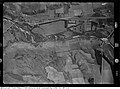
 Glentunnel Aerial 1, 1943.jpg 5,744 × 4,261; 4.68 MB
-
 Glentunnel Aerial 2,1943.jpg 5,759 × 4,279; 4.64 MB


