Category:Claydon, Oxfordshire
Jump to navigation
Jump to search
village in Oxfordshire, United Kingdom  | |||||
| Upload media | |||||
| Instance of | |||||
|---|---|---|---|---|---|
| Location | Claydon with Clattercot, Cherwell, Oxfordshire, South East England, England | ||||
| official website | |||||
 | |||||
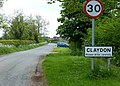
English: Claydon is a village in Claydon with Clattercot civil parish, about above sea level on a hill of Early Jurassic Middle Lias clay. Claydon is the northernmost village in Oxfordshire and the South East England Region. The parish is bounded by Warwickshire to the west and Northamptonshire to the east.
Subcategories
This category has the following 4 subcategories, out of 4 total.
Media in category "Claydon, Oxfordshire"
The following 46 files are in this category, out of 46 total.
-

-
 Boddington Road in Claydon - geograph.org.uk - 4500487.jpg 1,024 × 730; 293 KB
-
 Bridge 142 on the Oxford Canal - geograph.org.uk - 32090.jpg 640 × 427; 144 KB
-
 Bridge 145 on the Southern Oxford Canal - geograph.org.uk - 31584.jpg 600 × 450; 129 KB
-

-
 Museum of Bygones, Claydon - geograph.org.uk - 142233.jpg 640 × 480; 262 KB
-
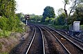
 Claydon railway crossing - geograph.org.uk - 460962.jpg 640 × 477; 78 KB
-
 Converted butty - geograph.org.uk - 202634.jpg 640 × 480; 82 KB
-
 Farmland near Claydon - geograph.org.uk - 3360321.jpg 640 × 430; 45 KB
-
 Field south of Claydon - geograph.org.uk - 2336636.jpg 640 × 400; 65 KB
-
 In the cutting near Claydon - geograph.org.uk - 1330181.jpg 640 × 415; 99 KB
-
 Knibb BluePlaque Claydon.jpg 1,280 × 1,280; 1.03 MB
-
 Lane in the village of Claydon - geograph.org.uk - 4500410.jpg 1,024 × 701; 268 KB
-
 Looking to Claydon - geograph.org.uk - 3360320.jpg 640 × 430; 43 KB
-
 Oxford Canal - geograph.org.uk - 125276.jpg 640 × 479; 79 KB
-
 Oxford Canal - geograph.org.uk - 143566.jpg 640 × 480; 283 KB
-
 Plaque on Claydon Village Hall - geograph.org.uk - 5100412.jpg 640 × 480; 103 KB
-
 Road leaves Claydon - geograph.org.uk - 2336645.jpg 640 × 480; 98 KB
-
 The Main Street in Claydon - geograph.org.uk - 4500436.jpg 1,024 × 694; 212 KB
-
 The Main Street in Claydon - geograph.org.uk - 4500477.jpg 1,024 × 760; 225 KB
-
 The Oxford Canal north of Claydon - geograph.org.uk - 2336654.jpg 640 × 480; 122 KB
-
 The Oxford Canal north of Claydon - geograph.org.uk - 2336657.jpg 640 × 480; 106 KB
-
 The Oxford Canal north of Claydon - geograph.org.uk - 4609866.jpg 800 × 618; 137 KB
-
 Barn south of Claydon - geograph.org.uk - 460755.jpg 640 × 477; 56 KB
-
 Butlin's Farm, Claydon - geograph.org.uk - 142339.jpg 640 × 480; 236 KB
-
 Claydon - geograph.org.uk - 142342.jpg 640 × 480; 266 KB
-
 Claydon Bottom Lock - geograph.org.uk - 65487.jpg 640 × 427; 121 KB
-
 Claydon Middle Lock, Oxford Canal - geograph.org.uk - 460731.jpg 640 × 477; 95 KB
-
 Claydon, Oxford Canal, Bridge 145 - geograph.org.uk - 307028.jpg 640 × 480; 84 KB
-
 Farm at Claydon - geograph.org.uk - 460760.jpg 640 × 477; 92 KB
-
 Farmhouse at Claydon - geograph.org.uk - 460765.jpg 640 × 477; 92 KB
-
 Farmhouse, Claydon - geograph.org.uk - 142341.jpg 640 × 480; 247 KB
-
 Farmland near Highfield Farm - geograph.org.uk - 460683.jpg 640 × 477; 102 KB
-
 Field at Lawn Hill - geograph.org.uk - 460701.jpg 640 × 477; 111 KB
-
 Footpath to Wardington - geograph.org.uk - 202637.jpg 640 × 480; 70 KB
-
 Log and barn at Lawn Hill - geograph.org.uk - 460691.jpg 640 × 477; 112 KB
-
 Looking up Farnborough Hill - geograph.org.uk - 460970.jpg 640 × 477; 80 KB
-
 Old Smithy, Claydon - geograph.org.uk - 142337.jpg 640 × 480; 284 KB
-
 Oxford Canal Feeder - geograph.org.uk - 143558.jpg 640 × 480; 270 KB
-
 Oxhey Bridge reconstruction - geograph.org.uk - 202618.jpg 640 × 480; 70 KB
-
 Post Heck road bridge - geograph.org.uk - 142168.jpg 640 × 480; 263 KB
-
 Road to the railway - geograph.org.uk - 460949.jpg 640 × 477; 81 KB
-
 Sunset at Clattercote reservoir - geograph.org.uk - 158284.jpg 640 × 480; 122 KB
-
 The lane to Appletree - geograph.org.uk - 156157.jpg 640 × 480; 88 KB
-
 View towards Clattercote Reservoir - geograph.org.uk - 143913.jpg 640 × 480; 304 KB
-
 View towards Highfield - geograph.org.uk - 202639.jpg 640 × 480; 65 KB


