Category:Cityscapes of Pittsburgh, Pennsylvania viewed from hills
Jump to navigation
Jump to search
Subcategories
This category has the following 2 subcategories, out of 2 total.
Media in category "Cityscapes of Pittsburgh, Pennsylvania viewed from hills"
The following 94 files are in this category, out of 94 total.
-
 1890s junction hollow bridges.png 3,644 × 2,936; 5.89 MB
-
 19680224 28 PAT1620 18th & Wachter.jpg 1,800 × 1,096; 390 KB
-
 19680224 32 PAT 1620 18th St. @ Quarry St.jpg 1,800 × 1,150; 517 KB
-
 19680224 40 Pittsburgh, Pennsylvania.jpg 1,800 × 1,096; 324 KB
-
 19680224 47 Pittsburgh, PA.jpg 1,800 × 1,107; 275 KB
-
 715.226520.CP.jpg 3,000 × 2,170; 1.52 MB
-
 Allegheny General Hospital from West End Overlook.jpg 1,457 × 1,093; 815 KB
-
 Allegheny River and Sharpsburg Bridge (1999.34.9).png 3,000 × 2,396; 11.53 MB
-
 Armstrong Cork Factory from Frank Curto Park.jpg 2,220 × 1,665; 1.83 MB
-
 Boulevard of the Allies (715.226493.CP).png 3,000 × 2,187; 4.43 MB
-
 Boulevard of the Allies (715.226706.CP).png 3,000 × 2,168; 4.2 MB
-
 Boulevard of the Allies (715.226720.CP).png 3,000 × 2,167; 4.22 MB
-
 Boulevard of the Allies (715.275076.CP).png 3,000 × 2,136; 4.1 MB
-
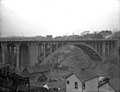
 Bridge View (715.275461.CP).jpg 3,000 × 2,072; 1.39 MB
-
 Confluence of the Allegheny and Monongahela Rivers (13539809325).jpg 2,000 × 1,007; 2.21 MB
-
 Curtoparkview.jpg 3,664 × 2,748; 2.11 MB
-
 Curtoview2.jpg 3,664 × 2,748; 2.18 MB
-
 Downtown (5349361119).jpg 4,592 × 3,056; 3.64 MB
-
 Downtown Pittsburgh from Federal Street, North Side, 2022-12-07 bw 02.jpg 4,320 × 3,240; 2.15 MB
-
 Downtown Pittsburgh from Federal Street, North Side, 2022-12-07.jpg 4,164 × 3,123; 2.45 MB
-
 Downtown Pittsburgh from the South Side Slopes, 2022-09-27, 01.jpg 3,656 × 2,734; 2.35 MB
-
 Downtown Pittsburgh from the South Side Slopes, 2022-09-27, 02.jpg 3,656 × 2,734; 2.75 MB
-
 Downtown Pittsburgh from the South Side Slopes, 2022-09-27, 03.jpg 3,656 × 2,734; 2.93 MB
-
 Duquense University steps (11617009).jpg 2,112 × 2,816; 4.59 MB
-
 East Sycamore Street Bridge.jpg 4,032 × 3,024; 5.29 MB
-
 Exposition Park during 1913 Flood (715.133263.CP).png 3,000 × 2,332; 4.2 MB
-
 Four Mile Run bridges from hillside.jpg 4,032 × 3,024; 5.54 MB
-
 Frazier Street Bridge from Oakland end.jpg 4,656 × 3,492; 7.12 MB
-
 Frazier Street Bridge overview.jpg 4,032 × 3,024; 5.59 MB
-
 From Greenfield- downtown (62803580).jpg 1,934 × 2,708; 3.45 MB
-
 From Greenfield- Panther Hollow & parkway (62803917).jpg 2,816 × 2,112; 4.52 MB
-

-

-
 Good morning, Pittsburgh! (4099912373).jpg 3,456 × 2,304; 3.16 MB
-
 Greenfield steps (63014752).jpg 1,890 × 2,650; 990 KB
-
 H. J. Heinz Company from Frank Curto Park.jpg 2,245 × 1,497; 1.42 MB
-
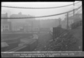
 Homestead Fog - panoramio.jpg 2,048 × 1,536; 1.2 MB
-
 In the mill district of Pittsburgh, Pennsylvania (fsa.8c29020).tif 4,815 × 5,109; 23.51 MB
-
 Jones and Laughlin steel mills, Pittsburgh, Pa. (det.4a10414).tif 4,983 × 3,980; 18.94 MB
-
 Laclede Street (715.168794.CP).jpg 3,000 × 2,413; 1.27 MB
-
 Larimer Avenue Bridge (715.133503.CP).jpg 3,000 × 2,175; 1.04 MB
-
 Lelia Street (715.25693.CP).jpg 3,000 × 2,054; 1.31 MB
-

-
-
 Liberty Bridge Looking South (20180813-hpichswp-0140).png 4,171 × 2,839; 7.46 MB
-
 Looking over the city (5544200812).jpg 3,240 × 4,320; 4.92 MB
-
 Manchesteroverlookview.jpg 3,664 × 2,748; 1.92 MB
-
 Maurice Street (715.3628097.CP).png 3,000 × 1,906; 4.25 MB
-
 Meadow Street Bridge (715.101837.CP).jpg 3,000 × 2,293; 847 KB
-
 Mission Street Pumping Station (715.122823A.CP).png 3,000 × 2,279; 3.36 MB
-
 New Greenfield bridge.jpg 4,032 × 3,024; 4.38 MB
-
 Nine Mile Run Browns Road (715.275363.CP).jpg 3,000 × 2,121; 1.28 MB
-
 Oakland Viewed From Flagstaff Hill.jpg 11,578 × 2,535; 9.42 MB
-
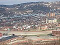
 Oo steel valley (24154552091).jpg 3,264 × 2,448; 2.36 MB
-
 Palm Garden Trestle over Saw Mill Run valley.jpg 4,032 × 3,024; 5.51 MB
-
 Panther Hollow Bridge (715.144140.CP).jpg 3,000 × 2,165; 957 KB
-
 Pgh DSC 0041.JPG (283636926).jpg 3,008 × 2,000; 1.46 MB
-
 PittCathedralofLearningfromUpperCampus.jpg 3,023 × 2,217; 3.22 MB
-
 Pittsburgh Panorama (62195063).jpg 5,203 × 1,920; 4.86 MB
-
 Pittsburgh Skyline 1.jpg 4,000 × 3,000; 4.02 MB
-
 Pittsburgh Skyline 2.jpg 2,592 × 1,944; 1.82 MB
-
 Pittsburgh Skyline 3.jpg 2,816 × 2,112; 993 KB
-

-
 Pittsburgh skyline from St. Mary’s Cemetery, Kennedy Township, 2024-09-23-1 Tri-X 4.jpg 2,760 × 1,840; 1,008 KB
-
 Pittsburgh skyline from St. Mary’s Cemetery, Kennedy Township, 2024-09-23.jpg 2,734 × 3,656; 2.93 MB
-
 Pittsburgh Skyline from West End Overlook 02.jpg 1,249 × 1,874; 1 MB
-
 Pittsburgh, Pa. (det.4a25783).tif 5,068 × 4,061; 19.66 MB
-
 Pittsburgh-20.jpg 2,560 × 1,920; 2.94 MB
-
 Pittsburgh-26.jpg 2,560 × 1,920; 2.61 MB
-
 Pocusset Trail in Schenley Park.jpg 4,032 × 3,024; 7.87 MB
-
 Railroad Tracks (715.168796.CP).jpg 3,000 × 2,405; 1.34 MB
-
 Schenley Park and vicinity, Pittsburgh, Pa. (det.4a10409).tif 4,979 × 3,976; 18.91 MB
-
 Schenley Park, Panther Bridge, Pittsburgh, Pa. (det.4a16756).tif 5,068 × 4,048; 19.6 MB
-
 Second Avenue Passenger Railway (Right (7429.0025R.PR).jpg 3,000 × 2,416; 1.15 MB
-
 Second Avenue to Bluff Street city steps Bluff-Uptown Pittsburgh.jpg 1,200 × 1,198; 325 KB
-
 Seldom Seen Greenway view.jpg 4,656 × 3,492; 9.48 MB
-
 Sixteenth Street Bridge from Frank Curto Park.jpg 2,250 × 1,500; 1.45 MB
-

-

-
 South Side Pittsburgh (6040247466).jpg 3,872 × 2,592; 2.61 MB
-
 South Side Pittsburgh Panorama Feb 2010.jpg 5,024 × 1,092; 744 KB
-
 Southside steps 3.jpg 2,816 × 2,112; 1.6 MB
-
 Southside, viewed from Duquesne.jpeg 2,816 × 2,112; 4.17 MB
-
 Strip District from Frank Curto Park.jpg 2,259 × 1,506; 1.63 MB
-
 Sunset (512798010).jpg 3,072 × 2,304; 3.83 MB
-
 Sylvan Avenue Bridge (715.144285.CP).jpg 3,000 × 2,180; 1.17 MB
-
 The end of the road- facing East (64063264).jpg 2,723 × 1,946; 4.19 MB
-
 The end of the road- facing West (64062832).jpg 2,024 × 1,444; 2.02 MB
-
 The Point In Development (1).jpg 3,312 × 2,244; 602 KB
-
 Troy Hill North East.jpg 2,222 × 1,517; 3.75 MB
-
 View from The Bluff (715.287511A.CP).jpg 3,000 × 2,356; 1.1 MB
-
 View from the Hill (715.216122.CP).jpg 3,000 × 2,221; 1.72 MB
-

-
 Views from high -1- South Side slopes (51584831).jpg 2,816 × 2,112; 4 MB


.png)

.png)
.png)
.png)
.png)
.jpg)
.jpg)


.jpg)


.jpg)

.png)


.jpg)
.jpg)
.jpg)
.jpg)


.jpg)
.jpg)
.jpg)
.png)
.png)
.png)
.jpg)

.png)
.jpg)
.png)

.jpg)
.jpg)

.jpg)
.jpg)


.jpg)
.jpg)


.jpg)


.jpg)
.jpg)
.jpg)
.jpg)
.jpg)

.jpg)
.jpg)

.jpg)
.jpg)