Category:Church of Assumption of the Holy Virgin, Dolné Orešany
Jump to navigation
Jump to search
| Object location | | View all coordinates using: OpenStreetMap |
|---|
| This category shows the protected monument with the number 207-816/1 (other) in the Slovak Republic. |
| This category shows the protected monument with the number 207-816/2 (other) in the Slovak Republic. |
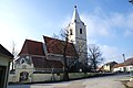
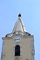
church building in Trnava District, Slovakia  Kostel Nanebevzetí Panny Marie (Dolné Orešany) | |||||
| Upload media | |||||
| Instance of | |||||
|---|---|---|---|---|---|
| Named after | |||||
| Patron saint | |||||
| Location | Dolné Orešany, Trnava District, Trnava Region, Slovakia | ||||
| Architectural style | |||||
| Diocese | |||||
| Heritage designation | |||||
 | |||||
Subcategories
This category has only the following subcategory.
Media in category "Church of Assumption of the Holy Virgin, Dolné Orešany"
The following 18 files are in this category, out of 18 total.
-
 Dolné Orešany church 01.JPG 3,872 × 2,592; 1.51 MB
-
 Dolné Orešany church 02.JPG 2,592 × 3,872; 1.39 MB
-
 Dolné Orešany church 03.JPG 2,592 × 3,872; 1.49 MB
-
 Dolné Orešany kostol 01.jpg 3,456 × 2,304; 1.6 MB
-
 Dolné Orešany kostol 02.jpg 2,304 × 3,456; 1.54 MB
-
 Dolné Orešany kostol 03.jpg 2,304 × 3,456; 1.07 MB
-
 Dolné Orešany kostol 04.jpg 2,304 × 3,456; 1.67 MB
-
 Dolné Orešany kostol 05.jpg 3,456 × 2,304; 1.61 MB
-
 Dolné Orešany kostol 06.jpg 2,304 × 3,456; 2.15 MB
-
 Dolné Orešany kostol 07.jpg 3,456 × 2,304; 1.61 MB
-
 Dolné Orešany kostol 08.jpg 2,304 × 3,456; 2.19 MB
-
 Dolné Orešany kostol 09.jpg 2,304 × 3,456; 2.02 MB
-
 Dolné Orešany kostol 10.jpg 2,304 × 3,456; 2.3 MB
-
 Dolné Orešany kostol 11.jpg 3,456 × 2,304; 2.13 MB
-
 Dolné Orešany kostol 12.jpg 3,456 × 2,304; 2 MB
-
 Dolné Orešany kostol 13.jpg 3,456 × 2,304; 1.74 MB
-
 Slovakia DolneOresany Kostol1.JPG 2,560 × 1,920; 2.38 MB
-
 Slovakia DolneOresany Kostol2.JPG 1,920 × 2,560; 2.4 MB


