Category:Church in Trampe (Uckermark)
Jump to navigation
Jump to search
| Object location | | View all coordinates using: OpenStreetMap |
|---|
church building in Uckermark district, Brandenburg state, Germany _2018_N.jpg) | |||||
| Upload media | |||||
| Instance of | |||||
|---|---|---|---|---|---|
| Location | Trampe, Brüssow, Amt Brüssow, Uckermark District, Brandenburg, Germany | ||||
| Heritage designation | |||||
 | |||||
This is the category of the Brandenburger Baudenkmal (cultural heritage monument) with the ID 09130070 (Wikidata)
|
English: Pictures of the church in Trampe, Brüssow municipality, Uckermark district, Brandenburg state, Germany
Deutsch: Bilder der Kirche in Trampe, Stadt Brüssow, Landkreis Uckermark, Land Brandenburg, Deutschland.
Français : Photos de l'église à Trampe, ville de Brüssow, arrondissement de Uckermark, état fédéral de Brandebourg, Allemagne
Media in category "Church in Trampe (Uckermark)"
The following 7 files are in this category, out of 7 total.
-
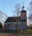 Dorfkirche Trampe (Uckermark) 2018 N.jpg 4,100 × 4,684; 10.19 MB
-
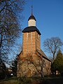
 Dorfkirche Trampe (Uckermark) 2018 NW.jpg 3,648 × 4,864; 9.14 MB
-
 Dorfkirche Trampe (Uckermark) 2018 S.jpg 5,200 × 4,860; 11.06 MB
-
 Dorfkirche Trampe (Uckermark) 2018 SE.jpg 4,864 × 3,648; 9.81 MB
-
 Dorfkirche Trampe (Uckermark) 2018 SW.jpg 3,648 × 4,864; 6.72 MB
-
 Dorfkirche Trampe (Uckermark) 2018 Südportal.jpg 3,534 × 4,780; 8.17 MB
-
 Dorfkirche Trampe (Uckermark) 2018 Westportal.jpg 4,730 × 3,648; 8.74 MB
_2018_NW.jpg)
_2018_S.jpg)
_2018_SE.jpg)
_2018_SW.jpg)
_2018_S%C3%BCdportal.jpg)
_2018_Westportal.jpg)