Category:Church Stowe
Jump to navigation
Jump to search
English: Church Stowe is a village in the West Northamptonshire district of the county of Northamptonshire in England. It is the largest settlement in the civil parish of Stowe Nine Churches.
village in Northamptonshire, United Kingdom  | |||||
| Upload media | |||||
| Instance of | |||||
|---|---|---|---|---|---|
| Location | Stowe Nine Churches, West Northamptonshire, Northamptonshire, East Midlands, England | ||||
 | |||||
Subcategories
This category has the following 2 subcategories, out of 2 total.
C
- Church Stowe War Memorial (1 F)
M
Media in category "Church Stowe"
The following 35 files are in this category, out of 35 total.
-
 100-mile tree - geograph.org.uk - 490154.jpg 640 × 477; 100 KB
-
 Birth of Radar Memorial - geograph.org.uk - 386034.jpg 480 × 640; 99 KB
-
 Church Stowe - geograph.org.uk - 2157440.jpg 640 × 492; 64 KB
-
 Church Stowe Bus Stop - geograph.org.uk - 2157470.jpg 640 × 480; 88 KB
-
 Church Stowe Farmland - geograph.org.uk - 2157480.jpg 640 × 480; 79 KB
-
 Church Stowe Signpost - geograph.org.uk - 2157446.jpg 640 × 480; 134 KB
-
 Church Stowe Village Green - geograph.org.uk - 2157486.jpg 640 × 480; 105 KB
-
 Church Stowe-Macmillan Way - geograph.org.uk - 2157466.jpg 640 × 480; 81 KB
-
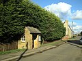
 Church Stowe-The Old School House - geograph.org.uk - 2147588.jpg 640 × 480; 60 KB
-
 Farm field at Upper Stowe - geograph.org.uk - 101745.jpg 640 × 480; 79 KB
-
 Macmillan Way at Church Stowe - geograph.org.uk - 101629.jpg 640 × 480; 65 KB
-
 Stowe Heights Farm - geograph.org.uk - 490237.jpg 640 × 477; 101 KB
-
-
-
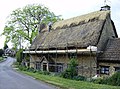 Thatcher at work - geograph.org.uk - 490190.jpg 640 × 477; 113 KB
-
 Thatcher at work - geograph.org.uk - 490203.jpg 640 × 477; 100 KB
-
 View from Church Stowe - geograph.org.uk - 490173.jpg 640 × 477; 73 KB
-
 Approaching Church Stowe - geograph.org.uk - 490161.jpg 640 × 477; 113 KB
-
 Church Stowe - geograph.org.uk - 490179.jpg 640 × 477; 115 KB
-
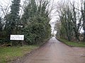
 Entrance to Stowe Heights Farm - geograph.org.uk - 490224.jpg 640 × 477; 93 KB
-

-
 Farmland at Stowe Lodge - geograph.org.uk - 101755.jpg 640 × 480; 65 KB
-
 Farthingstone - geograph.org.uk - 225502.jpg 640 × 480; 93 KB
-
 Footpath across a rape field - geograph.org.uk - 490212.jpg 640 × 477; 102 KB
-

-

-
 Into Lodge Plantation - geograph.org.uk - 490258.jpg 640 × 477; 164 KB
-
 Main line railway near Weedon. - geograph.org.uk - 101736.jpg 640 × 480; 118 KB
-

-
 Stowe Nine Churches - geograph.org.uk - 490248.jpg 640 × 477; 108 KB
-
 The track to Stowe Wood - geograph.org.uk - 389843.jpg 640 × 480; 65 KB
-
 Tributary of the Nene - geograph.org.uk - 388905.jpg 640 × 480; 139 KB
-
 Weedon - geograph.org.uk - 345297.jpg 640 × 480; 96 KB
-
 Weedon Hill - geograph.org.uk - 224819.jpg 640 × 480; 113 KB
-
 Weedon Hill - geograph.org.uk - 225324.jpg 640 × 480; 93 KB


