Category:Christmas in Princenhage, 2013
Jump to navigation
Jump to search
| Object location | | View all coordinates using: OpenStreetMap |
|---|
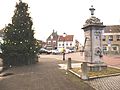
Nederlands: Afbeeldingen van de kerstversieringen en de kerststal in 2013 voor het oude raadhuis van Princenhage bij de Haagsemarkt in de wijk Princenhage in het zuiden van Breda.
Subcategories
This category has only the following subcategory.
Media in category "Christmas in Princenhage, 2013"
The following 4 files are in this category, out of 4 total.
-
 Haagsemarkt Princenhage DSCF3202.JPG 4,000 × 3,000; 5.18 MB
-
 Haagsemarkt Princenhage DSCF3203.JPG 4,000 × 3,000; 4.99 MB
-
 Haagsemarkt Princenhage DSCF3206.JPG 2,816 × 2,112; 2.74 MB
-
 Haagsemarkt Princenhage DSCF3226.JPG 4,000 × 3,000; 5.34 MB


