Category:Chapelle Saint-André (Noertzange)
Jump to navigation
Jump to search
| Object location | | View all coordinates using: OpenStreetMap |
|---|
 | |||||
| Upload media | |||||
| Instance of | |||||
|---|---|---|---|---|---|
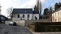
| Location | Noertzange, Bettembourg, Canton of Esch-sur-Alzette, Luxembourg | ||||
 | |||||
Media in category "Chapelle Saint-André (Noertzange)"
The following 3 files are in this category, out of 3 total.
-
 Kapelle Noertzange 01.jpg 1,500 × 1,868; 1.41 MB
-
 Kapelle Noertzange 02.jpg 1,903 × 1,460; 1.69 MB
-
 Näerzeng30.jpg 2,573 × 1,447; 570 KB

