Category:Caldwell, East Renfrewshire
Jump to navigation
Jump to search
Caldwell is an eastate to the west of the A736 road in Uplawmoor, East Renfrewshire. There was a mansion house, later used as a hospital, but was ruined by fire in 1995.
Subcategories
This category has the following 2 subcategories, out of 2 total.
C
- Caldwell Golf Club (2 F)
- Caldwell Tower (9 F)
Media in category "Caldwell, East Renfrewshire"
The following 8 files are in this category, out of 8 total.
-
 Access to Caldwell Lodge - geograph.org.uk - 1421355.jpg 640 × 480; 103 KB
-
 Caldwell Lodge drive - geograph.org.uk - 1092311.jpg 640 × 480; 105 KB
-
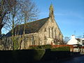 Caldwell Parish Church - geograph.org.uk - 95633.jpg 640 × 481; 117 KB
-
 Caldwell-Ladeside Woods at Loch Libo.JPG 2,288 × 1,712; 1.31 MB
-
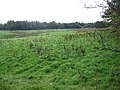
 Derelict Farm - geograph.org.uk - 1420455.jpg 640 × 480; 112 KB
-
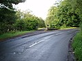
 Lochlibo Valley - geograph.org.uk - 1148430.jpg 640 × 480; 83 KB
-
 Melons Wood - geograph.org.uk - 251927.jpg 640 × 480; 110 KB
-
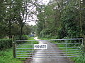 No go - geograph.org.uk - 251931.jpg 640 × 480; 145 KB


