Category:Buslingthorpe, Lincolnshire
Jump to navigation
Jump to search
hamlet and civil parish in Lincolnshire, England  | |||||
| Upload media | |||||
| Instance of | |||||
|---|---|---|---|---|---|
| Location | West Lindsey, Lincolnshire, East Midlands, England | ||||
| Population |
| ||||
 | |||||
Subcategories
This category has the following 2 subcategories, out of 2 total.
B
S
Media in category "Buslingthorpe, Lincolnshire"
The following 79 files are in this category, out of 79 total.
-

-

-
 Beck running east from Shortwood Lane - geograph.org.uk - 2744438.jpg 768 × 1,024; 291 KB
-
 Bend in Buslingthorpe Road, near Manor farm - geograph.org.uk - 2744444.jpg 1,280 × 960; 400 KB
-
 Beware of the bull - geograph.org.uk - 1976663.jpg 640 × 426; 119 KB
-
 Bridleway between Gibbet Lane and Mill Lane - geograph.org.uk - 3272836.jpg 1,024 × 768; 272 KB
-
-
 Buslingthorpe DMV, aerial 2019 (1) - geograph.org.uk - 6340070.jpg 1,024 × 683; 130 KB
-
 Buslingthorpe DMV, aerial 2019 (2) - geograph.org.uk - 6340077.jpg 1,024 × 683; 138 KB
-
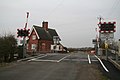
 Buslingthorpe Level Crossing - geograph.org.uk - 2745804.jpg 1,201 × 746; 586 KB
-
 Buslingthorpe Level Crossing - geograph.org.uk - 4155731.jpg 640 × 480; 59 KB
-
 Buslingthorpe Level Crossing - geograph.org.uk - 4155735.jpg 640 × 480; 57 KB
-
-

-
 Charter House - geograph.org.uk - 2829205.jpg 1,024 × 768; 158 KB
-
 Charter House, Buslingthorpe - geograph.org.uk - 5792870.jpg 1,600 × 1,065; 504 KB
-

-
 Country lane from Buslingthorpe - geograph.org.uk - 4382316.jpg 640 × 427; 80 KB
-
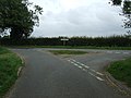 Country road junction - geograph.org.uk - 4155744.jpg 640 × 480; 67 KB
-
 Crop field, Buslingthorpe - geograph.org.uk - 3502896.jpg 640 × 500; 63 KB
-
 Crop field, Gibbet Hill - geograph.org.uk - 4527356.jpg 640 × 480; 95 KB
-
 Driveway to East Farm, Buslingthorpe - geograph.org.uk - 1411115.jpg 640 × 480; 71 KB
-

-
 Farm track (footpath) heading south - geograph.org.uk - 4155720.jpg 640 × 480; 56 KB
-
 Farm track off Buslingthorpe Road - geograph.org.uk - 5770997.jpg 1,600 × 1,065; 604 KB
-
 Farm track to Buslingthorpe - geograph.org.uk - 3272668.jpg 1,024 × 768; 163 KB
-

-
 Farmland east of Buslingthorpe - geograph.org.uk - 4155726.jpg 640 × 480; 79 KB
-
 Farmland east of Faldingworth - geograph.org.uk - 3502893.jpg 640 × 537; 44 KB
-

-
 Farmland west of Lissingley Lane - geograph.org.uk - 4155752.jpg 640 × 480; 71 KB
-

-

-

-
 Hollow way to a pond - geograph.org.uk - 2829215.jpg 1,024 × 768; 179 KB
-

-
 Junction on Lissingley Lane - geograph.org.uk - 4025720.jpg 1,024 × 727; 96 KB
-
 Lane towards Linwood - geograph.org.uk - 4155723.jpg 640 × 480; 59 KB
-
 Lane towards Linwood - geograph.org.uk - 4155727.jpg 640 × 480; 86 KB
-
 Lane towards Linwood - geograph.org.uk - 4155739.jpg 640 × 480; 82 KB
-
 Lissingley Lane - geograph.org.uk - 4155754.jpg 640 × 480; 69 KB
-
 Lissingley Level Crossing - geograph.org.uk - 2745800.jpg 1,242 × 904; 859 KB
-
 Lissingley Level Crossing - geograph.org.uk - 3272652.jpg 1,024 × 768; 149 KB
-
 Lissingley level crossing - geograph.org.uk - 4025718.jpg 1,024 × 768; 140 KB
-
 Lissingley Level Crossings - geograph.org.uk - 5771092.jpg 1,600 × 1,065; 675 KB
-
 Manor Farm, Buslingthorpe - geograph.org.uk - 4155717.jpg 640 × 480; 58 KB
-
 Mill Lane, Buslingthorpe (1) - geograph.org.uk - 1411132.jpg 640 × 480; 78 KB
-
 Mill Lane, Buslingthorpe (2) - geograph.org.uk - 1411152.jpg 640 × 480; 76 KB
-
 Mill Lane, Buslingthorpe (3) - geograph.org.uk - 1411161.jpg 640 × 480; 77 KB
-
 Mill Lane, Buslingthorpe (4) - geograph.org.uk - 1411168.jpg 640 × 480; 73 KB
-
 Mill Lane, Buslingthorpe (5) - geograph.org.uk - 1411203.jpg 640 × 480; 95 KB
-

-
 National cycle route ^1 - geograph.org.uk - 4025715.jpg 1,024 × 768; 129 KB
-
 North of the lane to Buslingthorpe - geograph.org.uk - 4846657.jpg 640 × 427; 71 KB
-
 Ordnance Survey Cut Mark - geograph.org.uk - 5480281.jpg 640 × 360; 110 KB
-
 Paddock by Musgrave Farm - geograph.org.uk - 4846690.jpg 640 × 427; 109 KB
-
 Postbox on Bulingthorpe Road, Buslingthorpe - geograph.org.uk - 5792877.jpg 1,600 × 1,065; 797 KB
-

-
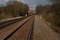
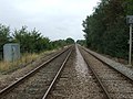 Railway towards Market Rasen - geograph.org.uk - 4155733.jpg 640 × 480; 91 KB
-
 Road to The Hardings - geograph.org.uk - 4155753.jpg 640 × 480; 44 KB
-
 Sheepscar Beck 03 June 2017.jpg 3,264 × 2,448; 3.6 MB
-
 Silos, Manor Farm - geograph.org.uk - 4155719.jpg 640 × 480; 53 KB
-
 Site of Buslingthorpe village - geograph.org.uk - 3751495.jpg 800 × 533; 173 KB
-
 Site of Buslingthorpe village - geograph.org.uk - 3751500.jpg 800 × 533; 201 KB
-
 Site of Buslingthorpe village - geograph.org.uk - 3751504.jpg 800 × 533; 149 KB
-
 Site of Buslingthorpe village - geograph.org.uk - 3751508.jpg 800 × 533; 193 KB
-
 Site of Buslingthorpe village - geograph.org.uk - 3751511.jpg 800 × 533; 170 KB
-
 St Michael's Church, Buslingthorpe - geograph.org.uk - 5770988.jpg 1,600 × 1,065; 801 KB
-
 St Michael's Church, Buslingthorpe - geograph.org.uk - 5791961.jpg 1,065 × 1,600; 317 KB
-
 St Michael's Church, Buslingthorpe - geograph.org.uk - 5791965.jpg 1,065 × 1,600; 330 KB
-
 St Michael's Church, Buslingthorpe - geograph.org.uk - 5791975.jpg 1,600 × 1,065; 418 KB
-
 Track to Grange Farm (footpath) - geograph.org.uk - 4537764.jpg 640 × 480; 65 KB
-
 Track to Manor Farm - geograph.org.uk - 1976658.jpg 640 × 426; 85 KB
-

-

-
 View towards Lissingley Farm - geograph.org.uk - 4871219.jpg 640 × 427; 54 KB
-

-
 Manor Farm - geograph.org.uk - 466818.jpg 640 × 427; 43 KB
-
 Over the hill - geograph.org.uk - 466821.jpg 640 × 427; 58 KB


_-_geograph.org.uk_-_6340070.jpg)
_-_geograph.org.uk_-_6340077.jpg)


_heading_south_-_geograph.org.uk_-_4155720.jpg)


_-_geograph.org.uk_-_6339127.jpg)


_-_geograph.org.uk_-_1411132.jpg)
_-_geograph.org.uk_-_1411152.jpg)
_-_geograph.org.uk_-_1411161.jpg)
_-_geograph.org.uk_-_1411168.jpg)
_-_geograph.org.uk_-_1411203.jpg)


_-_geograph.org.uk_-_4537764.jpg)


_-_geograph.org.uk_-_1411140.jpg)

