Category:Burley, Rutland
Jump to navigation
Jump to search
village and civil parish in Rutland, UK  | |||||
| Upload media | |||||
| Instance of | |||||
|---|---|---|---|---|---|
| Location | Rutland, East Midlands, England | ||||
| Population |
| ||||
| Area |
| ||||
 | |||||
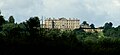
English: Burley or Burley-on-the-Hill is a village and civil parish in the county of Rutland in the East Midlands of England. It is located two miles north-east of Oakham.
Subcategories
This category has the following 2 subcategories, out of 2 total.
B
- Burley-on-the-Hill Mansion (9 F)
Media in category "Burley, Rutland"
The following 189 files are in this category, out of 189 total.
-
 'Corner Cottage' - geograph.org.uk - 5125638.jpg 3,776 × 2,520; 3.87 MB
-
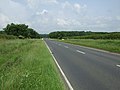
 A606 heading towards Stamford - geograph.org.uk - 3283197.jpg 3,461 × 2,488; 2.2 MB
-
 A606 near Barnsdale - geograph.org.uk - 2238286.jpg 800 × 600; 360 KB
-
 A606 towards Stamford - geograph.org.uk - 3017048.jpg 640 × 480; 66 KB
-
 Along the square boundary - geograph.org.uk - 5181011.jpg 640 × 448; 62 KB
-
 Ashwell Prison - geograph.org.uk - 2351468.jpg 640 × 472; 73 KB
-
 Ashwell Prison entrance - geograph.org.uk - 2351462.jpg 640 × 426; 85 KB
-
 Ashwell Road - geograph.org.uk - 2351459.jpg 640 × 465; 90 KB
-
 Ashwell Road leading out of Oakham - geograph.org.uk - 5125101.jpg 3,776 × 2,520; 3.91 MB
-
 Ashwell Road passes the prison - geograph.org.uk - 2351467.jpg 640 × 560; 82 KB
-

-
 B668 Cottesmore Road leaving Burley for Cottesmore - geograph.org.uk - 5125631.jpg 3,776 × 2,520; 4.03 MB
-
 Bench mark, Exton Lane - geograph.org.uk - 4816875.jpg 960 × 1,280; 576 KB
-
 Bench mark, Hillside Farm, Burley on the Hill - geograph.org.uk - 4824942.jpg 1,280 × 960; 345 KB
-

-
 Bench Mark, The Smithy, Burley on the Hill - geograph.org.uk - 4824935.jpg 960 × 1,280; 329 KB
-
 Benchmark on culvert on SE side of A606 - geograph.org.uk - 5133665.jpg 1,024 × 683; 210 KB
-
 Brick culvert for ditch beside A606 - geograph.org.uk - 5133670.jpg 1,024 × 683; 348 KB
-
 Bridleway off Langham Lane, Burley on the Hill - geograph.org.uk - 4824707.jpg 1,280 × 960; 253 KB
-
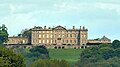
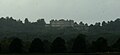
 Burley House - geograph.org.uk - 3282590.jpg 2,829 × 2,591; 1.55 MB
-

-
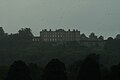
 Burley House peeking above the trees - geograph.org.uk - 3283169.jpg 3,129 × 2,110; 2.04 MB
-
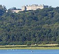
 Burley on the hill - geograph.org.uk - 2571677.jpg 1,600 × 1,200; 378 KB
-
 Burley on the Hill House, Rutland.jpg 580 × 326; 50 KB
-
 Burley on the Hill House, stable yard wall - geograph.org.uk - 4824927.jpg 1,280 × 924; 384 KB
-
 Burley on the Hill postbox ref LE15 48 - geograph.org.uk - 4824945.jpg 960 × 1,280; 376 KB
-
 Burley on the Hill, aerial 2017 - geograph.org.uk - 5436180.jpg 1,024 × 550; 124 KB
-
 Burley Park boundary wall - geograph.org.uk - 4816877.jpg 1,280 × 880; 284 KB
-
 Burley Road - geograph.org.uk - 5002624.jpg 4,608 × 3,456; 3.34 MB
-
 Burley Road - geograph.org.uk - 5002625.jpg 4,608 × 3,456; 3.38 MB
-
 Burley water tower - geograph.org.uk - 4816018.jpg 1,280 × 960; 285 KB
-
 Burley water tower - geograph.org.uk - 6111484.jpg 1,876 × 1,210; 2.04 MB
-
 Cemetery at Burley - geograph.org.uk - 1145414.jpg 640 × 480; 69 KB
-
 Cemetery, Langham Lane, Burley - geograph.org.uk - 5125127.jpg 3,776 × 2,520; 3.96 MB
-
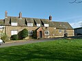 Chestnut Farmhouse, Burley on the Hill - geograph.org.uk - 4824932.jpg 1,280 × 960; 331 KB
-
 Church Cottage, Burley on the Hill - geograph.org.uk - 4824709.jpg 1,280 × 960; 404 KB
-
 Church of The Holy Cross, Burley - geograph.org.uk - 5125172.jpg 3,776 × 2,520; 3.24 MB
-
 Church of the Holy Cross, Burley on the Hill - geograph.org.uk - 4824868.jpg 1,280 × 977; 276 KB
-
 Church of the Holy Cross, Burley on the Hill - geograph.org.uk - 4824871.jpg 1,280 × 960; 286 KB
-
 Church of the Holy Cross, Burley on the Hill - geograph.org.uk - 4824874.jpg 960 × 1,280; 310 KB
-
 Church of the Holy Cross, Burley on the Hill - geograph.org.uk - 4824878.jpg 975 × 1,280; 352 KB
-
 Church of the Holy Cross, Burley on the Hill - geograph.org.uk - 4824882.jpg 1,280 × 960; 283 KB
-
 Church of the Holy Cross, Burley on the Hill - geograph.org.uk - 4824888.jpg 960 × 1,280; 266 KB
-
 Church of the Holy Cross, Burley on the Hill - geograph.org.uk - 4824890.jpg 1,280 × 960; 280 KB
-
 Church of the Holy Cross, Burley on the Hill - geograph.org.uk - 4824893.jpg 1,280 × 960; 285 KB
-
 Church of the Holy Cross, Burley on the Hill - geograph.org.uk - 4824896.jpg 1,280 × 960; 307 KB
-
 Church of the Holy Cross, Burley on the Hill - geograph.org.uk - 4824898.jpg 1,280 × 896; 589 KB
-
 Church of the Holy Cross, Burley on the Hill - geograph.org.uk - 4824904.jpg 1,280 × 960; 276 KB
-
 Church of the Holy Cross, Burley on the Hill - geograph.org.uk - 4824909.jpg 1,280 × 886; 294 KB
-
 Church of the Holy Cross, Burley on the Hill - geograph.org.uk - 4824916.jpg 1,280 × 960; 351 KB
-
 Church Road, Burley - geograph.org.uk - 6113491.jpg 1,920 × 1,280; 1.41 MB
-
 Cormorant nests, Rutland Water - geograph.org.uk - 4826095.jpg 1,280 × 862; 433 KB
-
 Cottesmore Road at Birley - geograph.org.uk - 2822060.jpg 640 × 428; 65 KB
-
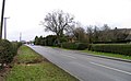 Cottesmore Road at Burley - geograph.org.uk - 2822055.jpg 640 × 395; 64 KB
-

-

-

-

-
 Driveways at Burley - geograph.org.uk - 2822057.jpg 640 × 427; 73 KB
-
 Duck Pond at Burley House entrance - geograph.org.uk - 135049.jpg 640 × 427; 117 KB
-
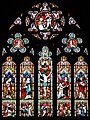
 East window, Holy Cross church, Burley - geograph.org.uk - 4477136.jpg 2,508 × 3,321; 6.42 MB
-
 Edge of field northwards - geograph.org.uk - 5181006.jpg 640 × 453; 67 KB
-
 Edge of field southwards - geograph.org.uk - 5181007.jpg 640 × 453; 74 KB
-
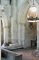
 Effigy of Knight and Lady, Holy Cross church, Burley - geograph.org.uk - 4477250.jpg 4,175 × 2,472; 5.89 MB
-
 Entrance to Ashwell Prison - geograph.org.uk - 2351463.jpg 640 × 415; 77 KB
-
 Entrance to Burley Cemetery - geograph.org.uk - 1145415.jpg 640 × 414; 62 KB
-
 Entrance to Cottesmore Domestic refuse Site - geograph.org.uk - 5363608.jpg 3,648 × 2,736; 4.11 MB
-
 Entrance to Cow Close Farm - geograph.org.uk - 2238402.jpg 800 × 600; 332 KB
-
 Estate House, Burley on the Hill - geograph.org.uk - 4824936.jpg 1,280 × 960; 441 KB
-
 Exton Lane - geograph.org.uk - 4816874.jpg 1,280 × 830; 206 KB
-
 Exton Lane - geograph.org.uk - 5125645.jpg 3,776 × 2,520; 4.12 MB
-
 Exton Lane eastwards - geograph.org.uk - 5181008.jpg 640 × 441; 56 KB
-
 Exton Lane near Burley - geograph.org.uk - 6111480.jpg 1,892 × 1,236; 1.32 MB
-

-
 Exton Lane westwards - geograph.org.uk - 5181009.jpg 640 × 444; 61 KB
-
 Exton Lane, Burley - geograph.org.uk - 6111482.jpg 1,920 × 1,280; 976 KB
-
 Farm buildings - geograph.org.uk - 145817.jpg 640 × 480; 101 KB
-

-
 Field edge southwards - geograph.org.uk - 5181012.jpg 640 × 500; 88 KB
-
 Field on the Edge of the Burley Estate - geograph.org.uk - 145890.jpg 640 × 427; 173 KB
-
 Field pond - geograph.org.uk - 5181013.jpg 640 × 437; 79 KB
-
 Field-road boundary hedge westwards - geograph.org.uk - 5181010.jpg 640 × 471; 69 KB
-
 Fields on 16 September 2016 - geograph.org.uk - 5181610.jpg 640 × 452; 70 KB
-
 Finch's nest - geograph.org.uk - 4826082.jpg 1,280 × 844; 216 KB
-
 Fingerpost, Burley on the Hill - geograph.org.uk - 4824934.jpg 960 × 1,280; 399 KB
-
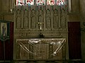
 Font, Holy Cross church, Burley - geograph.org.uk - 4477180.jpg 1,958 × 2,764; 2.89 MB
-
 Footpath from Langham Lane - geograph.org.uk - 4715702.jpg 4,608 × 3,456; 3.37 MB
-
 Footpath near to Burley - geograph.org.uk - 145814.jpg 640 × 467; 89 KB
-
 Footpath to Oakham Road - geograph.org.uk - 4715705.jpg 4,608 × 3,456; 3.52 MB
-
 Get off my land - geograph.org.uk - 456932.jpg 640 × 477; 92 KB
-
 Green by Church Road, Burley - geograph.org.uk - 6113495.jpg 1,920 × 1,280; 1.93 MB
-
 Hillside Farm, Burley on the Hill - geograph.org.uk - 4824708.jpg 1,280 × 894; 235 KB
-
 Hillside Farmhouse, Burley on the Hill - geograph.org.uk - 4824943.jpg 1,280 × 960; 341 KB
-
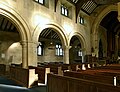
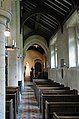
 Holy Cross, Burley on the Hill - Aisle - geograph.org.uk - 2235395.jpg 531 × 800; 106 KB
-

-

-
 Holy Cross, Burley on the Hill - Arcade - geograph.org.uk - 2235420.jpg 531 × 800; 104 KB
-
 Holy Cross, Burley on the Hill - Chancel - geograph.org.uk - 2235399.jpg 513 × 800; 138 KB
-

-

-
 Holy Cross, Burley on the Hill - Font - geograph.org.uk - 2235394.jpg 526 × 800; 113 KB
-
 Holy Cross, Burley on the Hill - geograph.org.uk - 2235389.jpg 526 × 800; 125 KB
-
 Holy Cross, Burley on the Hill - geograph.org.uk - 2235391.jpg 800 × 531; 107 KB
-
 Holy Cross, Burley on the Hill - geograph.org.uk - 2235392.jpg 800 × 536; 96 KB
-

-
-

-
-

-

-

-
-

-

-

-

-

-
 Horseshoe Farm, Burley on the Hill - geograph.org.uk - 4824941.jpg 1,280 × 960; 407 KB
-
 Horseshoe Farmhouse and attached cottages - geograph.org.uk - 4824940.jpg 1,280 × 960; 357 KB
-
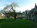
 House at Burley - geograph.org.uk - 1134707.jpg 640 × 523; 115 KB
-
-
 Langham Lane - geograph.org.uk - 1145413.jpg 640 × 480; 88 KB
-
 Langham Lane - geograph.org.uk - 5125111.jpg 3,776 × 2,520; 4.26 MB
-
 Langham Lane towards Burley - geograph.org.uk - 1145416.jpg 640 × 478; 74 KB
-
 MacMillan Way east of Oakham - geograph.org.uk - 6113421.jpg 1,920 × 1,280; 680 KB
-
 Memorial to Lady Charlotte Finch, Burley church - geograph.org.uk - 4477239.jpg 2,826 × 4,606; 5.73 MB
-
 Motte Oakham.jpg 640 × 480; 99 KB
-
 Mount Alstoe - geograph.org.uk - 4816001.jpg 1,280 × 960; 243 KB
-
 Oakham Canal near Langham - geograph.org.uk - 3911462.jpg 1,280 × 960; 432 KB
-
 Oakham from Burley on the Hill - geograph.org.uk - 4824919.jpg 1,280 × 836; 252 KB
-
 Oakham Road, Burley - geograph.org.uk - 6113550.jpg 1,920 × 1,280; 1.76 MB
-
 Old cottages in Burley - geograph.org.uk - 5211323.jpg 640 × 427; 82 KB
-
 Organ, Holy Cross church, Burley - geograph.org.uk - 4477194.jpg 2,448 × 3,696; 2.12 MB
-
 Overgrown section of the former Oakham canal - geograph.org.uk - 4266762.jpg 3,776 × 2,520; 4.22 MB
-
 Part of Burley - geograph.org.uk - 5125153.jpg 3,776 × 2,520; 4.05 MB
-
 Path in the churchyard, Burley on the Hill (geograph 7334581).jpg 1,024 × 768; 218 KB
-
 Pillbox near Langham - geograph.org.uk - 3911455.jpg 1,280 × 960; 223 KB
-
 Pond and wooden structure - geograph.org.uk - 5181607.jpg 640 × 482; 83 KB
-
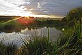 Pond at sunset - geograph.org.uk - 5181611.jpg 640 × 430; 81 KB
-
 Pond from SE - geograph.org.uk - 5181014.jpg 640 × 387; 85 KB
-
 Pond from west - geograph.org.uk - 5181015.jpg 640 × 461; 94 KB
-
 Pond off Exton Lane - geograph.org.uk - 5363603.jpg 3,648 × 2,736; 4.19 MB
-

-
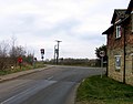 Road junction at Burley - geograph.org.uk - 1134709.jpg 640 × 499; 63 KB
-
 Roundabout by Ashwell Prison - geograph.org.uk - 2351460.jpg 640 × 495; 95 KB
-
 Rutland drystone wall - geograph.org.uk - 2238397.jpg 800 × 600; 426 KB
-
 Rutland Water from A606 - geograph.org.uk - 456912.jpg 640 × 477; 104 KB
-
 Simply Ginger^ - geograph.org.uk - 1301668.jpg 640 × 480; 103 KB
-

-

-
 Smart new bridleway bridge - geograph.org.uk - 4266749.jpg 3,776 × 2,520; 4.27 MB
-
 Stable block, Burley on the Hill House - geograph.org.uk - 4824922.jpg 1,280 × 960; 493 KB
-
 The A606 and the Hereward Way - geograph.org.uk - 1003546.jpg 640 × 610; 99 KB
-
 The end of Rutland Water - geograph.org.uk - 456936.jpg 640 × 477; 83 KB
-

-
 The Old Smithy at Burley - geograph.org.uk - 4715700.jpg 4,608 × 3,456; 3.41 MB
-
 The Old Vicarage, Burley on the Hill - geograph.org.uk - 4824929.jpg 1,280 × 960; 614 KB
-
 The Smithy. Burley on the Hill - geograph.org.uk - 4824933.jpg 1,280 × 960; 409 KB
-
 The Viking Way and Cycle Route 63 alongside the A606 - geograph.org.uk - 5125016.jpg 3,776 × 2,520; 4.22 MB
-
 The village green at Burley - geograph.org.uk - 4715696.jpg 4,608 × 3,456; 3.43 MB
-
 The village green at Burley - geograph.org.uk - 4715698.jpg 4,608 × 3,456; 3.47 MB
-
 The village green at Burley - geograph.org.uk - 4715701.jpg 4,608 × 3,456; 3.64 MB
-
 The water tower on Exton Lane - geograph.org.uk - 2995779.jpg 800 × 600; 113 KB
-
 Towards Crow Spinney from Exton Lane - geograph.org.uk - 1145418.jpg 640 × 429; 65 KB
-
 Towards Oakham - geograph.org.uk - 2351461.jpg 640 × 471; 76 KB
-
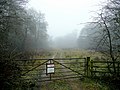 Track into Burley Wood - geograph.org.uk - 2238280.jpg 800 × 600; 418 KB
-
 Track to Cow Close Farm - geograph.org.uk - 1145417.jpg 640 × 412; 56 KB
-
 Track to Cow Close Farm - geograph.org.uk - 4715724.jpg 4,608 × 3,456; 3.41 MB
-
 Track to Cow Close Farm - geograph.org.uk - 4715728.jpg 4,608 × 3,456; 3.34 MB
-

-
-

-

-
-

-
-

-
-
 View towards Oakham - geograph.org.uk - 2613088.jpg 640 × 465; 59 KB
-
 Viking Way - geograph.org.uk - 2388411.jpg 640 × 427; 83 KB
-
 Water Tower. - geograph.org.uk - 389021.jpg 640 × 424; 137 KB
-
 Wooden structure next to pond - geograph.org.uk - 5181608.jpg 640 × 482; 128 KB
-
 A606 north of Rutland Water - geograph.org.uk - 1003604.jpg 640 × 535; 111 KB
-
 Blossom in the Spring - geograph.org.uk - 158729.jpg 640 × 480; 173 KB
-
 Cycle track and path - geograph.org.uk - 184869.jpg 640 × 508; 113 KB
-
 Cycle track round Rutland Water - geograph.org.uk - 188596.jpg 640 × 480; 99 KB
-
 New Oakham Ring Road - geograph.org.uk - 146249.jpg 640 × 427; 111 KB
-
 Road between Oakham and Ashwell - geograph.org.uk - 41119.jpg 640 × 480; 141 KB
-
 Sheep guarding HMP Ashwell - geograph.org.uk - 145830.jpg 640 × 438; 86 KB


.jpg)


