Category:Burg Neuenstein (Wahlen)
Jump to navigation
Jump to search
| Object location | | View all coordinates using: OpenStreetMap |
|---|
archaeological site and castle ruins in Wahlen in the canton of Basel-Landschaft, Switzerland _-_Kellerreste.jpg) | |||||
| Upload media | |||||
| Instance of | |||||
|---|---|---|---|---|---|
| Part of | |||||
| Location |
| ||||
| Heritage designation | |||||
 | |||||
Media in category "Burg Neuenstein (Wahlen)"
This category contains only the following file.
-
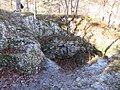 Ruine Neuenstein (Wahlen) - Kellerreste.jpg 2,048 × 1,536; 1.83 MB