Category:Brobury with Monnington on Wye
Jump to navigation
Jump to search
civil parish in Herefordshire, England  | |||||
| Upload media | |||||
| Instance of | |||||
|---|---|---|---|---|---|
| Named after | |||||
| Location | Herefordshire, West Midlands, England | ||||
| Population |
| ||||
 | |||||
English: Brobury with Monnington on Wye civil parish in Herefordshire, England. According to the 2001 census it had a population of 67. The parish includes Brobury and Monnington, both of which are on the River Wye.
Media in category "Brobury with Monnington on Wye"
The following 21 files are in this category, out of 21 total.
-

-
 A438 near Staunton-on-Wye - geograph.org.uk - 4791320.jpg 1,600 × 901; 683 KB
-
 Arable land at Staunton on Wye - geograph.org.uk - 2782316.jpg 1,024 × 680; 203 KB
-
 Bank Vole on the track - geograph.org.uk - 3170258.jpg 640 × 480; 115 KB
-
 Bridleway to Monnington Walk - geograph.org.uk - 2782314.jpg 680 × 1,024; 293 KB
-
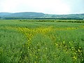
 Corn field near Brobury House - geograph.org.uk - 545493.jpg 640 × 480; 90 KB
-
 Cranesbill, Geranium sp. - geograph.org.uk - 1355402.jpg 640 × 640; 356 KB
-
 Fork in the road - geograph.org.uk - 1355424.jpg 640 × 480; 262 KB
-
 Last few rape flowers - geograph.org.uk - 1355359.jpg 640 × 480; 231 KB
-
 Monnington cider orchards - geograph.org.uk - 2786971.jpg 1,024 × 577; 302 KB
-
 Monnington Walk - geograph.org.uk - 3170232.jpg 640 × 480; 83 KB
-
 Monnington Walk - geograph.org.uk - 3723181.jpg 2,592 × 1,944; 1.26 MB
-
 Oak in a field near Letton - geograph.org.uk - 1355596.jpg 640 × 480; 281 KB
-

-

-
 Ordnance Survey Cut Mark - geograph.org.uk - 4758260.jpg 480 × 640; 87 KB
-
 Part of Monnington Walk - geograph.org.uk - 3170239.jpg 640 × 480; 88 KB
-
 Red Campion, Silene dioica - geograph.org.uk - 1355393.jpg 640 × 640; 343 KB
-
 The Portway Inn - geograph.org.uk - 3170276.jpg 640 × 480; 56 KB
-
 The River Wye (Bredwardine) - geograph.org.uk - 5817096.jpg 4,096 × 3,072; 3.7 MB
-
 Track and bridleway - geograph.org.uk - 4791318.jpg 1,600 × 901; 675 KB


.jpg)


_-_geograph.org.uk_-_5817096.jpg)
