Category:Bridgtown
Jump to navigation
Jump to search
English: Bridgtown is a civil parish in the Cannock Chase District of Staffordshire, England. It is situated on the A5 between Cannock and Great Wyrley. At the 2001 census, Bridgtown had a population of 885.
village in the United Kingdom | |||||
| Upload media | |||||
| Instance of | |||||
|---|---|---|---|---|---|
| Location | Cannock Chase, Staffordshire, West Midlands, England | ||||
| Population |
| ||||
 | |||||
Media in category "Bridgtown"
The following 20 files are in this category, out of 20 total.
-
 Bridgtown Bethel Methodist church - geograph.org.uk - 4205573.jpg 1,142 × 857; 324 KB
-
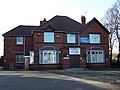 Bridgtown Social W.M.C., Cannock - geograph.org.uk - 1053746.jpg 640 × 480; 74 KB
-
 Brownfield Site, Walkmill Lane - geograph.org.uk - 2465386.jpg 640 × 428; 50 KB
-
 Car dealership, Cannock - geograph.org.uk - 4195459.jpg 1,142 × 857; 273 KB
-
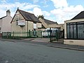 Church Street school, Bridgtown - geograph.org.uk - 4199566.jpg 1,142 × 857; 308 KB
-
 Former St Paul's Church, Bridgtown - geograph.org.uk - 4199571.jpg 1,142 × 857; 330 KB
-
 Hair Studio. North St. Bridgtown. - geograph.org.uk - 2444825.jpg 640 × 428; 70 KB
-
 Houses on Watling Street (A5) - geograph.org.uk - 6374168.jpg 800 × 562; 65 KB
-
 Housing on Lakeside Boulevard, Bridgtown, Cannock - geograph.org.uk - 3889208.jpg 1,469 × 1,102; 386 KB
-
 Lakeside Boulevard, Bridgtown - geograph.org.uk - 2465389.jpg 640 × 428; 58 KB
-
 Lakeside Plaza - geograph.org.uk - 2659453.jpg 430 × 640; 56 KB
-
 Lakeside Plaza from A460 east - geograph.org.uk - 3002470.jpg 640 × 462; 60 KB
-

-
 OS Flush Bracket - Bridgtown school - geograph.org.uk - 4199557.jpg 734 × 979; 380 KB
-
 OS Flush Bracket S8965 - geograph.org.uk - 3889211.jpg 857 × 1,142; 495 KB
-

-
 The Castle, Bridgtown, Cannock - geograph.org.uk - 1053680.jpg 640 × 480; 55 KB
-
 The Ramada Hotel, Cannock - geograph.org.uk - 2617527.jpg 600 × 800; 230 KB
-
 Walsall Road. Bridgtown - geograph.org.uk - 650231.jpg 640 × 480; 186 KB
-
 Watling Street (A5), Bridgtown - geograph.org.uk - 6374170.jpg 800 × 600; 58 KB


_-_geograph.org.uk_-_6374168.jpg)


,_Bridgtown_-_geograph.org.uk_-_6374170.jpg)