Category:Bower (civil parish)
Jump to navigation
Jump to search
Scottish parish in Highland, Scotland, UK | |||||
| Upload media | |||||
| Instance of | |||||
|---|---|---|---|---|---|
| Named after | |||||
| Location | |||||
| Population |
| ||||
| Area |
| ||||
 | |||||
Subcategories
This category has the following 4 subcategories, out of 4 total.
B
- Barrock Mill (3 F)
- Bower railway station (4 F)
S
- Loch Scarmclate (2 F)
Media in category "Bower (civil parish)"
The following 200 files are in this category, out of 323 total.
(previous page) (next page)-
 A rare bend - geograph.org.uk - 5900492.jpg 1,024 × 576; 200 KB
-
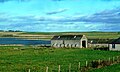
 Abandoned farm buildings at Bowertower - geograph.org.uk - 1980588.jpg 800 × 531; 137 KB
-
 Abandoned farm near Bowertower - geograph.org.uk - 1980570.jpg 800 × 531; 163 KB
-
 Access steps - geograph.org.uk - 2264851.jpg 3,648 × 2,736; 2.2 MB
-
 Access to Westside, Bowermadden - geograph.org.uk - 5528086.jpg 1,024 × 682; 151 KB
-
 Approaching Bloodyquoys - geograph.org.uk - 4227396.jpg 640 × 382; 66 KB
-
 B847 near Stemster House - geograph.org.uk - 1980656.jpg 800 × 531; 136 KB
-
 B870 near the junction with the B876 - geograph.org.uk - 2019891.jpg 800 × 531; 199 KB
-
 B874 near Knockdee - geograph.org.uk - 2020417.jpg 800 × 531; 122 KB
-
 B874 near Stemster Schoolhouse - geograph.org.uk - 5084336.jpg 640 × 480; 68 KB
-
 B874 towards Knockdee - geograph.org.uk - 5085416.jpg 640 × 480; 57 KB
-
 B874 towards Knockdee - geograph.org.uk - 5085420.jpg 640 × 480; 56 KB
-
 B874, Gillock - geograph.org.uk - 5085427.jpg 640 × 480; 59 KB
-
 B874, Glassagh - geograph.org.uk - 5085437.jpg 640 × 480; 60 KB
-
 B874, Knockdee - geograph.org.uk - 5084304.jpg 640 × 480; 64 KB
-
 B874, Knockdee - geograph.org.uk - 5084310.jpg 640 × 480; 69 KB
-
 B874, Knockdee - geograph.org.uk - 5084313.jpg 640 × 480; 108 KB
-
 B874, Stemster - geograph.org.uk - 5084345.jpg 640 × 480; 65 KB
-
 B876, Kirk - geograph.org.uk - 5898037.jpg 1,024 × 576; 234 KB
-
 B876, Myrelandhorn - geograph.org.uk - 5085574.jpg 640 × 480; 54 KB
-
 B876, South Kirk - geograph.org.uk - 5085569.jpg 640 × 480; 61 KB
-
 Barrock House, Lyth - geograph.org.uk - 5527934.jpg 1,024 × 682; 203 KB
-
 Bend in Burn of Bower near Burnside, Wick - geograph.org.uk - 5457162.jpg 5,184 × 3,888; 6.51 MB
-
 Bog, Hecken - geograph.org.uk - 5900491.jpg 1,024 × 576; 274 KB
-
 Bower Church - geograph.org.uk - 5527995.jpg 1,024 × 682; 202 KB
-
 Bower Church - geograph.org.uk - 5527996.jpg 1,024 × 682; 209 KB
-
 Bower Churchyard - geograph.org.uk - 5528017.jpg 1,024 × 682; 186 KB
-
 Bower Community Hall - geograph.org.uk - 2017590.jpg 3,648 × 2,736; 2.23 MB
-
 Bower Community Hall - geograph.org.uk - 5532066.jpg 1,024 × 682; 129 KB
-
 Bower Kirk - geograph.org.uk - 2699405.jpg 1,000 × 669; 165 KB
-
 Bower Mains - geograph.org.uk - 2699410.jpg 1,000 × 669; 218 KB
-
 Bower Manse - geograph.org.uk - 5528006.jpg 1,024 × 642; 161 KB
-
 Bower Old Church and churchyard - geograph.org.uk - 5528013.jpg 1,024 × 682; 177 KB
-
 Bower Quarry - geograph.org.uk - 1215123.jpg 640 × 425; 83 KB
-
 Brabster Moss - geograph.org.uk - 5085450.jpg 640 × 480; 74 KB
-
 Brabster West ruin near Watten, Caithness - geograph.org.uk - 5930622.jpg 5,184 × 3,888; 7.68 MB
-
 Bridge of Hecken - geograph.org.uk - 5531854.jpg 1,024 × 604; 176 KB
-
 Burn of Alterwall - geograph.org.uk - 4082235.jpg 640 × 427; 227 KB
-
 Burn of Bower at Bridge of Hecken - geograph.org.uk - 5531855.jpg 1,024 × 682; 170 KB
-
 Burn of Bower from the bridge near Swartiebank - geograph.org.uk - 2016385.jpg 3,648 × 2,736; 2.22 MB
-
 Caithness crop field - geograph.org.uk - 5084331.jpg 640 × 480; 71 KB
-
 Caithness Farm - geograph.org.uk - 1936111.jpg 4,416 × 3,312; 1.34 MB
-
 Caithness flag fence at Nipster - geograph.org.uk - 5532144.jpg 1,024 × 682; 175 KB
-
 Caithness flag fence at Nipster - geograph.org.uk - 5532150.jpg 1,024 × 682; 234 KB
-
 Cattle grazing near Bower Quarry - geograph.org.uk - 5103260.jpg 640 × 467; 65 KB
-
 Cereal crop at Brabsterdorran - geograph.org.uk - 5532079.jpg 1,024 × 682; 103 KB
-
 Clayock Farm - geograph.org.uk - 866494.jpg 640 × 421; 277 KB
-
 Clayock Farmland - geograph.org.uk - 4227364.jpg 640 × 404; 80 KB
-
 Clayock Farmland Drainage - geograph.org.uk - 4227369.jpg 640 × 434; 92 KB
-
 Clayock Farmland View - geograph.org.uk - 4227360.jpg 640 × 399; 82 KB
-
 Cleared conifer plantation at Hastigrow - geograph.org.uk - 5531859.jpg 1,024 × 682; 214 KB
-
 Clearfelled wood near Hastigrow - geograph.org.uk - 3694496.jpg 1,600 × 1,200; 640 KB
-
 Clearing in North Seater forestry near Watten, Caithness - geograph.org.uk - 5931049.jpg 3,128 × 2,346; 2.51 MB
-
-
 Close up, Victorian postbox, Corsback - geograph.org.uk - 5107133.jpg 1,290 × 2,400; 553 KB
-
 Conifers' Last Stand - geograph.org.uk - 1215408.jpg 640 × 425; 77 KB
-
 Corsback - geograph.org.uk - 4623474.jpg 2,048 × 1,536; 574 KB
-
 Corsback Hill - geograph.org.uk - 5085417.jpg 640 × 480; 84 KB
-
 Cottage at Swartiebank - geograph.org.uk - 2016389.jpg 3,648 × 2,736; 2.07 MB
-
 Cottage in the trees - geograph.org.uk - 1233849.jpg 640 × 412; 118 KB
-
 Cottages at Newton - geograph.org.uk - 2020265.jpg 800 × 531; 142 KB
-
 Crop field near Gelshfield - geograph.org.uk - 5103267.jpg 640 × 381; 39 KB
-
 Crop field near Tister - geograph.org.uk - 5084355.jpg 640 × 480; 83 KB
-
 Crowsnest Cottage - geograph.org.uk - 2386544.jpg 3,648 × 2,736; 2.17 MB
-
 Crowsnest Level Crossing Gate - geograph.org.uk - 2386528.jpg 3,648 × 2,736; 2.22 MB
-
 Dawn light at Bridge of Lyth - geograph.org.uk - 5535427.jpg 1,024 × 679; 182 KB
-
 Derelict cottage at Stemster - geograph.org.uk - 2017648.jpg 3,648 × 2,736; 2.08 MB
-
 Derelict farm buildings at Newton - geograph.org.uk - 2017619.jpg 3,648 × 2,736; 2.17 MB
-
 Derelict farm buildings at Newton - geograph.org.uk - 2020422.jpg 800 × 531; 137 KB
-
 Details of trig point at Brabsterdorran - geograph.org.uk - 2017578.jpg 1,796 × 1,956; 1.44 MB
-
 Dilapidated farm buildings at Poolhoy - geograph.org.uk - 1980653.jpg 800 × 531; 158 KB
-
 Drain and dyke - geograph.org.uk - 1252678.jpg 640 × 438; 119 KB
-
 Driveway to Barrock House - geograph.org.uk - 5527942.jpg 1,024 × 682; 287 KB
-
 Electricity sub station at Hastigrow - geograph.org.uk - 5531862.jpg 1,024 × 682; 158 KB
-
 Elizabethan postbox outside Stemster Schoolhouse - geograph.org.uk - 5099540.jpg 2,848 × 2,136; 1.41 MB
-
 Elizabethan postbox, Corsback - geograph.org.uk - 5107128.jpg 640 × 488; 83 KB
-
-
 Energy related shed at Bower - geograph.org.uk - 5528152.jpg 1,024 × 670; 135 KB
-
 Entrance to Seater Landfill Site - geograph.org.uk - 2015871.jpg 3,648 × 2,736; 2.02 MB
-
 Entry to Sackville - geograph.org.uk - 5531874.jpg 1,024 × 682; 294 KB
-
 Farm at Laurel - geograph.org.uk - 826905.jpg 640 × 480; 77 KB
-
 Farm buildings at Newton - geograph.org.uk - 2020266.jpg 800 × 531; 132 KB
-
 Farm buildings at Stanstill - geograph.org.uk - 2016368.jpg 3,648 × 2,736; 2.26 MB
-
 Farm buildings at Stemster - geograph.org.uk - 2020443.jpg 800 × 531; 150 KB
-
 Farm buildings Granton Mains Farm - geograph.org.uk - 2015801.jpg 3,648 × 2,736; 2.23 MB
-
 Farm buildings near North Watten - geograph.org.uk - 5085466.jpg 640 × 480; 89 KB
-
 Farm buildings, Knockdee - geograph.org.uk - 5084315.jpg 640 × 402; 45 KB
-
 Farm buildings, South Kirk - geograph.org.uk - 5085556.jpg 640 × 480; 57 KB
-
 Farm road to Mains of Bowertower - geograph.org.uk - 1980602.jpg 800 × 531; 149 KB
-
 Farm Track at Larel - geograph.org.uk - 1936174.jpg 4,416 × 3,312; 2.09 MB
-
 Farm track at Stemster - geograph.org.uk - 2020435.jpg 800 × 531; 165 KB
-
 Farm track near Hastigrow - geograph.org.uk - 3694492.jpg 1,600 × 1,200; 673 KB
-
 Farm track near Thura Mains - geograph.org.uk - 2020270.jpg 800 × 531; 207 KB
-
 Farm track to Tister - geograph.org.uk - 1215162.jpg 640 × 425; 94 KB
-
 Farmhouse, Home Farm - geograph.org.uk - 5084337.jpg 640 × 480; 98 KB
-

-
 Farmland at Kirk - geograph.org.uk - 1936207.jpg 4,416 × 3,312; 2.1 MB
-
 Farmland near Kirk Burn - geograph.org.uk - 1233906.jpg 640 × 421; 69 KB
-
 Farmland near Nipster - geograph.org.uk - 5085432.jpg 640 × 480; 67 KB
-
 Farmland near Plover Hill - geograph.org.uk - 3694449.jpg 1,600 × 1,200; 532 KB
-
 Farmland near Plover Hill - geograph.org.uk - 3694487.jpg 1,600 × 1,200; 574 KB
-
 Farmland off the B874 - geograph.org.uk - 5085423.jpg 640 × 480; 67 KB
-
 Farmland off the B874, Stemster - geograph.org.uk - 5084343.jpg 640 × 480; 59 KB
-

-
 Farmland view at Lyth - geograph.org.uk - 5527949.jpg 1,024 × 682; 148 KB
-
 Felled area, Hastigrow - geograph.org.uk - 5900483.jpg 1,024 × 576; 291 KB
-
 Fence, dyke and ditch at Ha' of Alterwall near Wick - geograph.org.uk - 5456530.jpg 1,600 × 1,200; 575 KB
-
 Fence, dyke and hedgerow - geograph.org.uk - 1252687.jpg 640 × 409; 114 KB
-
 Field corner at Lower Thura - geograph.org.uk - 5531879.jpg 1,024 × 682; 169 KB
-
 Field entrance off the B874 - geograph.org.uk - 5084295.jpg 640 × 480; 74 KB
-
 Field entrance off the B874 - geograph.org.uk - 5085419.jpg 640 × 480; 90 KB
-

-
 Field entrance, Brabster Moss - geograph.org.uk - 5085453.jpg 640 × 480; 90 KB
-
 Field of flags - geograph.org.uk - 1233911.jpg 640 × 422; 57 KB
-
 Field of yellow across Burn of Bower near Wick - geograph.org.uk - 5457136.jpg 5,184 × 3,888; 6.93 MB
-
 Field south of Hunster - geograph.org.uk - 902795.jpg 640 × 480; 74 KB
-
 Field, Glassagh - geograph.org.uk - 5085439.jpg 640 × 480; 74 KB
-
 Field, West Kirk - geograph.org.uk - 5898058.jpg 1,024 × 576; 216 KB
-
 Fields at Smiddyquoy - geograph.org.uk - 5532096.jpg 1,024 × 682; 203 KB
-
 Firebreak in the forest beside the narrow gauge rail track - geograph.org.uk - 5439237.jpg 4,000 × 3,000; 2.96 MB
-
 Flagstone Wall - geograph.org.uk - 1215337.jpg 640 × 425; 91 KB
-
 Flagstone wall - geograph.org.uk - 1215383.jpg 640 × 425; 87 KB
-
 Flagstone wall and woodland - geograph.org.uk - 1215395.jpg 640 × 425; 93 KB
-
 Forest edge and the course of Blind Burn - geograph.org.uk - 5439248.jpg 4,000 × 3,000; 3.65 MB
-
 Forest gap in North Seater wood, Caithness - geograph.org.uk - 5930546.jpg 5,184 × 3,888; 6.98 MB
-
 Freshly trimmed hedgerow - geograph.org.uk - 1215175.jpg 640 × 386; 86 KB
-
 From Gillock to Brabsterdorran - geograph.org.uk - 2818264.jpg 1,000 × 669; 191 KB
-
 Game store in the grounds of Barrock House - geograph.org.uk - 5528025.jpg 1,024 × 682; 213 KB
-
 Gateway at Ha' of Alterwall near Wick - geograph.org.uk - 5456524.jpg 1,600 × 1,200; 647 KB
-
 Gavinstown Lodge - geograph.org.uk - 5085434.jpg 640 × 480; 81 KB
-
 Georgemas to Wick line - geograph.org.uk - 2239251.jpg 1,000 × 669; 272 KB
-
 Gill Burn, Battans of Brabster, Caithness - geograph.org.uk - 5518292.jpg 1,459 × 1,094; 346 KB
-
 Gillock, Old Post Office - geograph.org.uk - 4623467.jpg 2,048 × 1,536; 727 KB
-
 Glassagh - geograph.org.uk - 5085436.jpg 640 × 480; 70 KB
-
 Gorse and flowers in the course of Burn of Bower near Wick - geograph.org.uk - 5457158.jpg 5,184 × 3,888; 7.92 MB
-
 Gorse near Faulds - geograph.org.uk - 824970.jpg 640 × 480; 64 KB
-

-
 Grassland and Loch Scarmclate - geograph.org.uk - 6290768.jpg 1,024 × 576; 254 KB
-
 Grassland near Muness - geograph.org.uk - 5085459.jpg 640 × 480; 63 KB
-
 Grassland to the South East of Seater Farm - geograph.org.uk - 2015907.jpg 3,648 × 2,736; 2.06 MB
-
 Grassland, Lyth - geograph.org.uk - 5901364.jpg 1,024 × 576; 325 KB
-
 Grassland, Poolhoy - geograph.org.uk - 5084415.jpg 640 × 480; 71 KB
-
 Grazing and fence line, Knockdee - geograph.org.uk - 5084301.jpg 640 × 480; 62 KB
-
 Grazing Land Near Loch Scarmclate - geograph.org.uk - 4227386.jpg 640 × 376; 59 KB
-
 Grazing off the B874, Knockdee - geograph.org.uk - 5084302.jpg 640 × 480; 84 KB
-
 Grazing sheep - geograph.org.uk - 1252689.jpg 640 × 415; 91 KB
-
 Grazing towards Loch Scarmclate - geograph.org.uk - 5103265.jpg 640 × 429; 47 KB
-
 Grazing, Bloodyquoys - geograph.org.uk - 5103261.jpg 640 × 423; 56 KB
-
 Grazing, Clayock - geograph.org.uk - 5104852.jpg 640 × 420; 55 KB
-
 Grazing, Gillock - geograph.org.uk - 5085426.jpg 640 × 480; 81 KB
-
 Grazing, Knockdee - geograph.org.uk - 5084305.jpg 640 × 480; 68 KB
-
 Grazing, Knockdee - geograph.org.uk - 5084317.jpg 640 × 410; 57 KB
-
 Grazing, Muness - geograph.org.uk - 5085455.jpg 640 × 480; 72 KB
-
 Grazing, Myrelandhorn - geograph.org.uk - 5085570.jpg 640 × 480; 75 KB
-
 Grazing, Tails of Kirk - geograph.org.uk - 5085551.jpg 640 × 480; 80 KB
-
 Grazing, Tister - geograph.org.uk - 5084407.jpg 640 × 480; 71 KB
-
 Grazing, Whitefield - geograph.org.uk - 5085415.jpg 640 × 480; 59 KB
-
 Heading south east, Faulds - geograph.org.uk - 5085462.jpg 640 × 480; 68 KB
-
 Heavy horses near Burnside - geograph.org.uk - 2408200.jpg 800 × 600; 223 KB
-
 Hecken - geograph.org.uk - 5900485.jpg 1,024 × 576; 183 KB
-
 Hedged lane - geograph.org.uk - 1215173.jpg 640 × 414; 61 KB
-
 Hedging near Brabster West ruin by Watten, Caithness - geograph.org.uk - 5930611.jpg 5,184 × 3,888; 7.94 MB
-
 Hillhead Farm triangulation pillar - geograph.org.uk - 1937566.jpg 640 × 480; 55 KB
-
 Hillhead, Lyth - geograph.org.uk - 5901352.jpg 1,024 × 576; 306 KB
-
 Hilliclay Mains - geograph.org.uk - 1935474.jpg 4,416 × 3,312; 1.41 MB
-
 Home Farm, Stemster - geograph.org.uk - 2020460.jpg 800 × 531; 157 KB
-
 House and farmland near Gillock - geograph.org.uk - 1980646.jpg 800 × 531; 151 KB
-
 House at Stanstill - geograph.org.uk - 2016364.jpg 3,648 × 2,736; 2.24 MB
-
 House Name Plate - geograph.org.uk - 2386558.jpg 2,941 × 2,120; 1.59 MB
-
 House, Gillock - geograph.org.uk - 5085428.jpg 640 × 480; 88 KB
-
 House, South Kirk - geograph.org.uk - 5085565.jpg 640 × 415; 46 KB
-
 Houses old and new at Halcro - geograph.org.uk - 5532063.jpg 1,024 × 682; 170 KB
-

-
-
 Lane by Bower Quarry - geograph.org.uk - 1215142.jpg 640 × 469; 101 KB
-
 Lane to Quoynee - geograph.org.uk - 1215127.jpg 640 × 422; 89 KB
-
 Lane with hedgerows - geograph.org.uk - 1215167.jpg 640 × 425; 87 KB
-
 Lane with hedgerows - geograph.org.uk - 1215179.jpg 640 × 351; 65 KB
-
 Large shed north of Alterwall - geograph.org.uk - 5536542.jpg 1,024 × 674; 144 KB
-
 Lightyears away - geograph.org.uk - 5898018.jpg 1,024 × 576; 148 KB
-
 Line to Wick near site of Bowers Station - geograph.org.uk - 1898480.jpg 960 × 720; 266 KB
-
 Loch Scaramclete - geograph.org.uk - 3234719.jpg 3,612 × 2,688; 5.22 MB
-
 Loch Scarmclate View - geograph.org.uk - 4227378.jpg 640 × 373; 86 KB
-
 Looking across to Brabster moss - geograph.org.uk - 824946.jpg 640 × 480; 69 KB
-
 Looking west at North Watten - geograph.org.uk - 824788.jpg 640 × 480; 76 KB
-
 Memorial at Brabsterdorran - geograph.org.uk - 2818254.jpg 1,000 × 669; 145 KB
-
 Milton Farm - Bad Weather approaching - geograph.org.uk - 4760438.jpg 1,800 × 1,012; 1.32 MB
-
 Milton Farm - geograph.org.uk - 2017781.jpg 3,648 × 2,736; 2.22 MB
-
 Minor road by North Watten Moss - geograph.org.uk - 5532232.jpg 1,024 × 682; 150 KB
-
 Minor road junction with the B876 - geograph.org.uk - 5085554.jpg 640 × 480; 44 KB
-
 Minor road near Blackpark - geograph.org.uk - 4899187.jpg 1,600 × 900; 343 KB
-
 Minor road near Bowermadden - geograph.org.uk - 3694474.jpg 1,600 × 1,200; 388 KB
-
 Minor road near Bowermadden - geograph.org.uk - 3694482.jpg 1,600 × 1,200; 358 KB
-
 Minor road near Bowermadden - geograph.org.uk - 3694483.jpg 1,600 × 1,200; 357 KB
-
 Minor road near Bowertower - geograph.org.uk - 1980593.jpg 800 × 531; 148 KB
-
 Minor road near Lyth - geograph.org.uk - 3694402.jpg 1,600 × 1,200; 280 KB
-
 Minor road north of Alterwater - geograph.org.uk - 4899191.jpg 1,600 × 900; 358 KB
-
 Minor road towards Brabsterdorran - geograph.org.uk - 5085460.jpg 640 × 480; 59 KB
-
 Minor road towards Faulds - geograph.org.uk - 5085441.jpg 640 × 480; 67 KB
-
 Minor road towards Faulds - geograph.org.uk - 5085446.jpg 640 × 480; 68 KB


&filefrom=Minor+road+towards+the+B874+-+geograph.org.uk+-+5084414.jpg#mw-category-media)