Category:Botley, Oxfordshire
Jump to navigation
Jump to search
village in the civil parish of North Hinksey, Oxfordshire, UK  | |||||
| Upload media | |||||
| Instance of | |||||
|---|---|---|---|---|---|
| Location | North Hinksey, Botley and North Hinksey, Vale of White Horse, Oxfordshire, South East England, England | ||||
 | |||||
English: Botley is a village in the civil parish of North Hinksey, just west of the Oxford city boundary in the English county of Oxfordshire. In 1974 it was transferred from Berkshire. It lies near the junction between the A34 Oxford ring road and the A420 to Swindon.
Subcategories
This category has the following 10 subcategories, out of 10 total.
B
D
E
- Elms Parade, Botley (10 F)
G
- George Inn, Botley (7 F)
P
S
- The Seacourt Bridge (3 F)
- Seacourt Tower (17 F)
W
Media in category "Botley, Oxfordshire"
The following 114 files are in this category, out of 114 total.
-
 Access road to the estate - geograph.org.uk - 1634826.jpg 480 × 640; 76 KB
-
 Alexandra Road seen from New Botley recreation ground - geograph.org.uk - 5855916.jpg 5,184 × 3,456; 3.09 MB
-
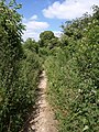
 Alley to the fields - geograph.org.uk - 1103464.jpg 480 × 640; 110 KB
-

-
 Benchmark on Binsey Lane Bridge abutment - geograph.org.uk - 5712326.jpg 1,024 × 683; 335 KB
-
 Binsey Lane - bridge over Bulstake Stream - geograph.org.uk - 6270596.jpg 1,280 × 960; 531 KB
-
 Binsey Lane - geograph.org.uk - 4352783.jpg 640 × 480; 83 KB
-
 Binsey Lane, 2007 floods - geograph.org.uk - 5856609.jpg 1,840 × 1,232; 991 KB
-
 The former Carpenters Arms, Botley, Oxfordshire, Nov 2012.jpg 3,264 × 2,448; 2.67 MB
-
 Botley Road flyover - geograph.org.uk - 1632754.jpg 640 × 480; 66 KB
-
 Bridge over Bulstake Stream - geograph.org.uk - 6606806.jpg 4,000 × 3,000; 4.56 MB
-
 Bridge over the Bulstrake Stream - geograph.org.uk - 4862056.jpg 2,048 × 1,536; 1.53 MB
-
 Bridge taking Binsey Lane over Bulstake Stream - geograph.org.uk - 5712295.jpg 1,024 × 683; 286 KB
-
 Bridleway to Harcourt Hill - geograph.org.uk - 872847.jpg 480 × 640; 139 KB
-
 Bus stop on West Way - geograph.org.uk - 1510158.jpg 640 × 427; 71 KB
-

-
 Chapel along the road - geograph.org.uk - 1632738.jpg 640 × 480; 94 KB
-
 Cripley Place - Abbey Road - geograph.org.uk - 3605284.jpg 640 × 480; 87 KB
-
 Cripley Place - Cripley Road - geograph.org.uk - 3605263.jpg 640 × 449; 58 KB
-
 Cripley Road - Botley Road - geograph.org.uk - 3601369.jpg 640 × 480; 66 KB
-
 Cripley Road - geograph.org.uk - 2535091.jpg 1,024 × 768; 220 KB
-

-
 Cumnor Hill - geograph.org.uk - 95774.jpg 640 × 480; 69 KB
-
 Curtis industrial estate - geograph.org.uk - 1633497.jpg 640 × 480; 63 KB
-
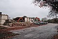 Demolition of the former MFI and Halfords building - geograph.org.uk - 4424617.jpg 2,063 × 1,370; 1.37 MB
-
 Duke Street - geograph.org.uk - 3999837.jpg 2,000 × 1,333; 851 KB
-
 Duke Street - geograph.org.uk - 5856702.jpg 5,184 × 3,456; 5.06 MB
-
 Duke Street, Oxford - geograph.org.uk - 4212670.jpg 800 × 607; 130 KB
-
 Electricity sub station - geograph.org.uk - 4352789.jpg 640 × 480; 83 KB
-
 Entrance to the playing field - geograph.org.uk - 1103455.jpg 640 × 480; 89 KB
-
 Eynsham Road, Dean Court - geograph-1799132.jpg 3,606 × 2,261; 2.41 MB
-
 Flats on Binsey Lane - geograph.org.uk - 4865526.jpg 1,996 × 1,464; 749 KB
-

-
 Full of weeds - geograph.org.uk - 1407003.jpg 640 × 480; 139 KB
-
 Further up the road - geograph.org.uk - 1634822.jpg 640 × 480; 70 KB
-
 Garages on Duke Street - geograph.org.uk - 4002552.jpg 1,650 × 2,025; 883 KB
-
 Golf range - geograph.org.uk - 4352796.jpg 640 × 480; 62 KB
-

-
 Graffiti on the wall - geograph.org.uk - 1632761.jpg 640 × 480; 71 KB
-
 Grate on the culvert - geograph.org.uk - 1634830.jpg 640 × 480; 141 KB
-
 Heading to Botley - geograph.org.uk - 1632682.jpg 640 × 480; 87 KB
-
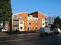
 Hinksey Business Centre - geograph.org.uk - 1633190.jpg 640 × 480; 78 KB
-
 Hinksey Floods - geograph.org.uk - 309119.jpg 640 × 480; 135 KB
-
 Hinksey Stream - geograph.org.uk - 1512039.jpg 640 × 427; 97 KB
-
 Hinksey Stream - geograph.org.uk - 1512041.jpg 640 × 427; 126 KB
-
 Houses on North Hinksey Lane - geograph.org.uk - 1512040.jpg 640 × 427; 108 KB
-
 Houses on Prestwich Place, New Botley - geograph.org.uk - 6270006.jpg 800 × 564; 114 KB
-
 Housing over the road - geograph.org.uk - 1632767.jpg 640 × 480; 80 KB
-
 In front of the school - geograph.org.uk - 1632768.jpg 640 × 480; 82 KB
-
 Johnsons of Oxford - geograph.org.uk - 4333433.jpg 800 × 595; 142 KB
-
 Junction on the road - geograph.org.uk - 1632966.jpg 640 × 480; 76 KB
-
 King George's playing field, New Botley - geograph.org.uk - 5856697.jpg 5,184 × 3,456; 5.62 MB
-
 King George's playing field, New Botley - geograph.org.uk - 5856703.jpg 5,184 × 3,456; 4.86 MB
-
 Lamarsh Road (at Brock Grove) - geograph.org.uk - 5856708.jpg 5,184 × 3,456; 5.03 MB
-
 Lamarsh Road and Earl Street in the distance - geograph.org.uk - 5856706.jpg 5,184 × 3,456; 4.99 MB
-
 Lamarsh Road from Botley Road, 2007 floods - geograph.org.uk - 5856754.jpg 1,840 × 1,232; 1.03 MB
-
 Lane leading from King George's playing field to Duke Street - geograph.org.uk - 5856699.jpg 5,184 × 3,456; 7.48 MB
-
 Looking north with the Thames to the west - panoramio.jpg 3,264 × 2,448; 2.46 MB
-
 Looking past the bank - geograph.org.uk - 1632968.jpg 480 × 640; 67 KB
-
 Looking south onto the Thames - panoramio.jpg 3,264 × 2,448; 2.33 MB
-
 McDonald's carpark - geograph.org.uk - 1633183.jpg 640 × 480; 59 KB
-
 McDonald's restaurant in Botley - geograph.org.uk - 1510161.jpg 640 × 427; 71 KB
-
 Minns industrial estate - geograph.org.uk - 1632699.jpg 640 × 480; 79 KB
-
 New Botley recreation ground - geograph.org.uk - 4003301.jpg 2,000 × 1,999; 750 KB
-
 New Botley Recreation Ground - geograph.org.uk - 5855563.jpg 5,184 × 3,450; 3.5 MB
-
 New Botley recreation ground, path - geograph.org.uk - 5856685.jpg 5,184 × 3,456; 6.58 MB
-
 North Hinksey - South View - 20220916143957.jpg 4,000 × 3,000; 2.33 MB
-
 North Hinksey - South View - 20220917095648.jpg 3,000 × 4,000; 2.18 MB
-
 Oatlands Road - geograph.org.uk - 5856683.jpg 5,184 × 3,456; 4.8 MB
-
 Old Botley - geograph.org.uk - 1633185.jpg 640 × 480; 90 KB
-
 Old Botley houses - geograph.org.uk - 1510167.jpg 640 × 433; 83 KB
-
 Old Botley houses - geograph.org.uk - 1510168.jpg 640 × 427; 86 KB
-
 Oswald Rayner.jpg 303 × 409; 17 KB
-

-
 Parting of ways - geograph.org.uk - 1103443.jpg 640 × 480; 83 KB
-
 Parting of ways - geograph.org.uk - 1633149.jpg 640 × 480; 84 KB
-
 Pasture south of the Bulstake Stream - geograph.org.uk - 4237112.jpg 4,000 × 3,000; 1.41 MB
-
 Path along the edge of New Botley recreation ground - geograph.org.uk - 5855913.jpg 5,184 × 3,456; 5.67 MB
-
 Path along the edge of New Botley recreation ground - geograph.org.uk - 5856688.jpg 5,184 × 3,456; 6.36 MB
-
 Path beside Oatlands Recreation Ground - geograph.org.uk - 6340233.jpg 851 × 1,280; 628 KB
-
 Path from Ferry Hinksey Road to Osney Island - geograph.org.uk - 5863724.jpg 3,456 × 5,184; 5.26 MB
-
 Play Area - Botley Park - geograph.org.uk - 3601457.jpg 640 × 480; 130 KB
-
 Playground in the corner - geograph.org.uk - 1103320.jpg 640 × 480; 43 KB
-
 Post box on the corner - geograph.org.uk - 1633180.jpg 480 × 640; 112 KB
-
 Pub entrance - geograph.org.uk - 1634843.jpg 640 × 480; 96 KB
-
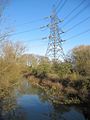 Pylon across the stream - geograph.org.uk - 1634845.jpg 480 × 640; 90 KB
-
 Pylons Lead the Way to Oxford - geograph.org.uk - 436444.jpg 640 × 480; 116 KB
-
 Railings by the dtch - geograph.org.uk - 1634834.jpg 640 × 480; 128 KB
-
 Recreation Ground - Botley Park - geograph.org.uk - 3601463.jpg 640 × 480; 75 KB
-
 Road to Cumnor - geograph.org.uk - 1633137.jpg 640 × 480; 78 KB
-
 Road to North Hinksey - geograph.org.uk - 1634814.jpg 640 × 480; 68 KB
-
 Road to the park - geograph.org.uk - 1632758.jpg 640 × 480; 83 KB
-
 School up the road - geograph.org.uk - 1632771.jpg 640 × 480; 74 KB
-
 Seacourt Hall - geograph.org.uk - 1632961.jpg 640 × 480; 82 KB
-
 Seacourt Stream - geograph.org.uk - 1632679.jpg 640 × 480; 98 KB
-
 Seacourt Stream - geograph.org.uk - 872839.jpg 640 × 480; 127 KB
-
 Seacourt Stream, Botley - geograph.org.uk - 1220099.jpg 640 × 427; 125 KB
-
 Shortcut to the path - geograph.org.uk - 1103447.jpg 640 × 480; 66 KB
-
 Side of the chapel - geograph.org.uk - 1632749.jpg 640 × 480; 84 KB
-
 South side of Bullstake Close, Oxford - geograph.org.uk - 4333373.jpg 786 × 800; 244 KB
-
 Sports Area - Botley Park - geograph.org.uk - 3601467.jpg 640 × 480; 79 KB
-
 Stream by the pub - geograph.org.uk - 1632687.jpg 640 × 480; 97 KB
-
 Sun on the Flood - geograph.org.uk - 3871884.jpg 2,448 × 1,788; 1.39 MB
-
 Tennis Courts - Botley Park - geograph.org.uk - 3601470.jpg 640 × 431; 49 KB
-
 The bridge over Bulstake - geograph.org.uk - 1103311.jpg 640 × 480; 109 KB
-
 The Bulstake Stream - geograph.org.uk - 2880076.jpg 3,700 × 2,232; 3.05 MB
-
 This way to River Hotel, Oxford - geograph.org.uk - 4243792.jpg 800 × 707; 158 KB
-
 View across the Bulstake Stream - geograph.org.uk - 5359824.jpg 1,024 × 768; 346 KB
-

-

-
 West side of Botley Park - geograph.org.uk - 4426208.jpg 4,288 × 2,416; 1.7 MB
-
 Westminster College Sports Centre - geograph.org.uk - 102654.jpg 640 × 480; 89 KB
-
 Westway to the lights - geograph.org.uk - 1633178.jpg 640 × 480; 78 KB
-
 Wine shop on Westway - geograph.org.uk - 1633171.jpg 640 × 480; 74 KB


_-_geograph.org.uk_-_5856708.jpg)


_-_geograph.org.uk_-_5856694.jpg)
_-_geograph.org.uk_-_5863722.jpg)


