Category:Bonsall, Derbyshire
Jump to navigation
Jump to search
village and civil parish in Derbyshire Dales district, Derbyshire, England  | |||||
| Upload media | |||||
| Instance of | |||||
|---|---|---|---|---|---|
| Location | Derbyshire Dales, Derbyshire, East Midlands, England | ||||
| Population |
| ||||
| Said to be the same as | Bonsall (Wikimedia duplicated page, civil parish) | ||||
| official website | |||||
 | |||||
Subcategories
This category has the following 4 subcategories, out of 4 total.
B
- St James' Church, Bonsall (10 F)
- Bonsall Village Cross (4 F)
- Brightgate, Derbyshire (5 F)
S
- Slaley, Derbyshire (12 F)
Media in category "Bonsall, Derbyshire"
The following 200 files are in this category, out of 427 total.
(previous page) (next page)-
 "T'Owd Man of Bonsal" (Replica) - geograph.org.uk - 3740808.jpg 3,454 × 5,182; 5.69 MB
-
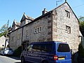 8 and 10 High Street, Bonsall.jpg 4,320 × 3,240; 3.08 MB
-
 A bend in the A5012 - geograph.org.uk - 5610042.jpg 1,280 × 853; 368 KB
-
 A corner of Bonsall - geograph.org.uk - 2894377.jpg 1,024 × 681; 184 KB
-

-
-
 A gate on the byway - geograph.org.uk - 5858976.jpg 4,320 × 3,240; 3.86 MB
-
 A single tree - geograph.org.uk - 4875224.jpg 640 × 426; 46 KB
-
 A small crag - scar - geograph.org.uk - 4885673.jpg 640 × 426; 47 KB
-

-
 A track leading to Bonsallmoor Lane - geograph.org.uk - 1623319.jpg 640 × 480; 58 KB
-
 A5012 - Via Gellia - geograph.org.uk - 2297076.jpg 800 × 531; 148 KB
-
 A5012 Via Gellia - geograph.org.uk - 2297052.jpg 800 × 531; 158 KB
-
 A5012 Via Gellia - geograph.org.uk - 2297080.jpg 800 × 531; 156 KB
-
 Across the track (1) - geograph.org.uk - 5859107.jpg 4,320 × 3,240; 3.62 MB
-
 Across the track (2) - geograph.org.uk - 5859110.jpg 4,320 × 3,240; 3.75 MB
-
 Almost a hedge - geograph.org.uk - 4875203.jpg 640 × 426; 46 KB
-
 Approaching Bonsall by Town End Farm - geograph.org.uk - 2894353.jpg 1,024 × 720; 226 KB
-
 Assemblies of God Church, Bonsall - geograph.org.uk - 1243287.jpg 640 × 480; 92 KB
-
 Bales of silage at Whitelow - geograph.org.uk - 4076568.jpg 2,590 × 1,850; 1.72 MB
-
 Barn beside Bonsall Lane - geograph.org.uk - 3099293.jpg 2,048 × 1,536; 516 KB
-
 Barn in the fields - geograph.org.uk - 2360036.jpg 950 × 340; 205 KB
-
 Barn near Low Farm - geograph.org.uk - 2359943.jpg 950 × 533; 301 KB
-
 Barn on Blakelow lane. - geograph.org.uk - 5369134.jpg 640 × 427; 72 KB
-
 Barn ruin - geograph.org.uk - 272368.jpg 640 × 480; 119 KB
-
 Barn, Bonsall Lane Farm - geograph.org.uk - 4875214.jpg 640 × 426; 86 KB
-
 Bell lane. - geograph.org.uk - 5369136.jpg 640 × 427; 81 KB
-
 Bend in the track near Town End Farm - geograph.org.uk - 3413078.jpg 1,024 × 768; 168 KB
-
 Blakelow Farm - geograph.org.uk - 4875231.jpg 640 × 426; 92 KB
-
 Blakelow Farm and spoil heaps - geograph.org.uk - 1231956.jpg 640 × 480; 85 KB
-
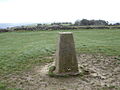 Blakelow Hill trig - geograph.org.uk - 409095.jpg 640 × 480; 110 KB
-
 Blakelow Lane (north) - geograph.org.uk - 4885465.jpg 640 × 426; 89 KB
-
 Blakelow Lane - geograph.org.uk - 4885462.jpg 640 × 426; 90 KB
-
 Bonsall - a view of the village - geograph.org.uk - 2359986.jpg 950 × 739; 448 KB
-
 Bonsall - Approaching on Clatterway - geograph.org.uk - 845002.jpg 640 × 480; 121 KB
-
 Bonsall - Approaching on Clatterway - geograph.org.uk - 845005.jpg 640 × 480; 96 KB
-

-
 Bonsall - Black Tor Road View - geograph.org.uk - 845001.jpg 640 × 480; 114 KB
-
 Bonsall - Cascades Garden Centre - geograph.org.uk - 848824.jpg 480 × 640; 133 KB
-
 Bonsall - Church Street - geograph.org.uk - 845676.jpg 640 × 480; 91 KB
-
 Bonsall - Church Street View - geograph.org.uk - 845730.jpg 640 × 480; 110 KB
-
 Bonsall - Church Street View - geograph.org.uk - 845764.jpg 640 × 480; 128 KB
-

-

-
 Bonsall - Cottages on Uppertown Lane - geograph.org.uk - 853042.jpg 640 × 480; 82 KB
-

-
 Bonsall - Footpath off Church Street - geograph.org.uk - 845773.jpg 640 × 480; 117 KB
-

-
 Bonsall - geograph.org.uk - 2845959.jpg 1,500 × 1,125; 1.15 MB
-
 Bonsall - High Street - geograph.org.uk - 845654.jpg 640 × 480; 78 KB
-
 Bonsall - Looking up The Bank - geograph.org.uk - 850468.jpg 640 × 480; 89 KB
-
 Bonsall - Open Gardens - geograph.org.uk - 850469.jpg 640 × 480; 126 KB
-
 Bonsall - Open Gardens - geograph.org.uk - 853031.jpg 640 × 480; 102 KB
-

-
 Bonsall - The Barley Mow Public House - geograph.org.uk - 848835.jpg 640 × 480; 91 KB
-
 Bonsall - The Dale - geograph.org.uk - 845011.jpg 640 × 480; 94 KB
-
 Bonsall - The Dale - geograph.org.uk - 850465.jpg 640 × 480; 90 KB
-
 Bonsall - The Old Vicarage - geograph.org.uk - 845715.jpg 640 × 480; 115 KB
-
 Bonsall - Uppertown Lane - geograph.org.uk - 851388.jpg 640 × 480; 82 KB
-
 Bonsall - Uppertown Lane - geograph.org.uk - 853046.jpg 640 × 480; 81 KB
-
-
 Bonsall - View down The Dale - geograph.org.uk - 850463.jpg 640 × 480; 95 KB
-
 Bonsall - View down Yeoman Street - geograph.org.uk - 845630.jpg 640 × 480; 88 KB
-
 Bonsall - Village Hall and Memorial - geograph.org.uk - 845009.jpg 640 × 480; 98 KB
-
 Bonsall - Village Memorial - geograph.org.uk - 845007.jpg 480 × 640; 78 KB
-
 Bonsall - Walking up The Dale - geograph.org.uk - 850462.jpg 640 × 480; 104 KB
-
 Bonsall - Well on The Dale - geograph.org.uk - 850466.jpg 640 × 480; 91 KB
-
 Bonsall - Yeoman Street - geograph.org.uk - 845604.jpg 640 × 480; 87 KB
-
 Bonsall - Yeoman Street - geograph.org.uk - 845610.jpg 640 × 480; 83 KB
-
 Bonsall - Yeoman Street - geograph.org.uk - 845618.jpg 640 × 480; 82 KB
-
 Bonsall - Yeoman Street - geograph.org.uk - 845637.jpg 640 × 480; 102 KB
-
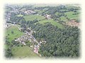 Bonsall arial.jpg 450 × 338; 19 KB
-
 Bonsall from the south - geograph.org.uk - 2894383.jpg 769 × 1,024; 308 KB
-
 Bonsall from the West - geograph.org.uk - 5981557.jpg 1,080 × 810; 224 KB
-
 Bonsall house - geograph.org.uk - 5857343.jpg 4,320 × 3,240; 4.02 MB
-
 Bonsall Lane - geograph.org.uk - 3157711.jpg 640 × 427; 256 KB
-
 Bonsall Lane - geograph.org.uk - 4316251.jpg 1,280 × 1,280; 782 KB
-
 Bonsall Lane - geograph.org.uk - 4875200.jpg 640 × 426; 70 KB
-
 Bonsall Lane - geograph.org.uk - 4875207.jpg 640 × 426; 58 KB
-
 Bonsall Lane - geograph.org.uk - 4875211.jpg 640 × 426; 77 KB
-
 Bonsall Lane - geograph.org.uk - 4875217.jpg 640 × 426; 64 KB
-
 Bonsall Lane - geograph.org.uk - 4875221.jpg 640 × 426; 41 KB
-
 Bonsall Lane - geograph.org.uk - 4875228.jpg 640 × 426; 62 KB
-
 Bonsall Lane - geograph.org.uk - 4875229.jpg 640 × 426; 74 KB
-
 Bonsall Lane - geograph.org.uk - 4875235.jpg 640 × 426; 77 KB
-
 Bonsall Lane - geograph.org.uk - 4875243.jpg 640 × 426; 72 KB
-
 Bonsall Lane - geograph.org.uk - 4875254.jpg 640 × 426; 59 KB
-
 Bonsall Lane - geograph.org.uk - 4885440.jpg 640 × 426; 82 KB
-
 Bonsall Lane - geograph.org.uk - 4885451.jpg 640 × 426; 76 KB
-
 Bonsall Lane - geograph.org.uk - 4885557.jpg 640 × 426; 88 KB
-
 Bonsall Lane - geograph.org.uk - 4885598.jpg 640 × 426; 51 KB
-
 Bonsall Lane - geograph.org.uk - 4885600.jpg 640 × 426; 50 KB
-
 Bonsall Lane - geograph.org.uk - 4885605.jpg 640 × 426; 71 KB
-
 Bonsall Lane - geograph.org.uk - 4885612.jpg 640 × 426; 89 KB
-
 Bonsall Lane - geograph.org.uk - 4885633.jpg 640 × 426; 53 KB
-
 Bonsall Lane Farm - geograph.org.uk - 4875212.jpg 640 × 426; 87 KB
-
 Bonsall Lane Farm - geograph.org.uk - 4875218.jpg 640 × 426; 95 KB
-
 Bonsall Moor - Bonsall Lane Farm - geograph.org.uk - 965516.jpg 640 × 480; 78 KB
-
 Bonsall Moor - Footpath on the bend - geograph.org.uk - 1392717.jpg 640 × 480; 97 KB
-

-
 Bonsall Moor Barn - geograph.org.uk - 4037548.jpg 800 × 600; 141 KB
-
 Bonsall moor. - geograph.org.uk - 5371867.jpg 640 × 427; 54 KB
-
 Bonsall village centre - geograph.org.uk - 6009179.jpg 1,440 × 2,560; 1.85 MB
-
 Bonsall, Derbys - geograph.org.uk - 1155266.jpg 640 × 427; 73 KB
-
 Bonsall, Derbys - geograph.org.uk - 1155290.jpg 640 × 427; 102 KB
-
 Bonsall, Derbyshire.jpg 640 × 480; 111 KB
-
 Bonsall, on a path down from Upper Town - geograph.org.uk - 2551247.jpg 2,952 × 2,270; 1.89 MB
-
 Bonsall- View from The Bank - geograph.org.uk - 851386.jpg 640 × 480; 96 KB
-
 Bonsallmoor Lane - geograph.org.uk - 3157761.jpg 427 × 640; 263 KB
-
 Bonsallmoor Lane - geograph.org.uk - 4875206.jpg 640 × 426; 55 KB
-
 Bonsallmoor Lane - geograph.org.uk - 5017972.jpg 5,133 × 2,920; 2 MB
-
 Bottom Leys Farm (2) - geograph.org.uk - 1623303.jpg 640 × 480; 153 KB
-
 Bottom Leys Farm - geograph.org.uk - 1623302.jpg 640 × 480; 123 KB
-
 Bottom of Ember Lane, Bonsall - geograph.org.uk - 3413048.jpg 1,024 × 768; 161 KB
-
 Bright Gate Farm - geograph.org.uk - 3099300.jpg 2,048 × 1,536; 513 KB
-
 Brightgate Farm - geograph.org.uk - 2907903.jpg 768 × 1,024; 243 KB
-
 Brightgate Farm - geograph.org.uk - 4885560.jpg 640 × 426; 71 KB
-
 Brightgate Farm - geograph.org.uk - 4885569.jpg 640 × 426; 60 KB
-
 Brightgate Farm - geograph.org.uk - 4885575.jpg 640 × 426; 112 KB
-
 Brightgate Farm - geograph.org.uk - 4885596.jpg 640 × 426; 92 KB
-
 Brightgate Farm, near Matlock - geograph.org.uk - 1231961.jpg 640 × 480; 71 KB
-
 Brumlea Farm and Upper Town - geograph.org.uk - 1623291.jpg 640 × 480; 87 KB
-
 Bull in field - geograph.org.uk - 3323564.jpg 853 × 1,280; 176 KB
-
 Bungalow and garden near Bonsall - geograph.org.uk - 2907946.jpg 1,024 × 768; 213 KB
-
 Butcher's Shop, now closed - geograph.org.uk - 1243294.jpg 640 × 480; 96 KB
-
 By a corner of Leys Lane - geograph.org.uk - 2894406.jpg 1,024 × 804; 339 KB
-
 Castellated House - geograph.org.uk - 5669175.jpg 1,024 × 668; 197 KB
-
 Cattle by Bonsall Lane - geograph.org.uk - 4885628.jpg 640 × 426; 50 KB
-
 Cattle grazing - geograph.org.uk - 4885449.jpg 640 × 426; 66 KB
-
 Cattle grazing, Blakelow Hill - geograph.org.uk - 4875245.jpg 640 × 426; 43 KB
-
 Cattle resting - geograph.org.uk - 4875220.jpg 640 × 426; 43 KB
-
 Church Lane, Bonsall - geograph.org.uk - 2894357.jpg 1,024 × 679; 240 KB
-
 Churchyard, Bonsall - geograph.org.uk - 2894368.jpg 1,024 × 768; 374 KB
-
 Clump of trees - geograph.org.uk - 4893029.jpg 640 × 426; 53 KB
-

-
 Corrugated iron barn - geograph.org.uk - 4885603.jpg 640 × 426; 64 KB
-
 Cottage Farm - geograph.org.uk - 4885552.jpg 640 × 426; 56 KB
-
 Cottage on Bell Lane, Upper Town - geograph.org.uk - 3740531.jpg 4,812 × 3,850; 5.35 MB
-
 Cottages at Bell Ln, Upper Town near Bonsall - geograph.org.uk - 6009181.jpg 2,560 × 1,440; 1.56 MB
-
 Cottages off Clatterway, south of Bonsall - geograph.org.uk - 2906466.jpg 4,000 × 2,248; 2.19 MB
-
 Country lane to Blakelow farm. - geograph.org.uk - 5369131.jpg 640 × 427; 105 KB
-
 Covered mine shaft - geograph.org.uk - 272478.jpg 640 × 480; 149 KB
-
 Covered Mine Shafts near Grangemill - geograph.org.uk - 2678742.jpg 3,296 × 2,472; 1.1 MB
-
 Covered reservoir - geograph.org.uk - 5859078.jpg 4,320 × 3,240; 3.12 MB
-
 Derbyshire UK parish map highlighting Bonsall.svg 888 × 1,308; 2.34 MB
-
 Dewpond with view to Winster Moor - geograph.org.uk - 4076563.jpg 2,592 × 1,944; 2.66 MB
-
 Down the mine shaft - geograph.org.uk - 272482.jpg 640 × 480; 93 KB
-
 Dry stone walls and barns - geograph.org.uk - 1243262.jpg 640 × 480; 59 KB
-
 East of Wigleymeadow Farm - geograph.org.uk - 4076578.jpg 2,592 × 1,944; 1.89 MB
-
 Ebenezer Wesleyan Reform Chapel - geograph.org.uk - 2907910.jpg 1,024 × 768; 254 KB
-
 Ember Farm - geograph.org.uk - 5857320.jpg 4,320 × 3,240; 4.92 MB
-
 Ember Lane - geograph.org.uk - 5424241.jpg 1,600 × 1,200; 514 KB
-
 Ember Lane Bonsall - geograph.org.uk - 5424206.jpg 1,600 × 1,200; 915 KB
-
 Ember Lane Bonsall - geograph.org.uk - 5424217.jpg 1,600 × 1,200; 656 KB
-
 Entering Brightgate - geograph.org.uk - 4885549.jpg 640 × 426; 107 KB
-
 Entering Brightgate - geograph.org.uk - 4885593.jpg 640 × 426; 84 KB
-
 Entrance to Brightgate Farm - geograph.org.uk - 4885565.jpg 640 × 426; 80 KB
-

-
 Ex Lime Kilns - geograph.org.uk - 2297032.jpg 800 × 531; 194 KB
-
 Farm by Nailor Lane - geograph.org.uk - 4885691.jpg 640 × 426; 63 KB
-
 Farm track near Town End Farm - geograph.org.uk - 3413087.jpg 1,024 × 768; 128 KB
-
 Farmland by Bonsall Lane - geograph.org.uk - 4885609.jpg 640 × 426; 51 KB
-
 Farmland by Bonsall Lane - geograph.org.uk - 4885625.jpg 640 × 426; 46 KB
-
 Farms and houses South of Bonsall - geograph.org.uk - 1243321.jpg 640 × 480; 105 KB
-
 Field adjacent to Limestone Way - geograph.org.uk - 2845987.jpg 1,500 × 1,125; 1.72 MB
-
 Field barn - geograph.org.uk - 272401.jpg 640 × 480; 101 KB
-
 Field barn - geograph.org.uk - 4885615.jpg 640 × 426; 62 KB
-
 Field barn - geograph.org.uk - 4885629.jpg 640 × 426; 53 KB
-
 Field barn - geograph.org.uk - 5859069.jpg 4,320 × 3,240; 2.51 MB
-
 Field barn near Blakelow Farm - geograph.org.uk - 2907897.jpg 1,024 × 768; 138 KB
-
 Field Barn near Low Farm - geograph.org.uk - 2242499.jpg 3,296 × 2,472; 1.1 MB
-
 Field Barn, Bonsall - geograph.org.uk - 6354712.jpg 800 × 533; 137 KB
-
 Field barn, Bonsall Lane - geograph.org.uk - 4875242.jpg 640 × 426; 67 KB
-
 Field Barns near Moorlands Lane - geograph.org.uk - 2678729.jpg 3,296 × 2,472; 1.41 MB
-
 Field barns near Slaley - geograph.org.uk - 2894390.jpg 1,024 × 768; 317 KB
-
 Field by Nailor Lane - geograph.org.uk - 4893015.jpg 640 × 426; 52 KB
-
 Field north of Bonsall - geograph.org.uk - 2845973.jpg 1,500 × 1,125; 1.65 MB
-
 Fields and barn by Leys Lane - geograph.org.uk - 2894410.jpg 1,024 × 768; 229 KB
-
 Fields and barn in the springtime - geograph.org.uk - 2360049.jpg 950 × 461; 263 KB
-
 Fields near Bonsall - geograph.org.uk - 4885648.jpg 640 × 426; 60 KB
-
 Footpath above Bonsall Hollow - geograph.org.uk - 5423963.jpg 4,000 × 3,000; 4.93 MB
-
 Footpath above Bonsall Hollow - geograph.org.uk - 5423971.jpg 4,000 × 3,000; 5.03 MB
-
 Footpath beside Ball Eye Quarry - geograph.org.uk - 5423980.jpg 4,000 × 3,000; 4.87 MB
-
 Footpath near Bottom Leys Farm - geograph.org.uk - 3445834.jpg 4,000 × 3,000; 3.04 MB
-
 Footpath off Bonsall Lane - geograph.org.uk - 4875197.jpg 640 × 426; 62 KB
-
 Footpath off Bonsall Lane - geograph.org.uk - 4885586.jpg 640 × 426; 83 KB
-
 Footpath off Nailor Lane - geograph.org.uk - 4892996.jpg 640 × 426; 80 KB
-
 Footpath off Nailor Lane - geograph.org.uk - 4893038.jpg 640 × 426; 92 KB
-
 Footpath to Matlock Bath - geograph.org.uk - 5669208.jpg 1,024 × 627; 234 KB
-
 Footpath to Upperwood - geograph.org.uk - 3413094.jpg 1,024 × 768; 172 KB
-
 Footpath towards Cromford - geograph.org.uk - 2649665.jpg 640 × 480; 245 KB
-
 Footpath west vof Low Farm - geograph.org.uk - 3740820.jpg 5,184 × 3,888; 6.61 MB
-
 For Sale on Clatterway - geograph.org.uk - 1855477.jpg 640 × 480; 138 KB
-
 Former Lead Processing Mill - geograph.org.uk - 2297092.jpg 800 × 531; 148 KB
-
 Four trees as one - geograph.org.uk - 4316265.jpg 1,280 × 1,280; 446 KB
-
 Four ways to go - geograph.org.uk - 5858999.jpg 4,320 × 3,240; 4.98 MB
-
 Gated road near Moor Farm - geograph.org.uk - 272417.jpg 640 × 480; 123 KB
-
 Glimpse of quarry workings - geograph.org.uk - 2894346.jpg 1,024 × 768; 253 KB
-
 Grange Mill Quarry - geograph.org.uk - 5017976.jpg 4,705 × 3,157; 1.52 MB
-
 Grassy meadow and trees - geograph.org.uk - 2894348.jpg 758 × 1,024; 355 KB
_-_geograph.org.uk_-_3740808.jpg)


_-_geograph.org.uk_-_5859107.jpg)
_-_geograph.org.uk_-_5859110.jpg)


_-_geograph.org.uk_-_4885465.jpg)


_-_geograph.org.uk_-_1623303.jpg)


