Category:Blaxton
Jump to navigation
Jump to search
English: Blaxton is a village in the Metropolitan Borough of Doncaster (part of South Yorkshire, England), on the border with Lincolnshire. It lies to the north of Finningley, on the A614 road, and is located at approximately 53° 29' 30" North, 0° 59' West, at an elevation of around 5 metres above sea level. It has a population of 1,179.
Nederlands: Blaxton is een dorp (village) en civil parish in het bestuurlijke gebied Doncaster, in het Engelse graafschap South Yorkshire. De civil parish telt
village in United Kingdom | |||||
| Upload media | |||||
| Instance of | |||||
|---|---|---|---|---|---|
| Location | Doncaster, South Yorkshire, Yorkshire and the Humber, England | ||||
| Population |
| ||||
 | |||||
Media in category "Blaxton"
The following 146 files are in this category, out of 146 total.
-
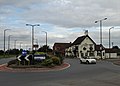 "The Bluebell Inn" and roundabout in Blaxton (geograph 5106310).jpg 4,953 × 3,566; 2.57 MB
-
 4 horses on Blaxton common. - geograph.org.uk - 1769895.jpg 640 × 480; 68 KB
-
 A614 Road Passing Acomb Farm - geograph.org.uk - 5160669.jpg 4,608 × 3,456; 4.35 MB
-
 Acomb Farm - geograph.org.uk - 1261421.jpg 640 × 480; 63 KB
-
 Acomb Farm - geograph.org.uk - 2422115.jpg 1,600 × 1,200; 567 KB
-
 Acomb Farm - geograph.org.uk - 5255071.jpg 800 × 600; 101 KB
-
 Approaching Levels Lane - geograph.org.uk - 4306565.jpg 1,024 × 768; 396 KB
-
 Approaching the bend in the footpath to Blaxton - geograph.org.uk - 4306581.jpg 1,024 × 768; 303 KB
-
 Approaching the river bank - geograph.org.uk - 2711361.jpg 1,024 × 768; 157 KB
-
 Back entrance to Robin Hood Airport - geograph.org.uk - 502632.jpg 640 × 480; 75 KB
-
 Bank End Road Blaxton - geograph.org.uk - 4535387.jpg 1,024 × 768; 147 KB
-

-
 Birch woodland on Blaxton common. - geograph.org.uk - 1769908.jpg 640 × 480; 107 KB
-
 Blaxton Common - geograph.org.uk - 2880937.jpg 640 × 427; 91 KB
-
 Blaxton Common Farm - geograph.org.uk - 2880908.jpg 640 × 427; 119 KB
-
 Blaxton Common, aerial 2014 - geograph.org.uk - 3879379.jpg 1,024 × 683; 80 KB
-
 Blaxton recreation ground. - geograph.org.uk - 1769891.jpg 640 × 480; 58 KB
-
 Blaxton Roundabout - geograph.org.uk - 1261397.jpg 640 × 404; 44 KB
-
 Blaxton, aerial 2014 - geograph.org.uk - 3879383.jpg 1,024 × 683; 128 KB
-
 Bridge to landscaped garden at Walkers' Nurseries, Blaxton - geograph.org.uk - 5106309.jpg 4,743 × 3,641; 5.95 MB
-
 Bus Depot - geograph.org.uk - 502633.jpg 640 × 480; 74 KB
-
 Candy Bank at Nan Sampson Bank - geograph.org.uk - 6584049.jpg 1,600 × 1,065; 505 KB
-
 Candy Corner Fishery - geograph.org.uk - 1237601.jpg 640 × 480; 105 KB
-
 Candy Farm - geograph.org.uk - 2339631.jpg 1,024 × 768; 198 KB
-
 Candy Farm - geograph.org.uk - 4049424.jpg 640 × 480; 68 KB
-

-
 Carrot Field near God's Cross - geograph.org.uk - 5160665.jpg 4,608 × 3,456; 4.56 MB
-
 Children's playground at Blaxton - geograph.org.uk - 5251817.jpg 5,376 × 3,024; 2.19 MB
-

-
 Common Lane (Byway) - geograph.org.uk - 5160670.jpg 4,608 × 3,456; 3.54 MB
-
 Common Lane - geograph.org.uk - 2880871.jpg 640 × 427; 137 KB
-
 Common Lane - geograph.org.uk - 2880880.jpg 640 × 427; 82 KB
-
 Common Lane at Sandath Hill - geograph.org.uk - 2712087.jpg 1,024 × 768; 272 KB
-
 Common Lane from A614 - geograph.org.uk - 5251806.jpg 5,376 × 3,024; 2.62 MB
-
 Common Lane towards the A614 - geograph.org.uk - 2422110.jpg 1,600 × 1,200; 847 KB
-
 County Boundary at Candy Bank - geograph.org.uk - 5160628.jpg 4,608 × 3,456; 4.31 MB
-
 Crop Field - geograph.org.uk - 5160662.jpg 4,608 × 3,456; 4.46 MB
-
 Crop Field near Blaxton - geograph.org.uk - 5160619.jpg 4,608 × 3,456; 4.52 MB
-
 Crop Field near Godscross Drain - geograph.org.uk - 5160660.jpg 4,480 × 3,334; 3.36 MB
-
 Crop field west of Thorne Road - geograph.org.uk - 4049275.jpg 640 × 480; 65 KB
-
 Diverted train near Auckley Level Crossing - geograph.org.uk - 5978238.jpg 1,024 × 768; 184 KB
-
-
 Doncaster Suburbs - geograph.org.uk - 184063.jpg 640 × 480; 97 KB
-

-
 Electricity poles in a stubble field - geograph.org.uk - 4306627.jpg 1,024 × 768; 165 KB
-
 Emergency Access Gate 4 - Robin Hood Airport - geograph.org.uk - 5106305.jpg 5,067 × 3,801; 3.37 MB
-
 Entering Blaxton - geograph.org.uk - 1261378.jpg 640 × 480; 86 KB
-
 Entering the Isle of Axholme - geograph.org.uk - 5608758.jpg 5,184 × 3,888; 4.58 MB
-
 Farm Entrance and Pumping Station near Wroot - geograph.org.uk - 5160630.jpg 4,608 × 3,456; 4.25 MB
-
 Farmland White House Farm - geograph.org.uk - 4049269.jpg 640 × 457; 48 KB
-
 Field of stubble on High Common - geograph.org.uk - 5255072.jpg 800 × 600; 156 KB
-
 Fields, Finningley - geograph.org.uk - 3491258.jpg 640 × 531; 75 KB
-
 Finningley Level Crossing - geograph.org.uk - 1262123.jpg 640 × 399; 42 KB
-
 Finningley level crossing and signal box - geograph.org.uk - 5251746.jpg 5,354 × 2,984; 1.78 MB
-
 Finningley signal box - geograph.org.uk - 5106312.jpg 4,853 × 3,689; 3.16 MB
-

-
 Fly-tipping and the entrance to Ninescores Farm - geograph.org.uk - 2711470.jpg 1,024 × 768; 263 KB
-
 Flying over Blaxton - geograph.org.uk - 5255083.jpg 800 × 600; 62 KB
-
 Footpath and Access Road Junction - geograph.org.uk - 5160649.jpg 4,608 × 3,456; 3.76 MB
-
 Footpath at Blaxton - geograph.org.uk - 4306653.jpg 1,024 × 768; 221 KB
-
 Footpath beside a field of stubble - geograph.org.uk - 5255081.jpg 800 × 600; 182 KB
-
 Footpath to Blaxton - geograph.org.uk - 4306569.jpg 1,024 × 768; 230 KB
-
 Footpath To Blaxton Common - geograph.org.uk - 184078.jpg 640 × 480; 151 KB
-
 Footpath to Levels Lane - geograph.org.uk - 4306595.jpg 1,024 × 768; 302 KB
-
 Footpath to Levels Lane - geograph.org.uk - 4306630.jpg 1,024 × 768; 158 KB
-
 Footpath to Levels Lane - geograph.org.uk - 4306650.jpg 768 × 1,024; 329 KB
-
 Former sand pit - geograph.org.uk - 4306583.jpg 1,024 × 768; 294 KB
-
 Former sand pit - geograph.org.uk - 4306591.jpg 1,024 × 768; 227 KB
-
 Former Wesleyan Chapel - geograph.org.uk - 5255028.jpg 800 × 600; 96 KB
-
 Former Wesleyan Chapel, Blaxton - geograph.org.uk - 5251758.jpg 5,376 × 2,376; 1.7 MB
-
 Gated Public Footpath - geograph.org.uk - 1261418.jpg 640 × 480; 109 KB
-
 Godscross Drain at Candy Bridge - geograph.org.uk - 2339635.jpg 1,024 × 768; 143 KB
-
 Gorse-lined path on High Common - geograph.org.uk - 5255076.jpg 800 × 600; 139 KB
-
 Grazing on Ling Common - geograph.org.uk - 5160625.jpg 4,608 × 3,456; 3.84 MB
-
 Have you an accurate speedo^ - geograph.org.uk - 503644.jpg 480 × 640; 95 KB
-
 Hedgerow and crop field - geograph.org.uk - 4049274.jpg 640 × 480; 62 KB
-
 In the woods beside Levels Lane Plantation - geograph.org.uk - 5251811.jpg 5,376 × 3,024; 3.95 MB
-
 Lake in the woods, 1 - geograph.org.uk - 5251814.jpg 5,376 × 3,024; 2.83 MB
-
 Lake in the woods, 2 - geograph.org.uk - 5251815.jpg 5,376 × 3,024; 3.12 MB
-
 Ling or High Common - geograph.org.uk - 4306586.jpg 1,024 × 768; 182 KB
-
 Long track to the Long plantation - geograph.org.uk - 676533.jpg 640 × 408; 96 KB
-
 Maize Field at Sampson's Levels - geograph.org.uk - 5160627.jpg 4,608 × 3,456; 3.7 MB
-
 Mosham Road (B1396) - geograph.org.uk - 4049270.jpg 640 × 480; 50 KB
-
 New concessionary walk. - geograph.org.uk - 509054.jpg 640 × 480; 111 KB
-
 Ninescores Lane off Nan Sampson Lane - geograph.org.uk - 6584054.jpg 1,600 × 1,065; 937 KB
-
 No vehicle access here - geograph.org.uk - 5645682.jpg 800 × 600; 83 KB
-

-
 On Blaxton common. - geograph.org.uk - 1769904.jpg 640 × 480; 37 KB
-
 On Ling or High Common - geograph.org.uk - 5251812.jpg 5,376 × 3,024; 2.33 MB
-

-
 Path to Levels Lane - geograph.org.uk - 4306588.jpg 1,024 × 768; 362 KB
-
 Pond O'The Hill, Blaxton - geograph.org.uk - 1511790.jpg 640 × 427; 74 KB
-
 Remembrance artwork on the Station Hotel - geograph.org.uk - 5255014.jpg 800 × 600; 126 KB
-
 Right hand corner on Common Lane - geograph.org.uk - 5251804.jpg 5,376 × 3,024; 2.67 MB
-
 River Torne near Candy Farm - geograph.org.uk - 4049414.jpg 640 × 480; 58 KB
-
 River Torne Soak Drain at Candy Farm - geograph.org.uk - 5645689.jpg 800 × 600; 92 KB
-
 Road near the Levels Lane Plantation - geograph.org.uk - 5160654.jpg 4,608 × 3,456; 3.63 MB
-
 Robin Hood Airport (4 of 7) - geograph.org.uk - 449876.jpg 640 × 360; 70 KB
-
 Robin Hood Airport (5 of 7) - geograph.org.uk - 449891.jpg 640 × 360; 67 KB
-
 Robin Hood Airport (6 of 7) - geograph.org.uk - 449952.jpg 640 × 359; 55 KB
-
 Robin Hood Airport (7 of 7) - geograph.org.uk - 449959.jpg 640 × 359; 73 KB
-
 Roe Deer - geograph.org.uk - 4049402.jpg 640 × 480; 113 KB
-
 Roundabout on the A614, Blaxton - geograph.org.uk - 4049261.jpg 640 × 480; 56 KB
-
 Saga award stone - geograph.org.uk - 5255020.jpg 800 × 600; 154 KB
-

-
-
 Sharp bend in Wroot Road - geograph.org.uk - 4049377.jpg 640 × 480; 64 KB
-
 Small lake in Machin's Plantation - geograph.org.uk - 5255078.jpg 800 × 600; 138 KB
-
 Spoil heap - geograph.org.uk - 4306592.jpg 1,024 × 768; 245 KB
-
 The Blue Bell at Blaxton - geograph.org.uk - 5251750.jpg 5,376 × 3,024; 1.66 MB
-
 The Blue Bell Inn, Blaxton - geograph.org.uk - 4049258.jpg 640 × 480; 53 KB
-
 The Blue Bell Inn, Blaxton - geograph.org.uk - 4049272.jpg 640 × 480; 62 KB
-
 The Blue Bell Public House in Blaxton - geograph.org.uk - 5106779.jpg 4,442 × 3,245; 3.54 MB
-

-
 The Station Hotel, Finningley - geograph.org.uk - 5255012.jpg 800 × 600; 85 KB
-
 The Station Public House in Finningley - geograph.org.uk - 5106815.jpg 4,608 × 3,456; 3.85 MB
-
 The Station, Finningley - geograph.org.uk - 5250918.jpg 5,348 × 2,513; 1.82 MB
-
 Thorne Road (A614) - geograph.org.uk - 4049279.jpg 640 × 480; 67 KB
-
 Track to Candy Farm - geograph.org.uk - 4049416.jpg 640 × 480; 51 KB
-
 Track to the river bank - geograph.org.uk - 2711356.jpg 1,024 × 768; 334 KB
-
 Track towards Levels Lane Plantation - geograph.org.uk - 5251807.jpg 5,376 × 3,024; 2.81 MB
-
 View across Sampson's Levels - geograph.org.uk - 2339123.jpg 1,024 × 768; 172 KB
-
 View alongside a plantation - geograph.org.uk - 4306619.jpg 1,024 × 768; 306 KB
-
 View to Ninescores Farm - geograph.org.uk - 5608752.jpg 4,963 × 3,711; 5.74 MB
-
 View towards the water tower at Haxey - geograph.org.uk - 4306643.jpg 1,024 × 768; 196 KB
-
 War Memorial, Blaxton - geograph.org.uk - 4049260.jpg 640 × 480; 75 KB
-
 Waterfilled sand pit. - geograph.org.uk - 1769899.jpg 640 × 480; 63 KB
-
 Wesleyan Chapel in Blaxton - geograph.org.uk - 5106775.jpg 4,399 × 3,195; 3.78 MB
-
 Willow plantation - geograph.org.uk - 2711468.jpg 1,024 × 768; 185 KB
-
 Wind pump near the River Torne - geograph.org.uk - 4049421.jpg 640 × 480; 62 KB
-
 And then they were gone - geograph.org.uk - 676428.jpg 640 × 544; 110 KB
-
 At Bancroft Farm - geograph.org.uk - 502629.jpg 640 × 412; 64 KB
-
 B1396 near Blaxton. - geograph.org.uk - 508894.jpg 640 × 480; 103 KB
-
 Bee Food - geograph.org.uk - 184072.jpg 640 × 480; 98 KB
-
 Blaxton Common Farm. - geograph.org.uk - 509068.jpg 640 × 480; 120 KB
-
 Bridleway near Springs Farm - geograph.org.uk - 502707.jpg 627 × 437; 81 KB
-
 Bridleway near Springs Farm - geograph.org.uk - 502862.jpg 640 × 480; 153 KB
-
 Corner Track - geograph.org.uk - 293573.jpg 640 × 480; 104 KB
-
 Drain to the Boundary - geograph.org.uk - 293571.jpg 640 × 480; 103 KB
-
 Druid's circle. - geograph.org.uk - 509024.jpg 640 × 379; 80 KB
-
 Fiftyeights Road - geograph.org.uk - 502850.jpg 480 × 640; 95 KB
-
 Finningley Green - geograph.org.uk - 503645.jpg 640 × 480; 140 KB
-
 Finningley Quarry - geograph.org.uk - 502712.jpg 640 × 480; 87 KB
-
 Road to Ninescores - geograph.org.uk - 184070.jpg 640 × 480; 125 KB
-
 Track To Auckley - geograph.org.uk - 194729.jpg 640 × 480; 87 KB
-
 Track to disused sand and gravel works - geograph.org.uk - 676415.jpg 640 × 480; 126 KB
.jpg)


_-_geograph.org.uk_-_5160670.jpg)


_leaving_Robin_Hood_Airport_-_geograph.org.uk_-_502613.jpg)


_-_geograph.org.uk_-_4049270.jpg)


_-_geograph.org.uk_-_449876.jpg)
_-_geograph.org.uk_-_449891.jpg)
_-_geograph.org.uk_-_449952.jpg)
_-_geograph.org.uk_-_449959.jpg)


_-_geograph.org.uk_-_4049279.jpg)


