Category:Binton
Jump to navigation
Jump to search
village in Warwickshire, England, UK  | |||||
| Upload media | |||||
| Instance of | |||||
|---|---|---|---|---|---|
| Location | Stratford-on-Avon, Warwickshire, West Midlands, England | ||||
| Population |
| ||||
| Area |
| ||||
 | |||||
English: Binton is a village and civil parish in the Stratford district of Warwickshire, England. It is about five miles (8 km) west of Stratford-upon-Avon. According to the 2001 census it had a population of 272.
Subcategories
This category has the following 2 subcategories, out of 2 total.
B
- Binton railway station (2 F)
P
Media in category "Binton"
The following 79 files are in this category, out of 79 total.
-
 A46 Approaching The Stag - geograph.org.uk - 3655859.jpg 640 × 470; 66 KB
-

-
 A46 East of Red Hill Near Stratford - geograph.org.uk - 5339850.jpg 640 × 480; 68 KB
-
 A46 passes The Stag - geograph.org.uk - 5170998.jpg 800 × 525; 82 KB
-
 A46 Passing The Stag - geograph.org.uk - 3655865.jpg 640 × 437; 46 KB
-
 A46 Temple Grafton Junction - geograph.org.uk - 3655880.jpg 640 × 490; 62 KB
-

-
 Alcester Road, Red Hill - geograph.org.uk - 6500379.jpg 1,920 × 1,280; 1.44 MB
-
 An attentive audience - geograph.org.uk - 122588.jpg 640 × 480; 108 KB
-
 Animal feeder by the footpath - geograph.org.uk - 3352104.jpg 2,000 × 1,500; 623 KB
-

-
 B439 Near Binton Bridges - geograph.org.uk - 5411931.jpg 640 × 483; 79 KB
-
 B439 Turning For Lower Binton - geograph.org.uk - 5411927.jpg 640 × 480; 63 KB
-

-
 Binton - geograph.org.uk - 2256288.jpg 640 × 402; 59 KB
-
 Binton Bridges - geograph.org.uk - 59247.jpg 640 × 480; 217 KB
-
 Binton Bridges Caravan Park - geograph.org.uk - 2991839.jpg 2,000 × 1,503; 419 KB
-
 Binton Village Hall - geograph.org.uk - 122581.jpg 640 × 479; 73 KB
-
 Binton-Church Bank - geograph.org.uk - 6059861.jpg 1,600 × 1,200; 528 KB
-

-
 Caravan Park, Binton - geograph.org.uk - 2323013.jpg 640 × 428; 99 KB
-
 Cottages in Binton - geograph.org.uk - 2298260.jpg 1,024 × 680; 167 KB
-
 Countryside near Temple Grafton - geograph.org.uk - 2256279.jpg 640 × 480; 68 KB
-
 Course of old railway to Stratford-upon-Avon - geograph.org.uk - 2337724.jpg 1,024 × 680; 279 KB
-
 Evening Sun on the Avon - geograph.org.uk - 2256307.jpg 640 × 459; 102 KB
-
 Farm buildings, Red Hill - geograph.org.uk - 5379818.jpg 640 × 480; 61 KB
-
 Fields near Lower Binton - geograph.org.uk - 2256297.jpg 640 × 432; 100 KB
-
 Footpath crosses Binton Brook - geograph.org.uk - 3351092.jpg 2,000 × 1,500; 560 KB
-
 Footpath to Red Hill - geograph.org.uk - 2339477.jpg 1,024 × 680; 191 KB
-
 Footpath to Redhill - geograph.org.uk - 2343114.jpg 1,024 × 680; 219 KB
-
 Gas Tanks - geograph.org.uk - 2256316.jpg 640 × 376; 62 KB
-

-
 Lane from Billesley towards A46 Alcester Road - geograph.org.uk - 2189259.jpg 2,000 × 1,495; 204 KB
-
 Lane north west of Binton - geograph.org.uk - 3321233.jpg 2,000 × 1,500; 622 KB
-
 Lane to Luddington - geograph.org.uk - 2730880.jpg 2,000 × 1,495; 307 KB
-
 Lane to Temple Grafton - geograph.org.uk - 2189271.jpg 2,000 × 1,494; 234 KB
-
 Lower Binton Church - geograph.org.uk - 4277441.jpg 640 × 480; 78 KB
-
 Lower Binton road junction from B439 - geograph.org.uk - 3152212.jpg 640 × 465; 112 KB
-
 Lung Trees^ - geograph.org.uk - 3351073.jpg 2,000 × 1,500; 551 KB
-
 Main Road, Binton - geograph.org.uk - 3319999.jpg 2,000 × 1,500; 567 KB
-
 Main Road, Binton - geograph.org.uk - 3321215.jpg 2,000 × 1,500; 601 KB
-
 Minor road, Red Hill - geograph.org.uk - 5379820.jpg 640 × 480; 96 KB
-
 Mooring on the Avon - geograph.org.uk - 2491379.jpg 1,024 × 768; 184 KB
-
 Old Station Buildings at Binton - geograph.org.uk - 2256337.jpg 640 × 480; 70 KB
-
 Ploughed Field at Red Hill - geograph.org.uk - 2256274.jpg 640 × 480; 81 KB
-
 Power Lines to Dodwell - geograph.org.uk - 122685.jpg 640 × 480; 98 KB
-

-
 River Avon, Binton Bridges - geograph.org.uk - 3543759.jpg 2,288 × 1,712; 829 KB
-

-
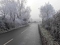
 Road Out of Binton Frosty Morning - geograph.org.uk - 4277443.jpg 640 × 480; 69 KB
-

-

-

-
 Snowdrops (Galanthus nivalis) on dismantled railway - geograph.org.uk - 3320067.jpg 2,000 × 1,500; 592 KB
-
 Straw bales and telegraph poles - geograph.org.uk - 129458.jpg 640 × 480; 89 KB
-
 The A46 at Red Hill - geograph.org.uk - 2339470.jpg 1,024 × 680; 211 KB
-
 The A46 near Red Hill - geograph.org.uk - 3385885.jpg 640 × 427; 55 KB
-
 The road out of Binton - geograph.org.uk - 2337701.jpg 640 × 425; 66 KB
-
 The Road to Lower Binton - geograph.org.uk - 4277440.jpg 640 × 475; 63 KB
-
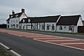
 The Stag at Redhill - geograph.org.uk - 4446954.jpg 640 × 478; 52 KB
-
 The Stag Inn - geograph.org.uk - 2339472.jpg 1,024 × 680; 133 KB
-
 The Stag public house, Red Hill - geograph.org.uk - 5379813.jpg 640 × 443; 45 KB
-

-
 Unnamed triangular wood - geograph.org.uk - 3320024.jpg 2,000 × 1,500; 556 KB
-
 View north west from footpath to Drayton Farm - geograph.org.uk - 3352084.jpg 2,000 × 1,500; 640 KB
-
 View to Binton church - geograph.org.uk - 2299119.jpg 1,024 × 680; 198 KB
-
 Welford-on-Avon Village Sign - geograph.org.uk - 5411935.jpg 640 × 480; 86 KB
-
 Well in Binton - geograph.org.uk - 4277442.jpg 640 × 480; 136 KB
-
 Binton - geograph.org.uk - 59248.jpg 640 × 480; 164 KB
-
 Braggington Lane - geograph.org.uk - 128095.jpg 640 × 480; 59 KB
-
 Bunkers Hill sign - geograph.org.uk - 128038.jpg 640 × 480; 49 KB
-
 Farm near Binton - geograph.org.uk - 134305.jpg 640 × 480; 56 KB
-
 Lower Binton - geograph.org.uk - 122584.jpg 640 × 480; 63 KB
-
 New Plantation - geograph.org.uk - 128033.jpg 640 × 480; 78 KB
-
 Peacock near Binton - geograph.org.uk - 129448.jpg 476 × 639; 130 KB
-
 Picking salad vegetables - geograph.org.uk - 455878.jpg 640 × 354; 133 KB
-
 Sandfields Barn - geograph.org.uk - 122687.jpg 640 × 480; 73 KB
-
 View from Bunkers Hill - geograph.org.uk - 128103.jpg 640 × 480; 54 KB
-
 View towards Hunt Hall Farm - geograph.org.uk - 128089.jpg 640 × 480; 75 KB


_on_dismantled_railway_-_geograph.org.uk_-_3320067.jpg)


