Category:Ballynoe
Jump to navigation
Jump to search
settlement and townland in County Down, Northern Ireland, UK ,_September_2009.JPG) | |||||
| Upload media | |||||
| Instance of | |||||
|---|---|---|---|---|---|
| Location |
| ||||
 | |||||
Subcategories
This category has the following 2 subcategories, out of 2 total.
B
- Ballynoe railway station (4 F)
- Ballynoe stone circle (60 F)
Media in category "Ballynoe"
The following 59 files are in this category, out of 59 total.
-

-
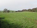
 Ballydargan Hill from the Glen Road - geograph.org.uk - 2745875.jpg 1,024 × 579; 120 KB
-
 Ballydargan Lake from the Ballylucas Road - geograph.org.uk - 2796604.jpg 1,024 × 768; 142 KB
-
 Ballynoe (01), September 2009.JPG 4,272 × 2,848; 6.66 MB
-
 Ballynoe (02), September 2009.JPG 4,272 × 2,848; 4.01 MB
-
 Ballynoe (03), September 2009.JPG 4,272 × 2,848; 3.83 MB
-
 Ballynoe (05), September 2009.JPG 4,272 × 2,848; 7.05 MB
-
 Ballynoe (06), September 2009.JPG 4,272 × 2,848; 3.15 MB
-
 Ballynoe (08), September 2009.JPG 4,272 × 2,848; 5.49 MB
-
 Ballynoe (09), September 2009.JPG 4,272 × 2,848; 3.27 MB
-
 Ballynoe (12), September 2009.JPG 4,272 × 2,848; 6.75 MB
-
 Ballynoe (20), September 2009.JPG 4,272 × 2,848; 7.69 MB
-
 Ballynoe (21), September 2009.JPG 2,848 × 4,272; 6.15 MB
-
 Ballynoe (24), September 2009.JPG 4,272 × 2,848; 6.34 MB
-
 Ballynoe (46), September 2009.JPG 4,272 × 2,848; 4.72 MB
-
 Ballynoe (49), September 2009.JPG 4,272 × 2,848; 6.08 MB
-
 Ballynoe (52), September 2009.JPG 4,272 × 2,848; 8.24 MB
-
 Ballynoe (54), September 2009.JPG 4,272 × 2,848; 6.49 MB
-
 Ballynoe (55), September 2009.JPG 2,848 × 4,272; 7.17 MB
-
 Ballynoe (56), September 2009.JPG 4,272 × 2,848; 5.02 MB
-
 Ballynoe (59), September 2009.JPG 4,272 × 2,848; 4.25 MB
-
 Ballynoe (60), September 2009.JPG 4,272 × 2,848; 6.78 MB
-
 Ballynoe (61), September 2009.JPG 4,272 × 2,848; 9.2 MB
-
-
 Ballynoe Stone Circle - geograph.org.uk - 4194998.jpg 1,024 × 766; 200 KB
-
 Bends of the Ballylucas Road - geograph.org.uk - 2625625.jpg 1,024 × 768; 146 KB
-
 Carrowbane Road east of Legamaddy Chapel - geograph.org.uk - 2636654.jpg 1,024 × 768; 247 KB
-
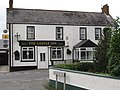
 Castle Inn, Ballynoe - geograph.org.uk - 4195003.jpg 1,024 × 768; 161 KB
-
 Crossing the Ballynoe to Downpatrick Road - geograph.org.uk - 2748595.jpg 1,024 × 768; 150 KB
-
 Drumlin north of Legamaddy Chapel - geograph.org.uk - 2636646.jpg 1,024 × 768; 165 KB
-
-
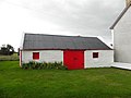 Farm building, Grangicam - geograph.org.uk - 2630771.jpg 640 × 480; 40 KB
-
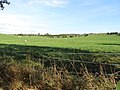
 Farmland south of the Crowbane Road - geograph.org.uk - 2636634.jpg 1,024 × 768; 124 KB
-
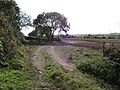
 Farmland west of the Ballynoe Road - geograph.org.uk - 4200721.jpg 1,024 × 680; 142 KB
-
-

-
-
 St Patrick's Parish Hall, Legamaddy - geograph.org.uk - 2636697.jpg 1,024 × 768; 284 KB
-

-

-
 The Ballylucas Road at Ballynewport - geograph.org.uk - 2625616.jpg 1,024 × 754; 93 KB
-
 The Ballynewport Bog - geograph.org.uk - 2624209.jpg 1,024 × 768; 211 KB
-
 The Ballynoe Road at Legamaddy - geograph.org.uk - 2636705.jpg 1,024 × 768; 269 KB
-
 The Castle Inn - geograph.org.uk - 2630775.jpg 640 × 480; 51 KB
-
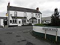
 The Castle Inn, Ballynoe - geograph.org.uk - 2748599.jpg 1,024 × 768; 197 KB
-
-

-

-
 The interior of St Patrick's Church, Legamaddy - geograph.org.uk - 2636688.jpg 767 × 1,024; 135 KB
-

-
 The Priests' Burial Plot at Legamaddy - geograph.org.uk - 2636700.jpg 768 × 1,024; 169 KB
-

-
 The tower of St Patrick's Chapel, Legamaddy - geograph.org.uk - 2636692.jpg 768 × 1,024; 216 KB
-
 Track linking Grangecam Road and Carrowbane Road - geograph.org.uk - 2748546.jpg 1,024 × 768; 304 KB
-
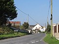
 View east across Ballynoe Cross Roads - geograph.org.uk - 4201100.jpg 1,024 × 767; 179 KB
-
 View north along Ballynoe Road - geograph.org.uk - 4202240.jpg 1,024 × 767; 167 KB
-

-
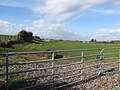
 View south along the Ballynoe Road - geograph.org.uk - 2748608.jpg 1,024 × 768; 166 KB
-
 View westwards towards Legamaddy Catholic Chapel - geograph.org.uk - 2636622.jpg 1,024 × 768; 136 KB


,_September_2009.JPG)
,_September_2009.JPG)
,_September_2009.JPG)
,_September_2009.JPG)
,_September_2009.JPG)
,_September_2009.JPG)
,_September_2009.JPG)
,_September_2009.JPG)
,_September_2009.JPG)
,_September_2009.JPG)
,_September_2009.JPG)
,_September_2009.JPG)
,_September_2009.JPG)
,_September_2009.JPG)
,_September_2009.JPG)
,_September_2009.JPG)
,_September_2009.JPG)
,_September_2009.JPG)
,_September_2009.JPG)


