Category:B3306 road (England)
Jump to navigation
Jump to search
major road in West Cornwall | |||||
| Upload media | |||||
| Instance of |
| ||||
|---|---|---|---|---|---|
| Location | England | ||||
| Transport network |
| ||||
| |||||
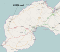
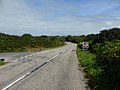
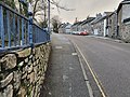
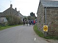
English: The B3306, also known as the West Cornwall Coast Road, is a minor road of west Cornwall, connecting St Ives in the east, via St Just, to the A30 near Sennen. The thirteen-mile road is considered one of the greatest driving roads in the United Kingdom for its scenery along the coast and the Cornish Moorland.

Media in category "B3306 road (England)"
The following 65 files are in this category, out of 65 total.
-
 AD 1836 milestone.JPG 1,996 × 2,424; 1.03 MB
-
 B3306 approaching Rosemergy - geograph.org.uk - 946595.jpg 495 × 640; 108 KB
-
 B3306 as it passes Land's End Airport - geograph.org.uk - 912143.jpg 640 × 480; 214 KB
-
 B3306 at Trevowhan - geograph.org.uk - 1816201.jpg 640 × 480; 60 KB
-
 B3306 bed and breakfast opportunity - geograph.org.uk - 3192582.jpg 3,648 × 2,048; 1.08 MB
-
 B3306 below Trendrine Hill - geograph.org.uk - 1389211.jpg 640 × 480; 76 KB
-
 B3306 milestone - Penzance 6 miles.jpg 3,024 × 4,032; 3.84 MB
-
 B3306 milestone - STIVS 6 miles.jpg 3,024 × 4,032; 3.36 MB
-
 B3306 milestone.jpg 3,024 × 4,032; 2.99 MB
-
 B3306 near St Just - geograph.org.uk - 912150.jpg 640 × 480; 213 KB
-
 B3306 North Coast Road Tom Corser.jpg 6,000 × 4,000; 6.11 MB
-
 B3306 North Coast Road2 Tom Corser.jpg 6,000 × 4,000; 6.42 MB
-
 B3306 road.png 941 × 815; 299 KB
-
 B3306 south of Folly Farm - geograph.org.uk - 3190463.jpg 3,504 × 2,048; 1.01 MB
-
 B3306 through Rosemergy - geograph.org.uk - 912418.jpg 640 × 480; 341 KB
-
 B3306 towards Rosewall Hill.jpg 4,128 × 2,322; 3.21 MB
-
 B3306, Higher Stennack passes The Community Fire Station - geograph.org.uk - 3190449.jpg 3,648 × 2,048; 1.16 MB
-
 Bygone industry - geograph.org.uk - 776428.jpg 640 × 426; 65 KB
-
 Carn Bosavern - geograph.org.uk - 164390.jpg 640 × 480; 79 KB
-
 Coffen stile to B3306 near Gear Farm entrance. - panoramio.jpg 3,648 × 2,056; 5.34 MB
-
 Gabriel Street, St Ives, January 2021.jpg 4,032 × 3,024; 5.1 MB
-
 Guide post near Zennor - old and new.jpg 3,024 × 4,032; 4.08 MB
-
 Guide post near Zennor.jpg 3,024 × 4,032; 4.06 MB
-
 Guide post to Penzance.jpg 3,024 × 4,032; 4.55 MB
-
 Higher Stennack nr Sandows Lane, St Ives, January 2021.jpg 4,032 × 3,024; 3.85 MB
-
 Higher Stennack Roundabout - geograph.org.uk - 899517.jpg 640 × 424; 89 KB
-
 Higher Stennack, St Ives - geograph.org.uk - 899525.jpg 640 × 424; 102 KB
-
 Higher Stennack, St Ives, May 2021.jpg 4,032 × 3,024; 9.69 MB
-
 Higher Stennack.jpg 4,032 × 3,024; 4.4 MB
-
 Housing on the B3306, Pendeen, Cornwall - July 2023 (1).jpg 4,032 × 2,495; 1.99 MB
-
 Housing on the B3306, Pendeen, Cornwall - July 2023 (2).jpg 3,796 × 2,608; 1.33 MB
-
 Junction of the B3306 with the A30 - geograph.org.uk - 169070.jpg 640 × 426; 82 KB
-
 Kelynack - geograph.org.uk - 1406909.jpg 640 × 480; 81 KB
-
 North Terrace and Royal Square, St Ives, January 2021.jpg 4,032 × 3,024; 3.51 MB
-
 North Terrace, St Ives, January 2021.jpg 4,032 × 3,024; 4.9 MB
-
 North Terrace, St Ives, June 2021.jpg 4,032 × 3,024; 8.43 MB
-
 Open top bus on Higher Stennack, St Ives, July 2021.jpg 4,032 × 3,024; 8.17 MB
-

-
 Road signs old and new - geograph.org.uk - 1470281.jpg 640 × 427; 101 KB
-
 Rosemergy - geograph.org.uk - 912414.jpg 640 × 480; 250 KB
-
 Signpost to Zennor, Cornwall.jpg 3,024 × 4,032; 3.75 MB
-
 Smarttart - geograph.org.uk - 164392.jpg 640 × 480; 95 KB
-
 St Ives Community Fire Station - geograph.org.uk - 3827478.jpg 1,536 × 1,151; 897 KB
-
 St.Ives 6476.jpg 1,200 × 666; 777 KB
-
 Stennack Surgery, St Ives, March 2022.jpg 4,032 × 3,024; 8.01 MB
-
 Terraced houses on the B3306, Pendeen, Cornwall.jpg 3,692 × 2,835; 2.22 MB
-

-
 The B3306 - geograph.org.uk - 4184213.jpg 4,000 × 2,664; 5.4 MB
-
 The B3306 - geograph.org.uk - 4184222.jpg 4,000 × 2,664; 7.16 MB
-
 The B3306 - geograph.org.uk - 4184236.jpg 3,863 × 2,568; 4.52 MB
-
 The B3306 at Boswednack - geograph.org.uk - 1483664.jpg 640 × 480; 76 KB
-
 The B3306 near Boscubben - geograph.org.uk - 1617224.jpg 640 × 480; 70 KB
-
 The B3306 near Trevalgan and Rosewall - geograph.org.uk - 3653899.jpg 1,224 × 918; 521 KB
-
 The entrance to Kerrow farm - geograph.org.uk - 1483618.jpg 640 × 480; 70 KB
-

-
 The Trewellard Arms Hotel - geograph.org.uk - 748240.jpg 640 × 480; 36 KB
-
 Tree felling in St Ives, Cornwall, March 2021.jpg 4,032 × 3,024; 6.52 MB
-
 Tregeseal , The B3306 - geograph.org.uk - 5750488.jpg 6,000 × 4,000; 5.74 MB
-
 Vegetated verge on the B3306 - geograph.org.uk - 1526470.jpg 640 × 480; 90 KB
-
 View down the Stennack, St Ives, March 2022.jpg 4,032 × 3,024; 5.42 MB
-
 View up Higher Stennack, St Ives, January 2021.jpg 4,032 × 3,024; 4.97 MB
-
 Welcome to St Ives - geograph.org.uk - 3653867.jpg 1,224 × 918; 519 KB
-
 Beware of ducks crossing^ - geograph.org.uk - 772419.jpg 640 × 480; 71 KB
-
 Zennor - ? (2).jpg 3,024 × 4,032; 3.53 MB
-
 Entrance to Trendrine Farm - geograph.org.uk - 748235.jpg 640 × 480; 69 KB


.jpg)
.jpg)


.jpg)
