Category:August 2013 in the East Riding of Yorkshire
Jump to navigation
Jump to search
Ceremonial counties of England: Bedfordshire · Berkshire · Buckinghamshire · Cambridgeshire · Cheshire · Cornwall · Cumbria · Derbyshire · Devon · Dorset · Durham · East Riding of Yorkshire · East Sussex · Essex · Gloucestershire · Greater London · Greater Manchester · Hampshire · Herefordshire · Hertfordshire · Isle of Wight · Kent · Lancashire · Leicestershire · Lincolnshire · Merseyside · Norfolk · North Yorkshire · Northamptonshire · Northumberland · Nottinghamshire · Oxfordshire · Rutland · Shropshire · Somerset · South Yorkshire · Staffordshire · Suffolk · Surrey · Tyne and Wear · Warwickshire · West Midlands · West Sussex · West Yorkshire · Wiltshire · Worcestershire
City-counties: Bristol ·
Former historic counties:
Other former counties:
City-counties: Bristol ·
Former historic counties:
Other former counties:
Deutsch: Bilder, die im August 2013 in the East Riding of Yorkshire aufgenommen worden sind. Bitte beachten Sie, dass dies weder das Datum des Uploads noch das Datum des Scannens eines Fotos ist.
English: Images/pictures taken in the East Riding of Yorkshire during August 2013. Note this is not the date of the upload, nor the date a photo was scanned.
Español: Fotografías o imágenes tomadas en the East Riding of Yorkshire durante agosto 2013. No es la fecha de subida ni escaneo, sino la fecha en que las fotografías o imágenes se crearon.
Esperanto: Bildoj faritaj en the East Riding of Yorkshire en aŭgusto 2013. Tio ne estas la dato, kiam la bildoj estis alŝutitaj aŭ skanitaj.
Français : Photographies ou images prises en the East Riding of Yorkshire durant août 2013. Ce n'est pas la date du téléchargement ou du scan.
Galego: Fotografías ou imaxes tomadas en the East Riding of Yorkshire durante agosto 2013. Non é a data de subida nin escaneamento, senón a data na que se crearon as fotografías ou imaxes.
Italiano: Fotografie o immagini scattate a the East Riding of Yorkshire nel agosto 2013. Nota bene: la data non si riferisce né a quella di upload né a quella in cui la foto è stata digitalizzata.
Norsk bokmål: Bilder tatt i the East Riding of Yorkshire i løpet av august 2013. Merk at dette ikke er datoen for opplasting, eller når et bilde har blitt skannet.
Norsk nynorsk: Bilete teke i the East Riding of Yorkshire i løpet av august 2013. Merk at dette ikkje er datoen for opplasting, eller når eit bilete har vorte skanna.
Русский: Изображения, сделанные в the East Riding of Yorkshire в течение август 2013 (не дата загрузки изображения).
Українська: Зображення, зроблені в the East Riding of Yorkshire протягом серпень 2013. Зауважте, що це не дата завантаження чи дата сканування фотографії.
| August 2012 | ← | August 2013 | → | August 2014 | |||||||
| Jan | Feb | Mar | Apr | May | Jun | Jul | Aug | Sep | Oct | Nov | Dec |
| 100 | 16 | 30 | 50 | 25 | 53 | 46 | 121 | 55 | 18 | 71 | 37 |
|---|---|---|---|---|---|---|---|---|---|---|---|
Subcategories
This category has only the following subcategory.
Media in category "August 2013 in the East Riding of Yorkshire"
The following 120 files are in this category, out of 120 total.
-
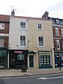 18-20 North Bar Within, Beverley.JPG 1,704 × 2,272; 924 KB
-
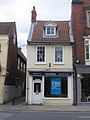 19 North Bar Within, Beverley.JPG 1,704 × 2,272; 871 KB
-
 26, 28 Eastgate, Beverley.JPG 2,272 × 1,704; 1.06 MB
-
 42 and 44 High Street Bridlington.JPG 1,704 × 2,272; 922 KB
-
 48 North Bar Without, Beverley.JPG 2,272 × 1,704; 1.1 MB
-
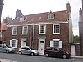
 5 Ladygate, Beverley.JPG 2,272 × 1,704; 1.16 MB
-
 54, 56 Toll Gavel, Beverley.JPG 2,272 × 1,704; 1,002 KB
-
 56 North Bar Without, Beverley.JPG 2,272 × 1,704; 1.45 MB
-
 67 High Street.JPG 1,704 × 2,272; 1.06 MB
-
 A building on Queen street, Withernsea (geograph 3611510).jpg 1,024 × 768; 161 KB
-
 A path leading to St Nicholas Church, Withernsea (geograph 3611390).jpg 1,024 × 768; 189 KB
-
 A path leading to St Nicholas Church, Withernsea (geograph 3611394).jpg 1,024 × 768; 227 KB
-
 A path leading to St Nicholas Church, Withernsea (geograph 3611398).jpg 1,024 × 768; 259 KB
-
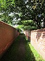 A path leading to St Nicholas Church, Withernsea (geograph 3611403).jpg 768 × 1,024; 298 KB
-
 Alma Street off Arthur Street, Withernsea (geograph 3611135).jpg 1,024 × 768; 186 KB
-
 Arthur Street towards Hull Road, Withernsea (geograph 3611194).jpg 1,024 × 768; 181 KB
-
 Arthur Street, Withernsea (geograph 3611117).jpg 1,024 × 768; 189 KB
-
 Arthur Street, Withernsea (geograph 3611121).jpg 1,024 × 768; 160 KB
-
 Arthur Street, Withernsea (geograph 3611131).jpg 1,024 × 768; 181 KB
-
 Arthur Street, Withernsea (geograph 3611179).jpg 1,024 × 768; 193 KB
-
 Arthur Street, Withernsea (geograph 3611188).jpg 768 × 1,024; 152 KB
-
 Bees on Thistle IMG 5963 - panoramio.jpg 1,084 × 1,200; 250 KB
-
 Bempton Cliffs, Bridlington (12240819295).jpg 2,144 × 3,216; 3.14 MB
-
 Cammidge Street off Arthur Street, Withernsea (geograph 3611128).jpg 1,024 × 768; 150 KB
-
 Edward Street off Arthur Street, Withernsea (geograph 3611183).jpg 1,024 × 768; 186 KB
-
 EYMS buses at the Withernsea Garage (geograph 3607200).jpg 1,024 × 768; 217 KB
-
 Farm track and harvested field (geograph 3623314).jpg 1,024 × 768; 183 KB
-
 Flamborough Head - geograph.org.uk - 4010883 (cropped).jpg 1,400 × 792; 1.26 MB
-
 Heading towards Park Avenue, Withernsea (geograph 3611470).jpg 1,024 × 768; 197 KB
-
 Hornsea Beach IMG 5782 - panoramio.jpg 1,400 × 933; 340 KB
-
 Hull Road, Withernsea (geograph 3611197).jpg 1,024 × 768; 152 KB
-
 Kirkfield Road off Queen Street, Withernsea (geograph 3611570).jpg 1,024 × 768; 144 KB
-
 Looking towards Queen Street North, Withernsea (geograph 3609415).jpg 1,024 × 768; 165 KB
-
 Lower Whitton Float, on a falling tide (geograph 3624728).jpg 1,024 × 768; 122 KB
-
 Man & deep.jpg 2,040 × 2,040; 1.8 MB
-
 Melanargia galathea (geograph 4919170).jpg 640 × 501; 108 KB
-
 Minster altar 3.jpg 1,424 × 2,144; 2.32 MB
-
 Minster north ceiling.jpg 1,424 × 2,144; 1.91 MB
-
 North Gate from North Promenade, Withernsea (geograph 3609377).jpg 1,024 × 768; 156 KB
-
 North Promenade, Withernsea (geograph 3607187).jpg 1,024 × 768; 140 KB
-
 North Promenade, Withernsea (geograph 3607191).jpg 1,024 × 768; 163 KB
-
 North Promenade, Withernsea (geograph 3607209).jpg 1,024 × 768; 175 KB
-
 North Promenade, Withernsea (geograph 3607268).jpg 1,024 × 768; 165 KB
-
 North Promenade, Withernsea (geograph 3607803).jpg 1,024 × 768; 159 KB
-
 North Promenade, Withernsea (geograph 3607805).jpg 1,024 × 768; 173 KB
-
 North Promenade, Withernsea (geograph 3609244).jpg 1,024 × 768; 120 KB
-
 North Promenade, Withernsea (geograph 3609247).jpg 1,024 × 768; 159 KB
-
 North Promenade, Withernsea (geograph 3609378).jpg 1,024 × 768; 129 KB
-
 North Promenade, Withernsea (geograph 3609406).jpg 1,024 × 768; 114 KB
-
 North Promenade, Withernsea (geograph 3609411).jpg 640 × 480; 59 KB
-
 North Promenade, Withernsea (geograph 3609754).jpg 1,024 × 768; 131 KB
-
 North Road, Withernsea (geograph 3611072).jpg 1,024 × 768; 185 KB
-
 North Road, Withernsea (geograph 3611076).jpg 1,024 × 768; 160 KB
-
 North Road, Withernsea (geograph 3611105).jpg 1,024 × 768; 175 KB
-
 North Road, Withernsea (geograph 3611113).jpg 1,024 × 768; 193 KB
-
 Northfield (road) off North Road, Withernsea (geograph 3611102).jpg 1,024 × 768; 181 KB
-
 Owthorne Walk off North Road, Withernsea (geograph 3611109).jpg 1,024 × 768; 141 KB
-
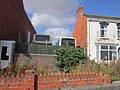
 Park Avenue, Withernsea (geograph 3611502).jpg 1,024 × 768; 221 KB
-
 Park Avenue, Withernsea (geograph 3611505).jpg 1,024 × 768; 155 KB
-
 Park Avenue, Withernsea (geograph 3611508).jpg 1,024 × 768; 165 KB
-
 Piggy Lane Market, Withernsea (geograph 3611293).jpg 1,024 × 768; 172 KB
-
 Piggy Lane Market, Withernsea (geograph 3611305).jpg 1,024 × 768; 139 KB
-
 Piggy Lane off Queen Street, Withernsea (geograph 3611289).jpg 1,024 × 768; 191 KB
-
 Princes Avenue off Queen Street, Withernsea (geograph 3612801).jpg 1,024 × 768; 157 KB
-
 Public Conveniences on Piggy Lane, Withernsea (geograph 3611341).jpg 1,024 × 768; 137 KB
-
 Public Conveniences Withernsea Sea Front (geograph 3607058).jpg 1,024 × 768; 121 KB
-
 Queen Street, Withernsea (geograph 3611369).jpg 1,024 × 768; 156 KB
-
 Queen Street, Withernsea (geograph 3612782).jpg 1,024 × 768; 172 KB
-
 Queen Street, Withernsea (geograph 3612785).jpg 1,024 × 768; 149 KB
-
 Queen Street, Withernsea (geograph 3612797).jpg 1,024 × 768; 138 KB
-
 Redcliff Middle Sand, River Humber (geograph 3624737).jpg 1,024 × 615; 79 KB
-
 Redcliffe Middle Sand and the distant Humber Bridge (geograph 3636730).jpg 1,024 × 615; 90 KB
-
 Redcliffe Middle Sand, from the west (geograph 3636722).jpg 1,024 × 768; 126 KB
-
 Seaside Road, Withernsea (geograph 3611224).jpg 1,024 × 768; 151 KB
-
 Seathorne (road), Withernsea (geograph 3611067).jpg 1,024 × 768; 153 KB
-
 Shops on Queen Street, Withernsea (geograph 3611235).jpg 1,024 × 768; 155 KB
-
 Shops on Queen Street, Withernsea (geograph 3611239).jpg 1,024 × 768; 170 KB
-
 Sister Kirkes The Promenade, Withernsea (geograph 3607089).jpg 1,024 × 768; 258 KB
-
 Sister Kirkes The Promenade, Withernsea (geograph 3607094).jpg 1,024 × 768; 235 KB
-
 St Nicholas Church Hall, Withernsea (geograph 3611476).jpg 1,024 × 768; 167 KB
-
 St Nicholas Church, Withernsea (geograph 3611408).jpg 768 × 1,024; 256 KB
-
 St Nicholas Church, Withernsea (geograph 3611413).jpg 768 × 1,024; 176 KB
-
 St Nicholas Church, Withernsea (geograph 3611442).jpg 1,024 × 768; 316 KB
-
 St Nicholas Church, Withernsea (geograph 3611452).jpg 1,024 × 768; 202 KB
-
 St Nicholas Church, Withernsea (geograph 3611457).jpg 1,024 × 768; 258 KB
-
 Steps down to the beach, Withernsea (geograph 3607047).jpg 1,024 × 768; 160 KB
-
 Steve Cobby.JPG 1,964 × 2,284; 1.83 MB
-
 Sunset near Rowley, East Yorkshire IMG 5466 - panoramio.jpg 1,400 × 747; 272 KB
-
 The Alexandra Hotel on Queen Street, Withernsea (geograph 3611231).jpg 1,024 × 768; 169 KB
-
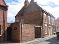
 The Bayle Gate, Bridlington 1.JPG 2,272 × 1,704; 1.33 MB
-
 The Bayle Gate, Bridlington.JPG 2,272 × 1,704; 1.12 MB
-
 The British Legion Club, Withernsea (geograph 3612793).jpg 1,024 × 768; 147 KB
-
 The Butterfly on Queen Street, Withernsea (geograph 3611219).jpg 768 × 1,024; 188 KB
-
 The Commercial on Piggy Lane, Withernsea (geograph 3611337).jpg 1,024 × 768; 153 KB
-
 The End of North Promenade, Withernsea (geograph 3609764).jpg 1,024 × 768; 126 KB
-
 The entrance to St Nicholas Surgery, Withernsea (geograph 3611355).jpg 1,024 × 768; 272 KB
-
 The Graveyard at St Nicholas Church, Withernsea (geograph 3611448).jpg 1,024 × 768; 196 KB
-
 The Lissett Airmen Memorial.jpg 3,763 × 2,592; 998 KB
-
 The Marine Hotel, North Promenade, Withernsea (geograph 3607919).jpg 1,024 × 768; 170 KB
-
 The Memorial Gardens, Withernsea (geograph 3606998).jpg 1,024 × 768; 168 KB
-
 The Meridian Centre on Pier Road, Withernsea (geograph 3606996).jpg 1,024 × 768; 152 KB
-
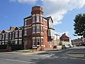
 The Municipal Building, Withernsea (geograph 3611385).jpg 1,024 × 768; 165 KB
-
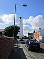
 The Pier Towers, Withernsea (geograph 3607043).jpg 1,024 × 768; 129 KB
-
 The Plant Centre on Piggy Lane, Withernsea (geograph 3611296).jpg 1,024 × 768; 167 KB
-
 The Queens, Withernsea (geograph 3611515).jpg 1,024 × 768; 182 KB
-
 The Spread Eagle on Queen Street North, Withernsea (geograph 3611214).jpg 1,024 × 768; 141 KB
-
 The Spread Eagle on Queen Street North, Withernsea (geograph 3611217).jpg 768 × 1,024; 149 KB
-
 The United Reformed Church, Withernsea (geograph 3611559).jpg 1,024 × 768; 149 KB
-
 The Yorkshire Wolds Way (geograph 3623343).jpg 1,024 × 768; 195 KB
-
 View alongside Top Plantation (geograph 3623334).jpg 1,024 × 768; 168 KB
-
 View towards Field House Farm (geograph 3623318).jpg 1,024 × 768; 134 KB
-
 Wading birds on Redcliff Middle Sand (geograph 3636742).jpg 1,024 × 615; 126 KB
-
 Waxholme Road from Seathorne (road), Withernsea (geograph 3611069).jpg 1,024 × 768; 175 KB
-
 Westoby Lane Sunset IMG 5448 - panoramio.jpg 1,400 × 779; 868 KB
-
 Withernsea Ambulance Station on Arthur Street (geograph 3611123).jpg 1,024 × 768; 218 KB
-
 Withernsea beach (geograph 3607051).jpg 1,024 × 768; 140 KB
-
 Withernsea Indoor Market on Queen Street (geograph 3611345).jpg 1,024 × 768; 138 KB
-
 Withernsea Methodist Church on Hull Road (geograph 3611201).jpg 1,024 × 768; 206 KB
-
 Withernsea promenade (geograph 3607064).jpg 1,024 × 768; 129 KB
-
 Young Street from North Promenade, Withernsea (geograph 3607633).jpg 1,024 × 768; 173 KB


.jpg)
.jpg)
.jpg)
.jpg)
.jpg)
.jpg)
.jpg)
.jpg)
.jpg)
.jpg)
.jpg)
.jpg)

.jpg)
.jpg)
.jpg)
.jpg)
.jpg)
.jpg)
.jpg)

.jpg)
.jpg)
.jpg)
.jpg)

.jpg)


.jpg)
.jpg)
.jpg)
.jpg)
.jpg)
.jpg)
.jpg)
.jpg)
.jpg)
.jpg)
.jpg)
.jpg)
.jpg)
.jpg)
.jpg)
.jpg)
.jpg)
_off_North_Road,_Withernsea_(geograph_3611102).jpg)
.jpg)
.jpg)
.jpg)
.jpg)
.jpg)
.jpg)
.jpg)
.jpg)
.jpg)
.jpg)
.jpg)
.jpg)
.jpg)
.jpg)
.jpg)
.jpg)
.jpg)
.jpg)
,_Withernsea_(geograph_3611067).jpg)
.jpg)
.jpg)
.jpg)
.jpg)
.jpg)
.jpg)
.jpg)
.jpg)
.jpg)
.jpg)
.jpg)


.jpg)


.jpg)
.jpg)
.jpg)
.jpg)
.jpg)
.jpg)

.jpg)
.jpg)
.jpg)
.jpg)
.jpg)
.jpg)
.jpg)
.jpg)
.jpg)
.jpg)
.jpg)
.jpg)
.jpg)
.jpg)
,_Withernsea_(geograph_3611069).jpg)

.jpg)
.jpg)
.jpg)
.jpg)
.jpg)
.jpg)