Category:Attleborough, Warwickshire
Jump to navigation
Jump to search
area in Nuneaton, Warwickshire, UK | |||||
| Upload media | |||||
| Instance of | |||||
|---|---|---|---|---|---|
| Location | Nuneaton, Nuneaton and Bedworth, Warwickshire, West Midlands, England | ||||
 | |||||
Media in category "Attleborough, Warwickshire"
The following 70 files are in this category, out of 70 total.
-
 'Old' Church Walk - geograph.org.uk - 879836.jpg 640 × 428; 86 KB
-
 'Road into Nuneaton' - geograph.org.uk - 877693.jpg 640 × 430; 82 KB
-
 Ashby Canal - geograph.org.uk - 227076.jpg 640 × 480; 73 KB
-
 Ashby Canal at Marston Junction - geograph.org.uk - 227252.jpg 640 × 480; 45 KB
-
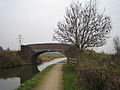
 Ashby Canal, Bridge number 1 - geograph.org.uk - 227080.jpg 640 × 480; 85 KB
-
 Attleborough "Look North" - geograph.org.uk - 865753.jpg 640 × 443; 148 KB
-
 Attleborough "quiet spot" - geograph.org.uk - 865756.jpg 640 × 426; 137 KB
-
 Attleborough - geograph.org.uk - 865750.jpg 640 × 426; 147 KB
-
 Attleborough Cemetery - geograph.org.uk - 870374.jpg 640 × 428; 128 KB
-
 Attleborough Cemetery - geograph.org.uk - 870377.jpg 428 × 640; 110 KB
-
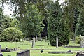 Attleborough Cemetery - geograph.org.uk - 870378.jpg 640 × 428; 142 KB
-
 Attleborough Cemetery - geograph.org.uk - 870379.jpg 428 × 640; 133 KB
-
 Attleborough Holy Trinity Church - geograph.org.uk - 879833.jpg 640 × 428; 100 KB
-
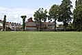
 Attleborough Housing Estate - geograph.org.uk - 877696.jpg 640 × 452; 98 KB
-
 Attleborough Recreation Ground - geograph.org.uk - 870233.jpg 428 × 640; 109 KB
-
 Attleborough Recreation Ground - geograph.org.uk - 870236.jpg 640 × 428; 93 KB
-
 Attleborough Recreation Ground - geograph.org.uk - 870237.jpg 640 × 443; 110 KB
-
 Attleborough Recreation Ground - geograph.org.uk - 870371.jpg 428 × 640; 112 KB
-
 Attleborough Recreation Ground - geograph.org.uk - 870372.jpg 640 × 445; 77 KB
-
 Attleborough Village - geograph.org.uk - 869649.jpg 640 × 428; 69 KB
-
 Attleborough Village - geograph.org.uk - 869652.jpg 640 × 428; 71 KB
-
 Attleborough Village - geograph.org.uk - 869663.jpg 640 × 428; 80 KB
-
 Attleborough Village - geograph.org.uk - 869667.jpg 640 × 443; 73 KB
-
 Attleborough Village - geograph.org.uk - 869670.jpg 640 × 443; 70 KB
-
 Attleborough Village - geograph.org.uk - 869675.jpg 640 × 418; 84 KB
-
 Attleborough Village - geograph.org.uk - 869684.jpg 640 × 422; 84 KB
-
 Attleborough Village - geograph.org.uk - 870224.jpg 640 × 428; 79 KB
-
 Attleborough Village - geograph.org.uk - 870225.jpg 640 × 428; 119 KB
-
 Attleborough Village - geograph.org.uk - 870228.jpg 640 × 428; 93 KB
-
 Attleborough Village - geograph.org.uk - 879823.jpg 640 × 430; 76 KB
-
 Attleborough Village - geograph.org.uk - 879827.jpg 640 × 428; 75 KB
-
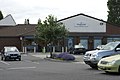
 Attleborough Village, "The Square" - geograph.org.uk - 879859.jpg 640 × 428; 73 KB
-
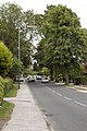
 Attleborough, B4114 Highfield Road - geograph.org.uk - 879858.jpg 640 × 423; 117 KB
-
 Attleborough, Highfield Road - geograph.org.uk - 879839.jpg 640 × 429; 85 KB
-
 Attleborough, Highfield Road - geograph.org.uk - 879857.jpg 640 × 428; 96 KB
-
 Attleborough, Lutterworth Road - geograph.org.uk - 870240.jpg 428 × 640; 100 KB
-
 Bridge No. 16, Coventry Canal - geograph.org.uk - 101988.jpg 640 × 480; 104 KB
-
 Country view - geograph.org.uk - 32696.jpg 640 × 480; 126 KB
-
 Dead End, Nuneaton Borough A.F.C. - geograph.org.uk - 541933.jpg 640 × 480; 46 KB
-

-
 Farmland near Bedworth - geograph.org.uk - 101985.jpg 640 × 480; 64 KB
-
 Gipsy Lane Bridge, Coventry Canal - geograph.org.uk - 101981.jpg 640 × 480; 69 KB
-
 Hill Farm - geograph.org.uk - 32689.jpg 640 × 480; 93 KB
-
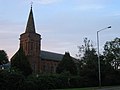 Holy Trinity Church - geograph.org.uk - 33145.jpg 640 × 480; 57 KB
-
 Ivanhoe Avenue (North), Attleborough - geograph.org.uk - 878124.jpg 640 × 428; 82 KB
-
 Ivanhoe Avenue, Attleborough - geograph.org.uk - 878121.jpg 640 × 430; 61 KB
-
 Leyland Road, Attleborough - geograph.org.uk - 878129.jpg 640 × 429; 61 KB
-

-
 Marston House Farm - geograph.org.uk - 193863.jpg 640 × 480; 78 KB
-
 Marston Junction - geograph.org.uk - 227082.jpg 640 × 480; 57 KB
-
 Mill Close - geograph.org.uk - 878117.jpg 640 × 430; 84 KB
-
 My Garden - geograph.org.uk - 869302.jpg 443 × 640; 129 KB
-
 Paul's Ford - geograph.org.uk - 32692.jpg 640 × 480; 136 KB
-
 Pauls Land - geograph.org.uk - 32425.jpg 640 × 480; 89 KB
-
 Pauls Land - geograph.org.uk - 878106.jpg 640 × 430; 59 KB
-
 Pauls Land - geograph.org.uk - 878109.jpg 640 × 430; 83 KB
-
 Pauls Land - geograph.org.uk - 878110.jpg 640 × 430; 92 KB
-
 Pauls Land - geograph.org.uk - 878113.jpg 640 × 429; 63 KB
-
 Rail Views WCML - geograph.org.uk - 877675.jpg 640 × 430; 73 KB
-
 Railway Views - geograph.org.uk - 877659.jpg 640 × 430; 61 KB
-
 Railway Views, WCML - geograph.org.uk - 877666.jpg 640 × 430; 75 KB
-
 Slalom Road - geograph.org.uk - 193864.jpg 640 × 480; 73 KB
-
 Steps to Crowhill Housing estate in Attleborough, Warwickshire.jpg 428 × 640; 101 KB
-

-

-

-
 Waverley Sq. Attleborough - geograph.org.uk - 877691.jpg 640 × 430; 114 KB
-
 WCML New Signals - geograph.org.uk - 869304.jpg 428 × 640; 170 KB
-
 West Coast Main Line, Attleborough - geograph.org.uk - 870380.jpg 428 × 640; 112 KB
-
 Marston Junction, Coventry Canal - geograph.org.uk - 462867.jpg 640 × 501; 71 KB


,_Attleborough_-_geograph.org.uk_-_878124.jpg)


