Category:Atlas Sekolah Hindia Nederland
Jump to navigation
Jump to search
English: Atlas Sekolah Hindia Nederland (literally "School atlas of the Dutch Indies").
Bahasa Indonesia: Atlas Sekolah Hindia Nederland.
Media in category "Atlas Sekolah Hindia Nederland"
The following 14 files are in this category, out of 14 total.
-
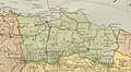
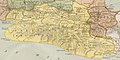
 1909 Atlas sekolah Hindia-Nederland map of Banten.jpg 967 × 725; 114 KB
-
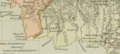
 1909 Atlas sekolah Hindia-Nederland map of Batavia.jpg 1,227 × 670; 154 KB
-
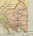
 1909 Atlas sekolah Hindia-Nederland map of Djambi.jpg 1,260 × 681; 144 KB
-
 1909 Atlas sekolah Hindia-Nederland map of East Sumatra.png 1,246 × 1,137; 1.89 MB
-
 1909 Atlas sekolah Hindia-Nederland map of Gouv Atjeh.jpg 844 × 726; 99 KB
-
 1909 Atlas Sekolah Hindia-Nederland map of Kotawaringin.png 1,535 × 687; 1.55 MB
-
 1909 Atlas sekolah Hindia-Nederland map of Lampoeng District.jpg 650 × 709; 81 KB
-
 1909 Atlas sekolah Hindia-Nederland map of North Maluku.png 739 × 590; 420 KB
-
 1909 Atlas sekolah Hindia-Nederland map of Palembang.jpg 889 × 695; 125 KB
-
 1909 Atlas sekolah Hindia-Nederland map of Preanger.jpg 1,409 × 710; 198 KB
-
 1909 Atlas sekolah Hindia-Nederland map of Tapanoeli 2.jpg 879 × 731; 118 KB
-
 1909 Atlas sekolah Hindia-Nederland map of Tapanoeli.jpg 921 × 715; 114 KB
-
 1909 Atlas sekolah Hindia-Nederland map of Tjirebon.jpg 690 × 724; 105 KB
-
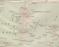
 Map of Madoera residency from Atlas Sekolah Hindia Belanda 1909.png 1,242 × 564; 811 KB


