Category:Ancient Roman roads in North Yorkshire
Jump to navigation
Jump to search
Ceremonial counties of England: Cumbria · East Riding of Yorkshire · Lincolnshire · North Yorkshire · Northumberland · West Sussex · West Yorkshire · Worcestershire
City-counties:
Former historic counties:
Other former counties:
City-counties:
Former historic counties:
Other former counties:
Subcategories
This category has the following 2 subcategories, out of 2 total.
M
- Moor Lane, Skipton (6 F)
W
- Wade's Causeway (8 F)
Media in category "Ancient Roman roads in North Yorkshire"
The following 12 files are in this category, out of 12 total.
-
 2015 Cam High Road.jpg 4,608 × 3,456; 8.17 MB
-
 High Edge - Draughton Moor - geograph.org.uk - 75898.jpg 640 × 480; 115 KB
-
 Roman Crossroads - geograph.org.uk - 295484.jpg 640 × 484; 137 KB
-
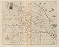 Roman Roads in Yorkshire Map Gri 33125011105661 0103-4.jpg 2,440 × 1,938; 1.57 MB
-
 Rudgate - geograph.org.uk - 306124.jpg 640 × 480; 52 KB
-
 Rudgate, Roman Road - geograph.org.uk - 295491.jpg 640 × 472; 95 KB
-
 Sign for the Roman Road - geograph.org.uk - 329099.jpg 640 × 479; 85 KB
-
 Skipton to Addingham Turnpike - geograph.org.uk - 47369.jpg 640 × 480; 95 KB
-
 Skipton Turnpike - geograph.org.uk - 914846.jpg 640 × 425; 194 KB
-
 Skipton-Addingham Turnpike. - geograph.org.uk - 153341.jpg 640 × 480; 79 KB
-
 Track below Draughton Moor - geograph.org.uk - 956700.jpg 640 × 480; 61 KB
-
 Track below High Edge - geograph.org.uk - 956721.jpg 640 × 480; 67 KB


