Category:Aerial photographs of Franklin County, Massachusetts
Jump to navigation
Jump to search
Subcategories
This category has only the following subcategory.
Media in category "Aerial photographs of Franklin County, Massachusetts"
The following 15 files are in this category, out of 15 total.
-
 20191016-NRCS-LSC-0007 - Flickr - USDAgov.jpg 4,852 × 3,235; 27.58 MB
-
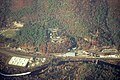
 Aerial view of auto shredder and railroad bridge in Greenfield, 1982.jpg 8,234 × 5,439; 8.73 MB
-
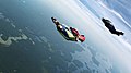
 Banking Right for Break Off (6367627785).jpg 1,024 × 576; 325 KB
-
 French King Bridge Massachusetts October 2021 003.jpg 5,464 × 3,640; 8.51 MB
-
 Massachusetts Landscape (6367628461).jpg 1,024 × 576; 215 KB
-
 RB-Pkg9-020 (49719464428).jpg 8,234 × 5,439; 3.94 MB
-
 RB-Pkg9-021 (49720001106).jpg 8,213 × 5,141; 3.73 MB
-
 RB-Pkg9-022 (49720001341).jpg 8,213 × 5,440; 3.54 MB
-
 RB-Pkg9-023 (49720316782).jpg 8,213 × 5,439; 3.12 MB
-
 RB-Pkg9-024 (49719465378).jpg 8,234 × 5,482; 3.58 MB
-
 Stoneleigh-Burnham School campus aerial.jpg 500 × 335; 120 KB
-
 Wingsuit Flock over Massachusetts (6367634137).jpg 1,024 × 576; 227 KB
-
 Wingsuit Flock over Massachusetts (6367634455).jpg 1,024 × 576; 249 KB
-
 Wingsuit Flying in Massachusetts (6367634713).jpg 1,024 × 573; 321 KB
-
 Wingsuit Formation in the Shadow of a Cloud (6367630195).jpg 1,024 × 576; 379 KB


.jpg)

.jpg)
.jpg)
.jpg)
.jpg)
.jpg)
.jpg)

.jpg)
.jpg)
.jpg)
.jpg)