Category:2008 in Powys
Jump to navigation
Jump to search
Cymraeg: 2008 yn awdurdod unedol Powys.
English: 2008 in the principal area of Powys, Wales.
Français : 2008 dans la zone principale du Powys.

Subcategories
This category has the following 10 subcategories, out of 10 total.
- January 2008 in Powys (14 F)
- February 2008 in Powys (10 F)
- April 2008 in Powys (16 F)
- May 2008 in Powys (43 F)
- July 2008 in Powys (19 F)
- August 2008 in Powys (9 F)
- December 2008 in Powys (16 F)
T
Media in category "2008 in Powys"
The following 28 files are in this category, out of 28 total.
-
 Brecon Beacons 2008 - panoramio (7).jpg 2,048 × 1,536; 649 KB
-
 Bridge 114, empty canal - geograph.org.uk - 670931.jpg 640 × 480; 93 KB
-
 Bridge No 144 - geograph.org.uk - 2635895.jpg 1,500 × 1,125; 1.39 MB
-
 Chapel, Aberhosan - geograph.org.uk - 791673.jpg 640 × 465; 97 KB
-
 Dolgadfan - geograph.org.uk - 986714.jpg 800 × 600; 678 KB
-
 Dylife Mine - geograph.org.uk - 1968647.jpg 1,712 × 2,288; 843 KB
-
 Forestry road near Bryn Du - geograph.org.uk - 765713.jpg 640 × 480; 227 KB
-
 Lamb and Flag Inn, North St, Rhayader - geograph.org.uk - 968737.jpg 640 × 480; 83 KB
-
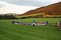 Laying out the Balloon - geograph.org.uk - 991752.jpg 640 × 426; 52 KB
-

-
 Nantyrhwch - near Dolgoch, Powys - geograph.org.uk - 1047069.jpg 640 × 501; 151 KB
-
 Nantyrhwch in Cwm Tywi, Powys - geograph.org.uk - 2176624.jpg 480 × 640; 150 KB
-
 New Gate - geograph.org.uk - 1060814.jpg 640 × 425; 144 KB
-
 Pasture beside Afon Diliw - geograph.org.uk - 1103602.jpg 640 × 480; 196 KB
-
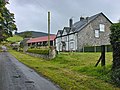
 Pen-y-bryn Hall - geograph.org.uk - 660076.jpg 480 × 640; 136 KB
-
 Replanted clear fell on Mynydd y Defaid - geograph.org.uk - 1107501.jpg 640 × 480; 274 KB
-
 St Mary's Bettws - geograph.org.uk - 979658.jpg 640 × 426; 53 KB
-
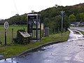 Telephone box and cycleway in Derwenlas - geograph.org.uk - 989304.jpg 640 × 480; 103 KB
-
 The Fabulous Water Beast - geograph.org.uk - 1552210.jpg 640 × 396; 65 KB
-
 The Hotel Metropole - geograph.org.uk - 779272.jpg 640 × 480; 101 KB
-
 The Rocks - geograph.org.uk - 1035697.jpg 640 × 480; 81 KB
-
 The Rocks, downstream - geograph.org.uk - 1035700.jpg 640 × 480; 84 KB
-
 The Rocks, river Wye - geograph.org.uk - 1035695.jpg 640 × 480; 94 KB
-
 Track to Esgair Ddu and Waun Llinau - geograph.org.uk - 1095284.jpg 640 × 480; 193 KB
-
 Two Bridges - geograph.org.uk - 928686.jpg 640 × 426; 76 KB
-
 View east from Blaen Bwch Farm 674351.jpg 640 × 480; 89 KB
-
 View south-east from Hay Bluff - geograph.org.uk - 1074568.jpg 640 × 426; 91 KB
-
 The Powys (Communities) Order 2008 (WSI 2008-584).pdf 1,239 × 1,752, 13 pages; 506 KB


_-_geograph.org.uk_-_899127.jpg)


.jpg)