Category:1974 maps
Jump to navigation
Jump to search
| ← · 1970 · 1971 · 1972 · 1973 · 1974 · 1975 · 1976 · 1977 · 1978 · 1979 · → |
Deutsch: Karten mit Bezug zum Jahr 1974
English: Maps related to the year 1974
Español: Mapas relativos al año 1974
Français : Cartes concernant l’an 1974
Русский: Карты 1974 года
Subcategories
This category has the following 7 subcategories, out of 7 total.
Media in category "1974 maps"
The following 58 files are in this category, out of 58 total.
-

-
 Aero view of Chickamauga and Chattanooga National Military Park (looking east). LOC 76696229.tif 5,869 × 4,440; 74.55 MB
-
 Angelina National Forest, Texas. LOC 75695970.jpg 6,482 × 6,334; 4.92 MB
-
 Angelina National Forest, Texas. LOC 75695970.tif 6,482 × 6,334; 117.47 MB
-
 Arctic Basin, established and theoretical jurisdiction limits. 7-74. LOC 76695260.jpg 5,597 × 6,037; 3.94 MB
-
 Arctic Basin, established and theoretical jurisdiction limits. 7-74. LOC 76695260.tif 5,597 × 6,037; 96.67 MB
-
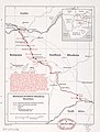 Botswana-Southern Rhodesia boundary. LOC 84692082.jpg 3,144 × 4,162; 1.18 MB
-
 Botswana-Southern Rhodesia boundary. LOC 84692082.tif 3,144 × 4,162; 37.44 MB
-
 Chile-Peru border region. LOC 2008627392.tif 10,986 × 9,712; 305.26 MB
-
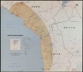 Chile-Peru border region. LOC 80690284.tif 8,457 × 7,404; 179.15 MB
-
 Comprehensive plan for the National Capital, major thoroughfare plan. LOC 75690028.jpg 9,053 × 6,538; 11.44 MB
-
 Comprehensive plan for the National Capital, major thoroughfare plan. LOC 75690028.tif 9,053 × 6,538; 169.34 MB
-
 Comprehensive plan for the National Capital, major thoroughfare plan. LOC 75697292.jpg 8,854 × 6,774; 11.97 MB
-
 Comprehensive plan for the National Capital, major thoroughfare plan. LOC 75697292.tif 8,854 × 6,774; 171.6 MB
-
 Comprehensive plan for the National Capital, mass transportation plan. LOC 75690029.jpg 8,389 × 6,992; 7.62 MB
-
 Comprehensive plan for the National Capital, mass transportation plan. LOC 75690029.tif 8,389 × 6,992; 167.82 MB
-
 Comprehensive plan for the National Capital, mass transportation plan. LOC 75697293.tif 8,445 × 7,002; 169.18 MB
-
 Egyptian-Israeli disengagement lines, January 1974. 1-74. LOC 74693449.jpg 6,680 × 8,672; 6.46 MB
-
 Egyptian-Israeli disengagement lines, January 1974. 1-74. LOC 74693449.tif 6,680 × 8,672; 165.74 MB
-
 Fort Raleigh National Historic Site LOC 80695127.jpg 6,000 × 3,453; 2.95 MB
-
 Fort Raleigh National Historic Site LOC 80695127.tif 6,000 × 3,453; 59.27 MB
-
 General soil map, Brown and Mills counties, Texas. LOC 92682534.tif 5,828 × 7,632; 127.26 MB
-
 General soil map, Cass and Marion counties, Texas LOC 92682921.tif 9,815 × 5,519; 154.98 MB
-
 General soil map, Sabine and San Augustine counties, Texas LOC 92682922.tif 7,311 × 11,563; 241.86 MB
-
 George Washington National Forest, 1971 LOC 78696318.jpg 14,126 × 7,256; 17.21 MB
-
 George Washington National Forest, 1971 LOC 78696318.tif 14,126 × 7,256; 293.25 MB
-
 Greers Ferry Lake, Arkansas LOC 82691818.jpg 7,224 × 10,286; 10.23 MB
-
 Greers Ferry Lake, Arkansas LOC 82691818.tif 7,224 × 10,286; 212.59 MB
-
 Holly Springs National Forest, Mississippi. LOC 75695925.jpg 6,103 × 8,286; 7.97 MB
-
 Holly Springs National Forest, Mississippi. LOC 75695925.tif 6,103 × 8,286; 144.68 MB
-
 Hydrologic unit map-1974, States of Maryland and Delaware. LOC 76695070.jpg 10,692 × 6,828; 8.54 MB
-
 Hydrologic unit map-1974, States of Maryland and Delaware. LOC 76695070.tif 10,692 × 6,828; 208.87 MB
-
 Kentucky LOC 89697266.jpg 11,803 × 6,257; 4.81 MB
-
 Kentucky LOC 89697266.tif 11,803 × 6,257; 211.29 MB
-
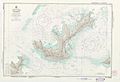 Mangareva 1974 nautical chart.jpg 8,766 × 6,016; 8.65 MB
-

-

-

-

-
 Map of the battlefields of Chattanooga, movement against Orchard Knob. LOC 77693127.jpg 6,831 × 5,296; 7.81 MB
-
 Map of the battlefields of Chattanooga, movement against Orchard Knob. LOC 77693127.tif 6,831 × 5,296; 103.5 MB
-
 Oblique Map of the Bering Sea, 1974.jpg 5,043 × 3,970; 2.48 MB
-
 Operational Navigation Chart A-2, 2nd edition.jpg 9,254 × 6,659; 13.7 MB
-
 Operational Navigation Chart B-2, 3rd edition.jpg 9,254 × 6,716; 13.42 MB
-
 Ouachita National Forest, Arkansas and Oklahoma. LOC 75690145.jpg 10,894 × 10,964; 20.6 MB
-
 Ouachita National Forest, Arkansas and Oklahoma. LOC 75690145.tif 10,894 × 10,964; 341.73 MB
-
 Sam Houston National Forest (Big Thicket and Raven District), Texas. LOC 75695972.jpg 9,448 × 6,695; 8.35 MB
-
 Sam Houston National Forest (Big Thicket and Raven District), Texas. LOC 75695972.tif 9,448 × 6,695; 180.97 MB
-
 State of Connecticut- Base map with highways and contours. LOC 76695372.jpg 16,601 × 13,008; 29.25 MB
-
 Sumter National Forest (Enoree Division), South Carolina. LOC 75690142.jpg 14,947 × 7,036; 17.24 MB
-
 Tennessee-Tombigbee Waterway. LOC 76691430.jpg 2,986 × 7,405; 2.22 MB
-
 Tennessee-Tombigbee Waterway. LOC 76691430.tif 2,986 × 7,405; 63.26 MB
-
 Route of the 1974 Tour de France.png 3,198 × 3,204; 2.79 MB
-

-

-
 W. Kerr Scott Reservoir LOC 78694375.jpg 10,329 × 5,448; 8.03 MB
-
 W. Kerr Scott Reservoir LOC 78694375.tif 10,329 × 5,448; 161 MB
-
 WalesOgwr1974.png 400 × 490; 12 KB
._LOC_76696229.jpg)


,_Texas._LOC_75695972.jpg)

,_South_Carolina._LOC_75690142.jpg)

_-_FIA_flood_hazard_boundary_map_;_Village_of_Brightwaters,_NY_(Suffolk_Co.),_map_index_-_FIA_flood_hazard_boundary_maps_LOC_84697299.jpg)

