Category:18th-century maps of Gard
Jump to navigation
Jump to search
Subcategories
This category has only the following subcategory.
C
Media in category "18th-century maps of Gard"
The following 8 files are in this category, out of 8 total.
-
 Aigues-Mortes et la Petite Camargue Gravure de Bellin 1764.jpg 1,820 × 2,348; 2.32 MB
-
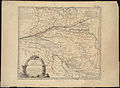
 Camargue Carte de Jaillot.jpg 5,089 × 3,606; 16.66 MB
-
 Carte du diocèse dUzès (5120563787).jpg 2,000 × 1,459; 2.97 MB
-
 Carte du diocèse dUzès (5121168174).jpg 1,420 × 2,000; 3.2 MB
-
 Carte du département du Gard - 1790-1793.tif 6,042 × 6,334; 109.54 MB
-
 Carte topographique des marais de Peccais.jpg 838 × 640; 332 KB
-
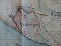 Plan de vallabrègues en 1785 ( AD Gard C161 ).jpg 2,592 × 1,944; 1.16 MB
-
 Atlas national portatif de la France 1792 (105093614).jpg 6,859 × 5,603; 6.42 MB


.jpg)
.jpg)

.jpg)
.jpg)