Category:1885 maps of Minnesota
Jump to navigation
Jump to search
States of the United States: California · Connecticut · Delaware · Florida · Georgia · Illinois · Iowa · Kansas · Kentucky · Louisiana · Maryland · Michigan · Minnesota · Mississippi · Missouri · Nevada · New Jersey · New York · North Carolina · Ohio · Oregon · Pennsylvania · Tennessee · Texas · Virginia · Washington · Wisconsin – Washington, D.C.
| 1883 1884 1885 1887 1888 1889 → |
Subcategories
This category has the following 9 subcategories, out of 9 total.
S
Media in category "1885 maps of Minnesota"
The following 32 files are in this category, out of 32 total.
-
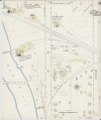
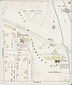
 Sanborn Fire Insurance Map from Anoka, Anoka County, Minnesota. LOC sanborn04250 001-1.jpg 6,450 × 7,650; 3.53 MB
-
 Sanborn Fire Insurance Map from Anoka, Anoka County, Minnesota. LOC sanborn04250 001-1.tif 6,450 × 7,650; 141.17 MB
-
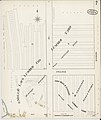
 Sanborn Fire Insurance Map from Anoka, Anoka County, Minnesota. LOC sanborn04250 001-10.jpg 6,450 × 7,650; 3.01 MB
-
 Sanborn Fire Insurance Map from Anoka, Anoka County, Minnesota. LOC sanborn04250 001-10.tif 6,450 × 7,650; 141.17 MB
-
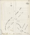
 Sanborn Fire Insurance Map from Anoka, Anoka County, Minnesota. LOC sanborn04250 001-2.jpg 6,450 × 7,650; 3.76 MB
-
 Sanborn Fire Insurance Map from Anoka, Anoka County, Minnesota. LOC sanborn04250 001-2.tif 6,450 × 7,650; 141.17 MB
-
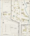
 Sanborn Fire Insurance Map from Anoka, Anoka County, Minnesota. LOC sanborn04250 001-3.jpg 6,450 × 7,650; 3.07 MB
-
 Sanborn Fire Insurance Map from Anoka, Anoka County, Minnesota. LOC sanborn04250 001-3.tif 6,450 × 7,650; 141.17 MB
-
 Sanborn Fire Insurance Map from Anoka, Anoka County, Minnesota. LOC sanborn04250 001-4.jpg 6,450 × 7,650; 3.18 MB
-
 Sanborn Fire Insurance Map from Anoka, Anoka County, Minnesota. LOC sanborn04250 001-4.tif 6,450 × 7,650; 141.17 MB
-
 Sanborn Fire Insurance Map from Anoka, Anoka County, Minnesota. LOC sanborn04250 001-5.jpg 6,450 × 7,650; 3.52 MB
-
 Sanborn Fire Insurance Map from Anoka, Anoka County, Minnesota. LOC sanborn04250 001-5.tif 6,450 × 7,650; 141.17 MB
-
 Sanborn Fire Insurance Map from Anoka, Anoka County, Minnesota. LOC sanborn04250 001-6.jpg 6,450 × 7,650; 3.27 MB
-
 Sanborn Fire Insurance Map from Anoka, Anoka County, Minnesota. LOC sanborn04250 001-6.tif 6,450 × 7,650; 141.17 MB
-
 Sanborn Fire Insurance Map from Anoka, Anoka County, Minnesota. LOC sanborn04250 001-7.jpg 6,450 × 7,650; 2.97 MB
-
 Sanborn Fire Insurance Map from Anoka, Anoka County, Minnesota. LOC sanborn04250 001-7.tif 6,450 × 7,650; 141.17 MB
-
 Sanborn Fire Insurance Map from Anoka, Anoka County, Minnesota. LOC sanborn04250 001-8.jpg 6,450 × 7,650; 3.44 MB
-
 Sanborn Fire Insurance Map from Anoka, Anoka County, Minnesota. LOC sanborn04250 001-8.tif 6,450 × 7,650; 141.17 MB
-
 Sanborn Fire Insurance Map from Anoka, Anoka County, Minnesota. LOC sanborn04250 001-9.jpg 6,450 × 7,650; 3.39 MB
-
 Sanborn Fire Insurance Map from Anoka, Anoka County, Minnesota. LOC sanborn04250 001-9.tif 6,450 × 7,650; 141.17 MB
-
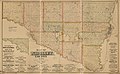 Map of Nicollet County, Minn. - from personal examination and public records. LOC 2012593065.jpg 17,487 × 10,789; 22.36 MB
-
 Map of Nicollet County, Minn. - from personal examination and public records. LOC 2012593065.tif 17,487 × 10,789; 539.78 MB
-
 Minneapolis, Minnesota. LOC 75694644.jpg 13,152 × 9,408; 24.5 MB
-
 Minneapolis, Minnesota. LOC 75694644.tif 13,152 × 9,408; 354.01 MB
-

-
 Sanborn Fire Insurance Map from Cokato, Wright County, Minnesota. LOC sanborn04278 001.tif 6,450 × 7,650; 141.17 MB
-

-
 Sanborn Fire Insurance Map from Farmington, Dakota County, Minnesota. LOC sanborn04296 001.tif 6,450 × 7,650; 141.17 MB
-

-
 Sanborn Fire Insurance Map from Taylors Falls, Chisago County, Minnesota. LOC sanborn04398 001.tif 6,450 × 7,650; 141.17 MB
-
 Sanborn Fire Insurance Map from Thomson, Carlton County, Minnesota. LOC sanborn04400 001.jpg 6,450 × 7,650; 3.72 MB
-
 Sanborn Fire Insurance Map from Thomson, Carlton County, Minnesota. LOC sanborn04400 001.tif 6,450 × 7,650; 141.17 MB


