Category:1850s maps of Java
Jump to navigation
Jump to search
Media in category "1850s maps of Java"
The following 18 files are in this category, out of 18 total.
-
 Junghuhn Kaart van het eiland Java - geologische Ausgabe -- Blatt 1.jpg 9,466 × 9,606; 12.69 MB
-
 Junghuhn Kaart van het eiland Java - geologische Ausgabe -- Blatt 2.jpg 9,439 × 9,608; 15.51 MB
-
 Junghuhn Kaart van het eiland Java - geologische Ausgabe -- Blatt 3.jpg 9,487 × 9,622; 16.63 MB
-
 Junghuhn Kaart van het eiland Java - geologische Ausgabe -- Blatt 4.jpg 9,401 × 9,621; 16.54 MB
-
 Junghuhn Kaart van het eiland Java - geologische Ausgabe Bl. 2.jpg 9,439 × 9,608; 17.36 MB
-
 Junghuhns Java-Karte.jpg 9,000 × 2,290; 3.99 MB
-
 Kaart van het eiland Java - Geologische Ausgabe.jpg 11,472 × 2,959; 9.41 MB
-
 Kaart van het eiland Java - Topografische Ausgabe.jpg 12,249 × 3,147; 9.24 MB
-
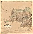
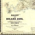 Kaart van het eiland Java.jpg 3,499 × 3,438; 2.08 MB
-
 Kaart-van-het-eiland-Java-Westblatt-Wikipedia.jpg 8,477 × 8,605; 11.84 MB
-
 Junghuhns Java-Karte Erstes Blatt.jpg 6,084 × 6,204; 9.07 MB
-
 Junghuhns Java-Karte Zweites Blatt.jpg 5,987 × 6,195; 10.27 MB
-
 Junghuhns Java-Karte Drittes Blatt.jpg 5,990 × 6,215; 9.9 MB
-
 Junghuhns Java-Karte Viertes Blatt.jpg 6,088 × 6,259; 8.26 MB
-

-
 Tengger-Gebirge.JPG 2,400 × 1,599; 1.11 MB
-
 Admiralty Chart No 2056 Strait of Sunda, Published 1851.jpg 10,025 × 7,651; 8.23 MB
-
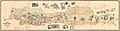
 Map japara 1858.jpg 1,200 × 1,200; 275 KB


.jpg)


