Category:1839 maps of Europe
Jump to navigation
Jump to search
Temperate regions: North America · South America · Africa · Europe · Asia · Oceania – Polar regions: – Other regions:
English: 1839 maps of Europe
Español: Mapas de Europa en 1839
Suomi: Euroopan kartat vuodelta 1839
Română: Hărți ale Europei din 1839
Subcategories
This category has the following 8 subcategories, out of 8 total.
F
- 1839 maps of France (15 F)
G
I
- 1839 maps of Italy (4 F)
N
- 1839 maps of Norway (2 F)
O
- Oberreit, Sect. Leipzig, 1836–39 (54 F)
P
- 1839 maps of Poland (1 F)
S
- 1839 maps of Spain (1 F)
U
- 1839 maps of Ukraine (10 F)
Media in category "1839 maps of Europe"
The following 7 files are in this category, out of 7 total.
-
 Carte générale d'Europe dressée - par Charle... - btv1b530930325.jpg 9,432 × 6,768; 10.86 MB
-
 Karta öfver Åland med dess Skägård.tif 8,602 × 7,784; 383.42 MB
-
 Mitchell's school atlas LOC 2007633727-12.jpg 3,489 × 2,683; 1.95 MB
-
 Mitchell's school atlas LOC 2007633727-12.tif 3,489 × 2,683; 26.78 MB
-
 Plan af Uleåborg 1839.jpg 6,911 × 5,536; 4.1 MB
-
 Tynec nad Labem COSK 1839.jpg 4,000 × 3,525; 3.71 MB
-
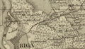 Šreienbušas muižas teritorija (1839.g.).png 1,411 × 816; 3.24 MB


.png)