Category:1829 maps of South America
Jump to navigation
Jump to search
Temperate regions: North America · South America · Africa · Europe · Asia · Oceania – Polar regions: – Other regions:
| 1820 1821 1822 1823 1824 1825 1826 1827 1828 1829 |
Media in category "1829 maps of South America"
The following 6 files are in this category, out of 6 total.
-
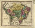
 Brazil, Bolivia & Peru. LOC 2003627066.jpg 3,330 × 2,674; 1.37 MB
-
 Brazil, Bolivia & Peru. LOC 2003627066.tif 3,330 × 2,674; 25.48 MB
-
 Brazil, Bolivia and Peru WDL632.png 1,275 × 1,024; 2.38 MB
-
 Coast of Peru from Arica to Chincha - btv1b8441125n.jpg 3,684 × 5,004; 2.57 MB
-
 Costa del Peru, desde Arica hasta Chincha - btv1b84412465.jpg 6,215 × 3,477; 2.84 MB
-
 Südamerika 1829.jpg 3,654 × 4,698; 3.94 MB


