Category:17th-century maps of Aragon
Jump to navigation
Jump to search
Autonomous communities of Spain: Andalusia · Aragon · Canary Islands · Catalonia · Autonomous cities:
Subcategories
This category has only the following subcategory.
Media in category "17th-century maps of Aragon"
The following 15 files are in this category, out of 15 total.
-
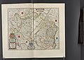
 Atlas ou Representation du Monde Universel t. 1. 1633 (109106120).jpg 17,091 × 11,767; 34.42 MB
-
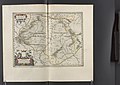
 Aragonia Regnum.jpg 2,824 × 2,268; 5.47 MB
-

-

-
 "Arragonia regnum - Auctore Joanne Baptista Labanna." (22264202871).jpg 3,695 × 3,055; 2.4 MB
-

-
 "Episcopatus Iacensis vulgo Iaca - Auctore Joanne Baptista Labanna." (21632670513).jpg 3,923 × 3,041; 2.58 MB
-

-
-

-

-

-
-

-

.jpg)

.jpg)
.jpg)
.jpg)
.jpg)
.jpg)
.jpg)
.10.(10).jpg)
.10.(11).jpg)
.10.(12).jpg)
.10.(13).jpg)
.10.(14).jpg)
.10.(15).jpg)
.10.(16).jpg)