Category:1635 maps of Ukraine
Jump to navigation
Jump to search
Media in category "1635 maps of Ukraine"
The following 5 files are in this category, out of 5 total.
-

-
 Situs Leopoliensis. Per Fridericum Getkant recognitus. A 1635. Septemb.jpg 7,536 × 5,408; 1.7 MB
-
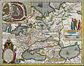
 Tabula Geographica Ukrainska.jpg 7,552 × 5,408; 1.73 MB
-

-