Category:Komatsu, Ishikawa
(Redirected from 小松市)

Internationalization
English: Komatsu city, Ishikawa, Japan
· 日本語: 小松市(こまつし)
· city in Ishikawa prefecture, Japan | |||||
| Upload media | |||||
| Instance of | |||||
|---|---|---|---|---|---|
| Location | Ishikawa Prefecture, Japan | ||||
| Located in or next to body of water | |||||
| Legal form |
| ||||
| Inception |
| ||||
| Population |
| ||||
| Area |
| ||||
| Replaces |
| ||||
| Different from | |||||
| official website | |||||
 | |||||
Subcategories
This category has the following 10 subcategories, out of 10 total.
Media in category "Komatsu, Ishikawa"
The following 48 files are in this category, out of 48 total.
-
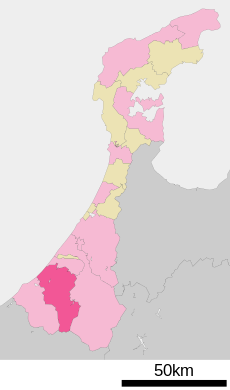
Komatsu in Ishikawa Prefecture Ja.svg 550 × 932; 12 KB
-
Komatsu in Ishikawa Prefecture.png 981 × 901; 27 KB
-
20090913金沢平野南部Tagged.jpg 1,450 × 860; 370 KB
-
AMeDAS (石川県小松市).jpg 480 × 640; 67 KB
-
Around The Five hundred mountain pass.jpg 5,184 × 3,456; 5.22 MB
-
Ataka-no-seki.jpg 1,296 × 972; 349 KB
-
Doihara Bonnet Square 20240430 01.jpg 3,903 × 2,931; 2.23 MB
-
Doihara Bonnet Square 20240430 02.jpg 4,624 × 3,472; 4.22 MB
-
Doihara-bonnet-square.JPG 2,048 × 1,536; 1.35 MB
-
DSC 0172 komatsu.jpg 3,000 × 4,000; 5.37 MB
-
DSC 0180 komatsu.jpg 3,000 × 4,000; 3.88 MB
-
Emblem of Komatsu, Ishikawa.jpg 82 × 79; 2 KB
-
Emblem of Komatsu, Ishikawa.svg 460 × 439; 2 KB
-
Flag of Komatsu, Ishikawa.svg 900 × 630; 2 KB
-
From the rooftop of the science hills komatsu.jpg 5,232 × 3,488; 1.86 MB
-
GEONET Komatsu.jpg 480 × 640; 45 KB
-
Golf Club Twin Fields, Komatsu Ishikawa Aerial photograph.2015.jpg 3,230 × 2,422; 2.76 MB
-
Hydraulic excavator.jpg 640 × 480; 73 KB
-
J-BUS Komatsu office.jpg 640 × 480; 29 KB
-
Japanese Tit 380024273.jpg 2,048 × 1,536; 580 KB
-
Kibagata Park.jpg 4,812 × 3,209; 3.53 MB
-
Flag of Komatsu, Ishikawa.png 900 × 630; 35 KB
-
Komatsu city center area Aerial photograph.1975.jpg 4,484 × 4,687; 13.88 MB
-
Komatsu city center area Aerial photograph.2015.jpg 4,913 × 6,381; 24.42 MB
-
Komatsu montage.JPG 289 × 493; 93 KB
-
Komatsu Sports Park.jpg 1,862 × 1,010; 1.19 MB
-
Kuha 489 501 in Doihara Bonnet Square.jpg 5,568 × 3,712; 6.1 MB
-
Lake Kibagata Lagoon Aerial photograph.2015.jpg 3,170 × 2,389; 2.78 MB
-
Map Ishikawa Komatsu-city 1956-9.png 220 × 330; 2 KB
-
Mountain stream japan 001.jpg 576 × 768; 163 KB
-
Nekobashi Ginza 2021-03 ac (1).jpg 5,863 × 3,899; 3.12 MB
-
Nekobashi Ginza 2021-03 ac (2).jpg 5,839 × 3,883; 3 MB
-
Population distribution of Komatsu, Ishikawa, Japan.svg 512 × 256; 22 KB
-
Renga Hanamichi Street 2021-03 ac (1).jpg 6,002 × 3,990; 3.03 MB
-
Renga Hanamichi Street 2021-03 ac (2).jpg 5,809 × 3,862; 2.73 MB
-
SakuraSyouzu, waters, Komatsu, Ishikawa Prefecture.jpg 4,000 × 3,000; 6.12 MB
-
Tour road in Kibagata Park.jpg 5,024 × 3,348; 4.5 MB
-
Underground fire hydrant.jpg 640 × 480; 79 KB
-
Water bucket.jpg 640 × 480; 62 KB
-
Yunokuni no mori echizen no yakata.jpg 1,024 × 680; 221 KB
-
小松市有明町方面風景 - panoramio.jpg 1,024 × 768; 259 KB
-
小松市沖町方面風景 - panoramio.jpg 1,024 × 768; 270 KB
-
小松運動公園 末広体育館.jpg 1,280 × 960; 299 KB
-
小松駅西口周辺.JPG 1,024 × 768; 183 KB
-
松葉屋 月よみ山路.jpg 4,032 × 3,024; 1.9 MB
-
機動衛生ユニット.jpg 800 × 533; 140 KB
-
白山 - panoramio.jpg 1,280 × 960; 368 KB
-
石川県小松市内にて撮影.jpg 3,000 × 4,000; 5.69 MB


